File:City of New-York - by David H. Burr. NYPL434685.tiff

Size of this JPG preview of this TIF file: 508 × 600 pixels. Other resolutions: 203 × 240 pixels | 407 × 480 pixels | 651 × 768 pixels | 868 × 1,024 pixels | 1,735 × 2,048 pixels | 4,944 × 5,835 pixels.
Original file (4,944 × 5,835 pixels, file size: 82.54 MB, MIME type: image/tiff)
Captions
Captions
Add a one-line explanation of what this file represents
Summary edit
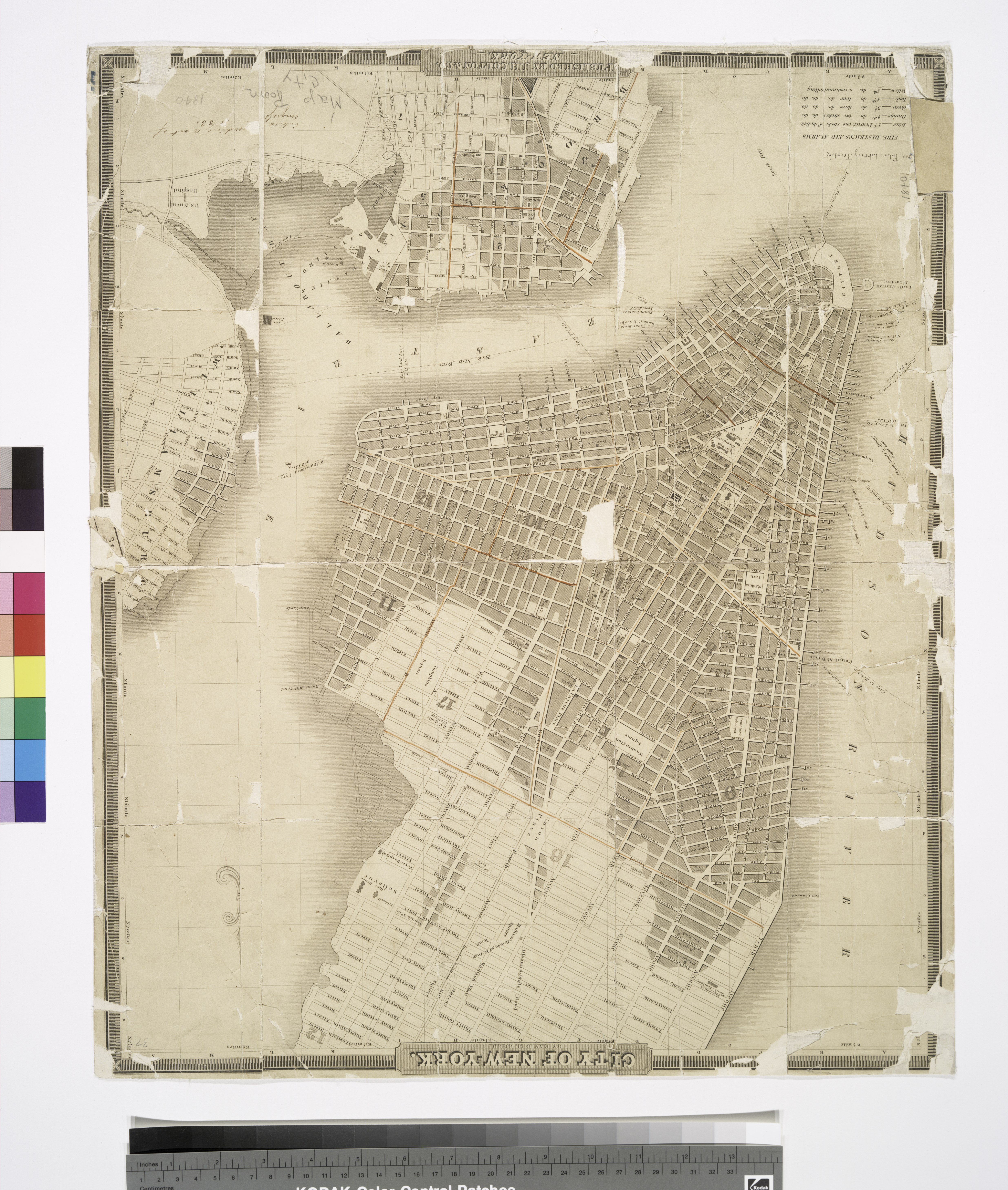
| Description | City of New-York / by David H. Burr.; Maps of New York City and State / New York City / Manhattan | |||||||||||||||||||||||
| Notes | Covers Manhattan up to 26th St. on the west side, and 40th St. on the east side. Also covers parts of Brooklyn and Williamsburg. ''Note 2.'') National Endowment for the Humanities Grant for Access to Early Maps of the Middle Atlantic Seaboard. ''Note 3.'') NYPL copy imperfect: lacks pieces of map from edges and center. ''Note 4.'') NYPL copy includes ms. notations in ink: Free Public Library, Trenton. Entered [ac]cording to act of Congress [... 18]33. ''Note 5.'') Shows ward boundaries, fire districts, parks, ferry lines, and other points of interest. | |||||||||||||||||||||||
| Item physical description | 1 map : hand col., 54 x 44 cm. | |||||||||||||||||||||||
| Catalogue call number | Map Div. 01-1794 | |||||||||||||||||||||||
| Date | ||||||||||||||||||||||||
| Source |
http://digitalgallery.nypl.org/nypldigital/dgkeysearchdetail.cfm?imageID=434685
|
|||||||||||||||||||||||
| Author | ||||||||||||||||||||||||
| Permission (Reusing this file) |
From The Lionel Pincus and Princess Firyal Map Division. http://maps.nypl.org
|
|||||||||||||||||||||||
| Location | Stephen A. Schwarzman Building / The Lionel Pincus and Princess Firyal Map Division | |||||||||||||||||||||||
| Digital item published | 2-28-2005; updated 5-16-2012 | |||||||||||||||||||||||
| Digital ID | 434685 | |||||||||||||||||||||||

The making of this file was supported by Wikimedia UK.
To see other files made with the support of Wikimedia UK, please see the category Supported by Wikimedia UK.
|
File history
Click on a date/time to view the file as it appeared at that time.
| Date/Time | Thumbnail | Dimensions | User | Comment | |
|---|---|---|---|---|---|
| current | 22:50, 26 April 2014 |  | 4,944 × 5,835 (82.54 MB) | Fæ (talk | contribs) | GWToolset:: Creating mediafile for Fæ. Tranche 3 5495-7474 |
You cannot overwrite this file.
File usage on Commons
There are no pages that use this file.