File:Civitates Orbis Terrarum-Maastricht (Wyck3).jpg

Size of this preview: 800 × 441 pixels. Other resolutions: 320 × 177 pixels | 640 × 353 pixels | 1,129 × 623 pixels.
Original file (1,129 × 623 pixels, file size: 308 KB, MIME type: image/jpeg)
Captions
Captions
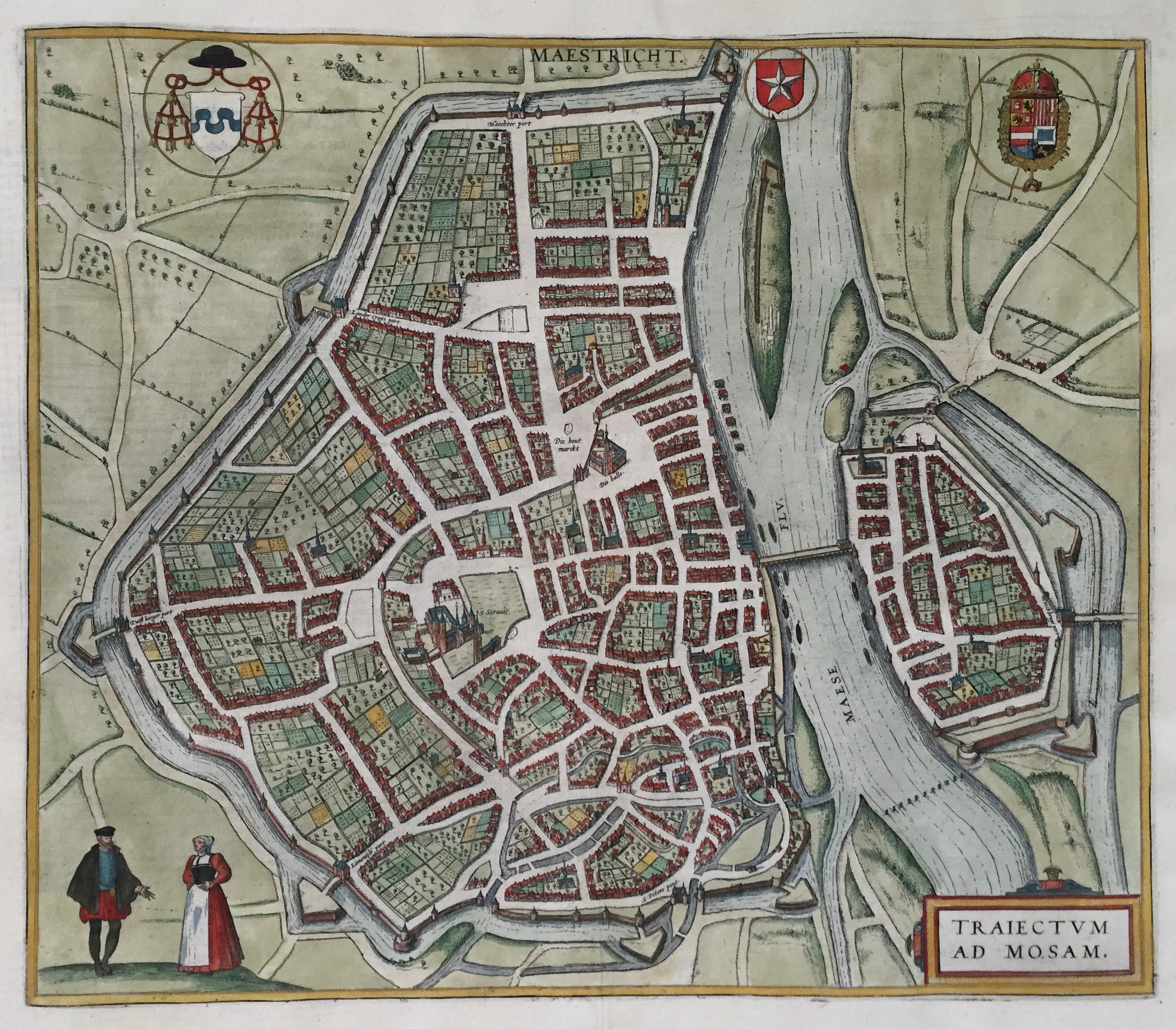
Detail of a map of Maastricht in around 1575, published in 1588 by Braun & Hogenberg in the atlas ''Civitates orbis Terrarum''.
Summary edit
.jpg&action=edit§ion=1)
| Description |
Nederlands: Detail van een plattegrond van Maastricht ("MAESTRICHT / TRAIECTVM AD MOSAM"), omstreeks 1575 getekend. Hier het stadsdeel Wyck, gelegen op de rechter Maasoever. Handgekleurde kopergravure in het Stedenboek van Braun & Hogenberg, uitgegeven in 1588 te Keulen als deel 3 van: Civitates orbis Terrarum: Urbium praecipuarum totius mundi Liber tertius (...). Afmetingen: 35,5 x 41 cm. Gele markering en rode cijfers toegevoegd door kleon3. |
| Source | |
| Author |
|date=circa 1575
|source=https://datnarrenschip.s3.amazonaws.com/9439.jpg |author=Georg Braun (1541-1622) and Frans Hogenberg (1535-1590) |permission= |other versions= }}
Licensing edit
.jpg&action=edit§ion=2)
|
This work is in the public domain in its country of origin and other countries and areas where the copyright term is the author's life plus 100 years or fewer. This work is in the public domain in the United States because it was published (or registered with the U.S. Copyright Office) before January 1, 1929. | |
| This file has been identified as being free of known restrictions under copyright law, including all related and neighboring rights. | |
File history
Click on a date/time to view the file as it appeared at that time.
| Date/Time | Thumbnail | Dimensions | User | Comment | |
|---|---|---|---|---|---|
| current | 20:42, 26 March 2021 | | 1,129 × 623 (308 KB) | Kleon3 (talk | contribs) | Uploaded a work by Georg Braun (1541-1622) and Frans Hogenberg (1535-1590) from https://datnarrenschip.s3.amazonaws.com/9439.jpg with UploadWizard |
You cannot overwrite this file.
File usage on Commons
There are no pages that use this file.
File usage on other wikis
The following other wikis use this file:
- Usage on nl.wikipedia.org
.jpg&oldid=861572973)