File:Colombia Topography 2.png
Size of this preview: 459 × 599 pixels. Other resolutions: 184 × 240 pixels | 368 × 480 pixels | 589 × 768 pixels | 785 × 1,024 pixels | 1,839 × 2,399 pixels.
Original file (1,839 × 2,399 pixels, file size: 3.79 MB, MIME type: image/png)
Captions
Captions
Add a one-line explanation of what this file represents
Matu el mas Kpo
Summary = edit
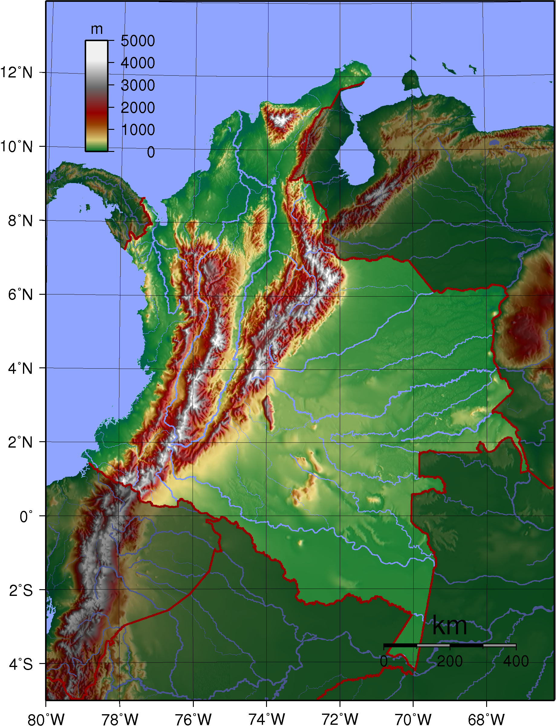
| Description | Topographic map of Colombia. Created with GMT from publicly released GLOBE data.[1] |
| Date | (UTC) |
| Source |
This file was derived from: Colombia Topography.png: |
| Author |
Colombia Topography.png by Sadalmelik
|
| This is a retouched picture, which means that it has been digitally altered from its original version. Modifications: highlight Colombia. The original can be viewed here: Colombia Topography.png:
|
Licensing edit
Sadalmelik, the copyright holder of this work, hereby publishes it under the following license:
| I, the copyright holder of this work, release this work into the public domain. This applies worldwide. In some countries this may not be legally possible; if so: I grant anyone the right to use this work for any purpose, without any conditions, unless such conditions are required by law. |
Original upload log edit
This image is a derivative work of the following images:
- File:Colombia Topography.png licensed with PD-self
- 2007-06-11T20:49:00Z Sadalmelik 1839x2399 (3121106 Bytes) {{Information |Description=Topographic map of Colombia. Created with GMT from publicly released GLOBE data.[http://www.ngdc.noaa.gov/mgg/topo/globe.html] |Source=self-made |Date=June 11, 2007 |Author= [[User:Sadalmelik|Sadalm
Uploaded with derivativeFX
File history
Click on a date/time to view the file as it appeared at that time.
| Date/Time | Thumbnail | Dimensions | User | Comment | |
|---|---|---|---|---|---|
| current | 01:12, 17 July 2013 | | 1,839 × 2,399 (3.79 MB) | UAwiki (talk | contribs) | minor retouches |
| 00:52, 17 July 2013 |  | 1,839 × 2,399 (3.79 MB) | UAwiki (talk | contribs) | == {{int:filedesc}} == {{Information |Description=Topographic map of Colombia. Created with GMT from publicly released GLOBE data.[http://www.ngdc.noaa.gov/mgg/topo/globe.html] |Source={{Derived from|Colombia_Topography.png|display=50}} |Date=2013-07-1... |
You cannot overwrite this file.
File usage on Commons
There are no pages that use this file.
File usage on other wikis
The following other wikis use this file:
- Usage on es.wikipedia.org
- Usage on fr.wikipedia.org
- Usage on uk.wikipedia.org