File:ColumbiaRiverGorgePanorama.jpg

Size of this preview: 800 × 192 pixels. Other resolutions: 320 × 77 pixels | 640 × 153 pixels | 1,024 × 245 pixels | 1,280 × 307 pixels | 2,560 × 614 pixels | 13,736 × 3,292 pixels.
Original file (13,736 × 3,292 pixels, file size: 9.19 MB, MIME type: image/jpeg)
Captions
Captions
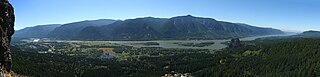
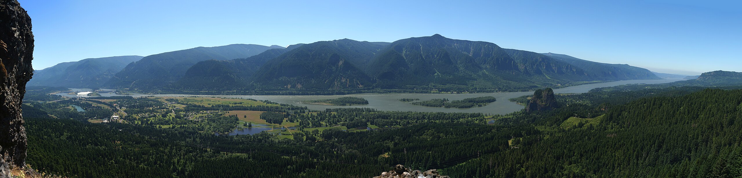
A view of the Columbia River Gorge from the near the top of Hamilton Mountain, looking south from the Washington state side of the gorge.
Summary edit
| Description |
English: A view of the Columbia River Gorge from the near the top of Hamilton Mountain, looking south from the Washington state side of the gorge. On the left side of the image, the Bonneville Dam is visible. On the left-center is the small town of North Bonneville. Behind the hills in the center of the image, the peak of Mt. Hood is just barely visible. The large rock at the river's edge on the right side is Beacon Rock. |
| Date | |
| Source | Own work |
| Author | Snottywong |
Licensing edit
I, the copyright holder of this work, hereby publish it under the following licenses:
This file is licensed under the Creative Commons Attribution-Share Alike 3.0 Unported license.
- You are free:
- to share – to copy, distribute and transmit the work
- to remix – to adapt the work
- Under the following conditions:
- attribution – You must give appropriate credit, provide a link to the license, and indicate if changes were made. You may do so in any reasonable manner, but not in any way that suggests the licensor endorses you or your use.
- share alike – If you remix, transform, or build upon the material, you must distribute your contributions under the same or compatible license as the original.

|
Permission is granted to copy, distribute and/or modify this document under the terms of the GNU Free Documentation License, Version 1.2 or any later version published by the Free Software Foundation; with no Invariant Sections, no Front-Cover Texts, and no Back-Cover Texts. A copy of the license is included in the section entitled GNU Free Documentation License. |
You may select the license of your choice.
| Annotations | This image is annotated: View the annotations at Commons |
File history
Click on a date/time to view the file as it appeared at that time.
| Date/Time | Thumbnail | Dimensions | User | Comment | |
|---|---|---|---|---|---|
| current | 00:25, 16 May 2013 | 13,736 × 3,292 (9.19 MB) | Jsayre64 (talk | contribs) | cropped out non-parallel edges - btw, great spot, great weather, great pano | |
| 20:09, 11 July 2011 | 13,770 × 3,468 (28.94 MB) | Scottywong (talk | contribs) | {{Information |Description ={{en|1=A view of the Columbia River Gorge from the near the top of Mt. Hamilton, looking south from the Washington state side of the gorge. On the left side of the image, the Bonneville Dam is visible. On the left-center i |
You cannot overwrite this file.
File usage on Commons
The following page uses this file:
File usage on other wikis
The following other wikis use this file:
- Usage on en.wikipedia.org
- Usage on es.wikipedia.org
- Usage on fr.wikipedia.org
- Usage on it.wikipedia.org
- Usage on ja.wikipedia.org
- Usage on nl.wikipedia.org
- Usage on ru.wikipedia.org
- Usage on vi.wikipedia.org