File:Columnar joints at Nakagi, Minami-Izu, Shizuoka, Japan.jpg
Size of this preview: 800 × 450 pixels. Other resolutions: 320 × 180 pixels | 640 × 360 pixels | 1,024 × 576 pixels | 1,280 × 720 pixels | 2,560 × 1,440 pixels | 4,608 × 2,592 pixels.
Original file (4,608 × 2,592 pixels, file size: 3.28 MB, MIME type: image/jpeg)
File information
Structured data
Captions
Summary edit
DescriptionColumnar joints at Nakagi, Minami-Izu, Shizuoka, Japan.jpg |
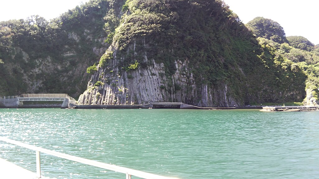
日本語: 伊豆半島ジオパークのジオサイトの1つに指定されている「中木の柱状節理」(静岡県賀茂郡南伊豆町中木)。2022年9月3日、中木港から「ヒリゾ浜」へ向かう渡船に乗船中に撮影。 |
Date | |
Source | Own work |
Author | 要塞騎士 |
Camera location | 34° 36′ 54″ N, 138° 49′ 27″ E | View this and other nearby images on: OpenStreetMap | 34.615000; 138.824167 |
---|
Licensing edit
I, the copyright holder of this work, hereby publish it under the following license:
This file is made available under the Creative Commons CC0 1.0 Universal Public Domain Dedication. | |
The person who associated a work with this deed has dedicated the work to the public domain by waiving all of their rights to the work worldwide under copyright law, including all related and neighboring rights, to the extent allowed by law. You can copy, modify, distribute and perform the work, even for commercial purposes, all without asking permission.
http://creativecommons.org/publicdomain/zero/1.0/deed.enCC0Creative Commons Zero, Public Domain Dedicationfalsefalse |
File history
Click on a date/time to view the file as it appeared at that time.
Date/Time | Thumbnail | Dimensions | User | Comment | |
---|---|---|---|---|---|
current | 13:52, 18 December 2023 | 4,608 × 2,592 (3.28 MB) | 要塞騎士 (talk | contribs) | Uploaded own work with UploadWizard |
You cannot overwrite this file.
File usage on Commons
There are no pages that use this file.
File usage on other wikis
Metadata
This file contains additional information such as Exif metadata which may have been added by the digital camera, scanner, or software program used to create or digitize it. If the file has been modified from its original state, some details such as the timestamp may not fully reflect those of the original file. The timestamp is only as accurate as the clock in the camera, and it may be completely wrong.
Image title | DSC_0651 |
---|---|
Camera manufacturer | SHARP |
Camera model | X4-SH |
Exposure time | 1/139 sec (0.0071942446043165) |
F-number | f/2.2 |
ISO speed rating | 100 |
Date and time of data generation | 13:06, 3 September 2022 |
Lens focal length | 3.405 mm |
Latitude | 34° 36′ 54″ N |
Longitude | 138° 49′ 27″ E |
Altitude | 32 meters above sea level |
Orientation | Normal |
Horizontal resolution | 72 dpi |
Vertical resolution | 72 dpi |
File change date and time | 13:06, 3 September 2022 |
Y and C positioning | Centered |
Exposure Program | Not defined |
Exif version | 2.2 |
Date and time of digitizing | 13:06, 3 September 2022 |
Meaning of each component |
|
APEX shutter speed | 7.123 |
APEX aperture | 2.27 |
APEX brightness | 4.28 |
Metering mode | Center weighted average |
Flash | Flash did not fire, compulsory flash suppression |
DateTime subseconds | 982029 |
DateTimeOriginal subseconds | 982029 |
DateTimeDigitized subseconds | 982029 |
Supported Flashpix version | 1 |
Color space | sRGB |
Sensing method | One-chip color area sensor |
Scene type | A directly photographed image |
Exposure mode | Auto exposure |
White balance | Auto white balance |
Focal length in 35 mm film | 25 mm |
Scene capture type | Standard |
Speed unit | Kilometers per hour |
Speed of GPS receiver | 3 |
Reference for direction of movement | True direction |
Direction of movement | 189 |
Geodetic survey data used | WGS-84 |
GPS tag version | 2.2.0.0 |