File:Continental Divide Trail, Black Range - Flickr - aspidoscelis (1).jpg

Size of this preview: 800 × 533 pixels. Other resolutions: 320 × 213 pixels | 640 × 427 pixels | 1,024 × 683 pixels | 1,280 × 853 pixels | 2,560 × 1,707 pixels | 3,600 × 2,400 pixels.
Original file (3,600 × 2,400 pixels, file size: 4.23 MB, MIME type: image/jpeg)
Captions
Captions
Add a one-line explanation of what this file represents
Summary edit
.jpg&action=edit§ion=1)
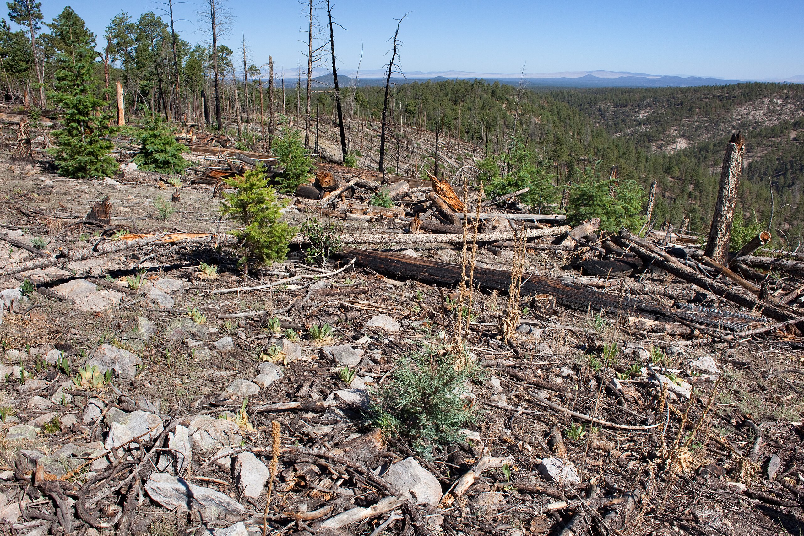
| Description | North end of the Black Range, along the Continental Divide trail just north of the road to Lookout Mountain, 33.3608 -107.8343, Sierra County, New Mexico, 9 Jun 2013. Recently burned Douglas fir and ponderosa pine forest, with Amauriopsis dissecta, Erigeron flagellaris, Laënnecia schiedeana, Packera neomexicana var. neomexicana, Pseudognaphalium, Senecio actinella, Senecio wootonii, Tragopogon dubius, Arenaria saxosa var saxosa, Juniperus deppeana, Astragalus gilensis, Oxytropis lambertii, Thermopsis rhombifolia, Ribes pinetorum, Pinus ponderosa, Penstemon ambiguus, Muhlenbergia montana, Fragaria vesca subsp. bracteata, Populus tremuloides, Verbascum thapsus, etc. |
| Date | |
| Source | Continental Divide Trail, Black Range |
| Author | Patrick Alexander from Las Cruces, NM |
Licensing edit
.jpg&action=edit§ion=2)
| This file is made available under the Creative Commons CC0 1.0 Universal Public Domain Dedication. | |
| The person who associated a work with this deed has dedicated the work to the public domain by waiving all of their rights to the work worldwide under copyright law, including all related and neighboring rights, to the extent allowed by law. You can copy, modify, distribute and perform the work, even for commercial purposes, all without asking permission.
|
| This image was originally posted to Flickr by aspidoscelis at https://flickr.com/photos/26246711@N00/9222333377. It was reviewed on 7 December 2020 by FlickreviewR 2 and was confirmed to be licensed under the terms of the cc-zero. |
File history
Click on a date/time to view the file as it appeared at that time.
| Date/Time | Thumbnail | Dimensions | User | Comment | |
|---|---|---|---|---|---|
| current | 21:25, 7 December 2020 | | 3,600 × 2,400 (4.23 MB) | Josve05a (talk | contribs) | == {{int:filedesc}} == =={{int:filedesc}}== {{Information |Description=North end of the Black Range, along the Continental Divide trail just north of the road to Lookout Mountain, 33.3608 -107.8343, Sierra County, New Mexico, 9 Jun 2013. Recently burned Douglas fir and ponderosa pine forest, with ''Amauriopsis dissecta, Erigeron flagellaris, Laënnecia schiedeana, Packera neomexicana'' var. ''neomexicana, Pseudognaphalium, Senecio actinella, Senecio wootonii, Tragopogon dubius, Arenaria saxosa... |
You cannot overwrite this file.
File usage on Commons
There are no pages that use this file.
.jpg&oldid=867847604)