File:Cooper Lake 1954.png

Size of this preview: 800 × 583 pixels. Other resolutions: 320 × 233 pixels | 640 × 466 pixels | 1,024 × 746 pixels | 1,160 × 845 pixels.
Original file (1,160 × 845 pixels, file size: 1.75 MB, MIME type: image/png)
Captions
Captions
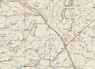
Excerpt of 1954 USGS Topgraphic Map (Cheyenne Quadrant)
Summary edit
| Description |
English: Excerpt of 1954 USGS Topgraphic Map (Cheyenne Quadrant) |
| Date | |
| Source | 1954 USGS Map (public domain) |
| Author | US Geological Service |
Licensing edit
This image is in the public domain in the United States because it only contains materials that originally came from the United States Geological Survey, an agency of the United States Department of the Interior. For more information, see the official USGS copyright policy.
|
File history
Click on a date/time to view the file as it appeared at that time.
| Date/Time | Thumbnail | Dimensions | User | Comment | |
|---|---|---|---|---|---|
| current | 12:17, 21 May 2020 | | 1,160 × 845 (1.75 MB) | Milowent (talk | contribs) | Uploaded a work by US Geological Service from 1954 USGS Map (public domain) with UploadWizard |
You cannot overwrite this file.
File usage on Commons
There are no pages that use this file.
File usage on other wikis
The following other wikis use this file:
- Usage on en.wikipedia.org