File:Countries by immigrant population.png
Size of this preview: 800 × 406 pixels. Other resolutions: 320 × 162 pixels | 640 × 325 pixels | 1,024 × 520 pixels | 1,280 × 649 pixels | 3,132 × 1,589 pixels.
Original file (3,132 × 1,589 pixels, file size: 165 KB, MIME type: image/png)
Captions
Captions
Add a one-line explanation of what this file represents
Summary edit
| Description |
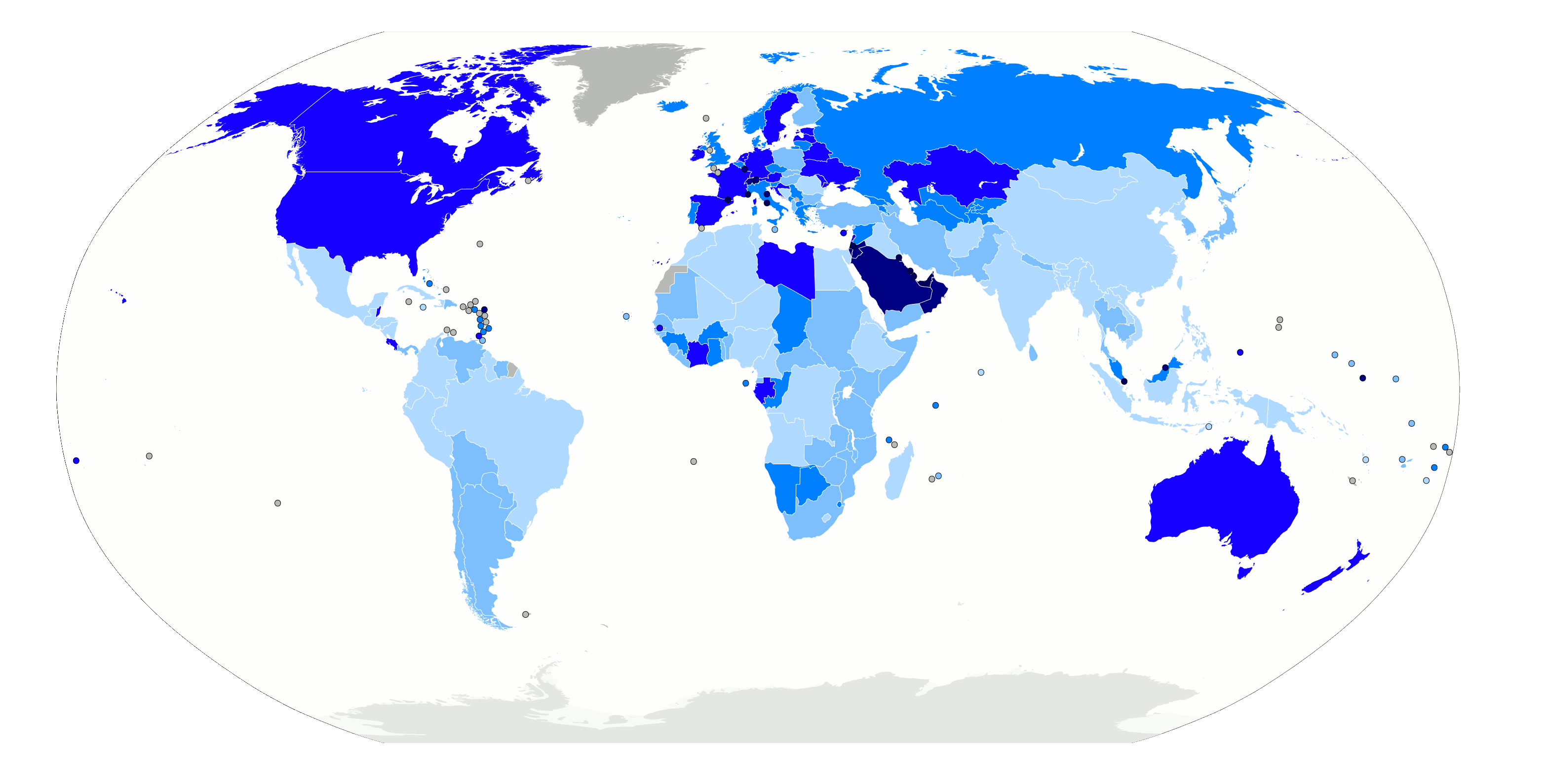
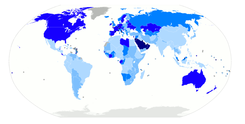
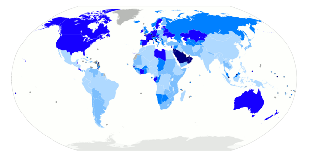
Map of the world with countries coloured according to their immigrant population as a percentage of the whole population, based on the UN's World Population Policies 2005 data ([1]). Legend: no data more than 50% 20% to 50% 10% to 20% 4% to 10% 1% to 4% less than 1% |
| Date | |
| Source | Own work, derived from Image:BlankMap-World6.svg |
| Author | Thebainer (Stephen Bain) |
| Permission (Reusing this file) |
N/A |
| Other versions | File:Countries by immigrant population.svg, vector version |
Licensing edit
| I, Stephen Bain, hereby publish this work under the following licences: | ||
This file is licensed under the Creative Commons Attribution-Share Alike 3.0 Unported, 2.5 Generic, 2.0 Generic and 1.0 Generic license.
You may select the licence of your choice. |

File history
Click on a date/time to view the file as it appeared at that time.
| Date/Time | Thumbnail | Dimensions | User | Comment | |
|---|---|---|---|---|---|
| current | 02:59, 13 November 2012 | | 3,132 × 1,589 (165 KB) | JohnnyMrNinja (talk | contribs) | color indexed |
| 12:48, 11 March 2007 |  | 3,132 × 1,589 (479 KB) | Stephen Bain (talk | contribs) | ==Information== {{Information |Description=Map of the world with countries coloured according to their immigrant population as a percentage of the whole population, based on the UN's World Population Policies 2005 data ([http://www.u |
You cannot overwrite this file.
File usage on Commons
There are no pages that use this file.
File usage on other wikis
The following other wikis use this file:
- Usage on bg.wikipedia.org