File:County atlas of Sullivan, New York LOC 2013593063-22.jpg
Size of this preview: 488 × 600 pixels. Other resolutions: 195 × 240 pixels | 391 × 480 pixels | 625 × 768 pixels | 833 × 1,024 pixels | 1,666 × 2,048 pixels | 3,814 × 4,687 pixels.
Original file (3,814 × 4,687 pixels, file size: 1.7 MB, MIME type: image/jpeg)
Captions
Captions
Add a one-line explanation of what this file represents
Summary edit
| Description |
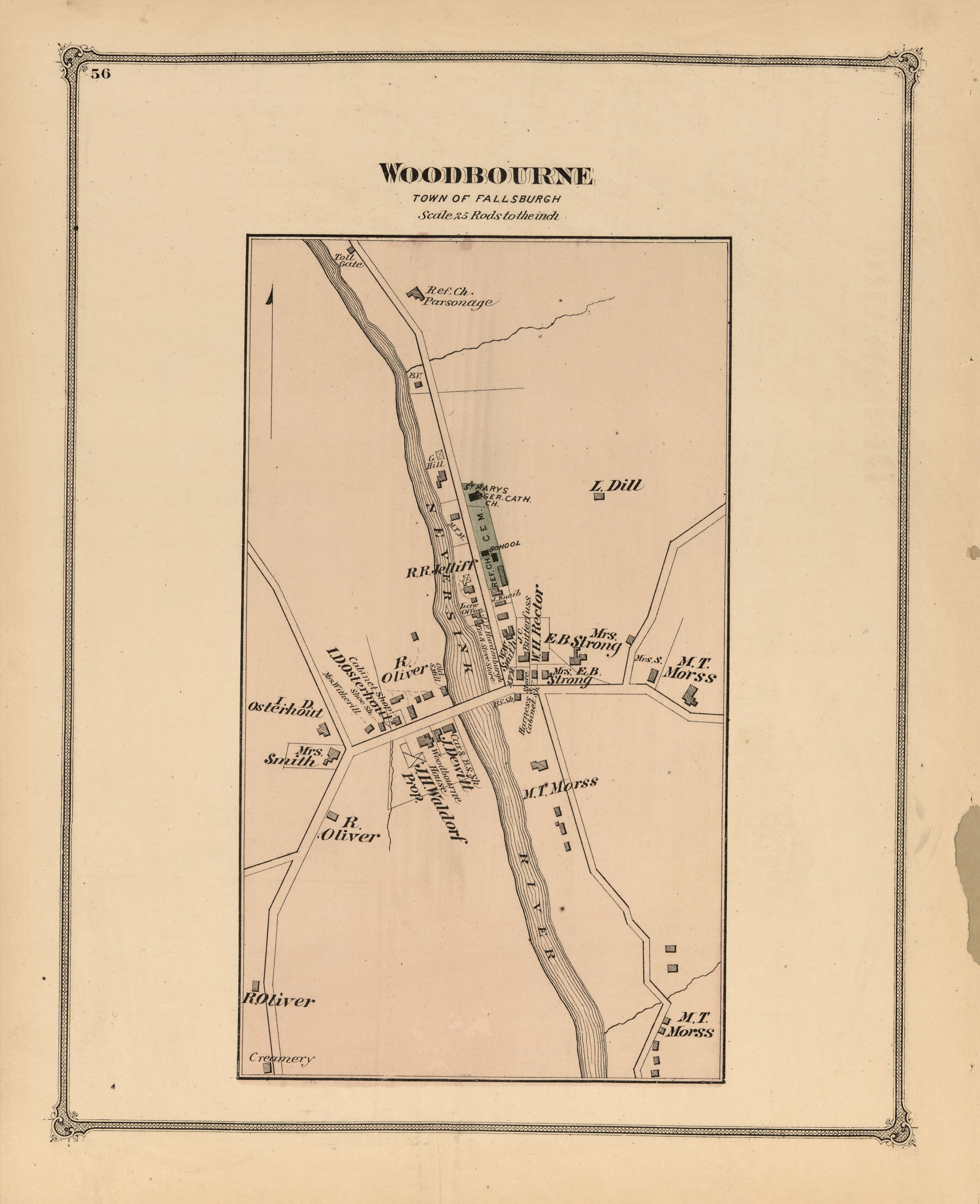
English: Spine title: New York, Sullivan County 1875, Walker & Jewett LC copy deacidified and rebound with each leaf encapsulated. Phillips 2256 Includes city and town plans, distance table, and directory. Available also through the Library of Congress Web site as a raster image. |
||
| Title | County atlas of Sullivan, New York | ||
| Shelf ID | G1253.S9 B4 1875 | ||
| Parent | https://www.loc.gov/resource/g3803sm.gla00190/ | ||
| Sheet title | Woodbourne | ||
| Date | |||
| Source | https://www.loc.gov/item/2013593063/ | ||
| Author | Beers, F. W. (Frederick W.); Walker & Jewett (Firm) | ||
| Permission (Reusing this file) |
|
||
| Other versions |
|
||
| Location | United States · Sullivan County · New York (State) · Sullivan County. · New York | ||
| Part of | American Memory · Catalog · County Landownership Maps · Geography And Map Division · Cultural Landscapes | ||
| Subject | Atlases · Sullivan County (N.Y.) · United States · Maps · Sullivan County · Real Property · New York (State) |


Licensing edit
|
This is a faithful photographic reproduction of a two-dimensional, public domain work of art. The work of art itself is in the public domain for the following reason:
The official position taken by the Wikimedia Foundation is that "faithful reproductions of two-dimensional public domain works of art are public domain".
This photographic reproduction is therefore also considered to be in the public domain in the United States. In other jurisdictions, re-use of this content may be restricted; see Reuse of PD-Art photographs for details. | ||||
File history
Click on a date/time to view the file as it appeared at that time.
| Date/Time | Thumbnail | Dimensions | User | Comment | |
|---|---|---|---|---|---|
| current | 05:24, 11 October 2018 | | 3,814 × 4,687 (1.7 MB) | Fæ (talk | contribs) | LOC Maps multisheet https://www.loc.gov/item/2013593063/ sheet 22 of 42 #1646 |
You cannot overwrite this file.
File usage on Commons
The following page uses this file: