File:Cuenca-055-056-057-058-B.svg

Original file (SVG file, nominally 2,079 × 1,356 pixels, file size: 5.94 MB)
Captions
Captions
Summary edit
| Description |
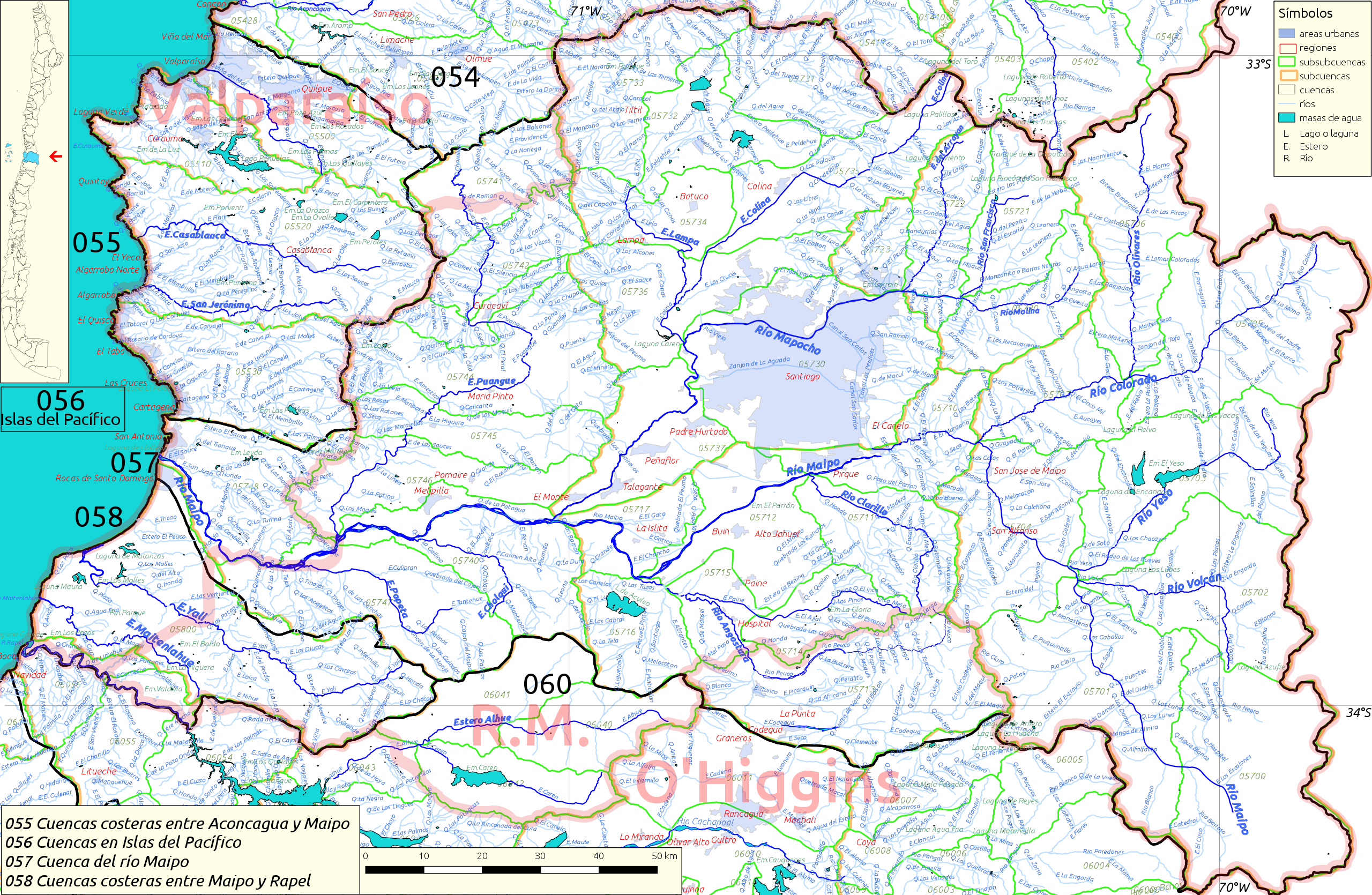
Español: Cuencas hidrográficas 055, 056, 057 (río Maipo) y 058 del inventario nacional de cuencas de Chile
Este mapa se elaboró con información extraída de:
Donde BNC, MMA y cedeus significan:
Los datos fueron procesados con QGIS version 2.18.17, exportados al formato SVG con las opciones "render map labels as outlines" desconectada pero "export map layers as svg groups" conectada. Con Inkscape 0.92 se eliminó la excesiva repetición de nombres, los nombres fueron colocados paralelos a los ríos o lagos y en lugares más visibles. Nombres y números que el editor no pudo asociar a objeto alguno fueron borrados. Finalmente se redujo el volumen de datos por medio de svgo (svg-optimizer). |
| Date | |
| Source | Own work |
| Author | Juan Villalobos |
Licensing edit
- You are free:
- to share – to copy, distribute and transmit the work
- to remix – to adapt the work
- Under the following conditions:
- attribution – You must give appropriate credit, provide a link to the license, and indicate if changes were made. You may do so in any reasonable manner, but not in any way that suggests the licensor endorses you or your use.
- share alike – If you remix, transform, or build upon the material, you must distribute your contributions under the same or compatible license as the original.
File history
Click on a date/time to view the file as it appeared at that time.
| Date/Time | Thumbnail | Dimensions | User | Comment | |
|---|---|---|---|---|---|
| current | 11:15, 8 October 2019 | | 2,079 × 1,356 (5.94 MB) | Juan Villalobos (talk | contribs) | svgcleaner --remove-nonsvg-attributes no |
| 18:42, 21 June 2019 |  | 2,079 × 1,356 (5.08 MB) | Juan Villalobos (talk | contribs) | svgcleaner, regiones en rojo 20%. | |
| 15:49, 5 March 2019 |  | 2,079 × 1,356 (5.25 MB) | Juan Villalobos (talk | contribs) | lat, long, layers, Estero-->E., Quebrada-->Q., Río-->R., svgcleaner instead of svgo | |
| 09:19, 1 February 2019 |  | 2,215 × 1,445 (5.56 MB) | Juan Villalobos (talk | contribs) | User created page with UploadWizard |
You cannot overwrite this file.
File usage on Commons
The following page uses this file:
File usage on other wikis
The following other wikis use this file:
- Usage on es.wikipedia.org
- Río Maipo
- Río Puangue
- Baños Morales
- Laguna del Encañado
- Laguna Esmeralda (Melipilla)
- Ojos de Mar de Llolleo
- Canal Mallarauco
- Categoría:Cuenca del río Maipo (057)
- Cuenca del río Maipo
- Central hidroeléctrica Carena
- Central hidroeléctrica Puntilla
- Embalse Huechún (Melipilla)
- Humedal Río Maipo
- Estero Popeta
- Estero Coyanco
- Estero Cholqui
- Usage on he.wikipedia.org
- Usage on sh.wikipedia.org
- Usage on www.wikidata.org