File:DCA flight map.svg

Size of this PNG preview of this SVG file: 800 × 528 pixels. Other resolutions: 320 × 211 pixels | 640 × 423 pixels | 1,024 × 676 pixels | 1,280 × 846 pixels | 2,560 × 1,691 pixels | 1,323 × 874 pixels.
Original file (SVG file, nominally 1,323 × 874 pixels, file size: 375 KB)
Captions
Captions
Add a one-line explanation of what this file represents
Summary edit
| Description |
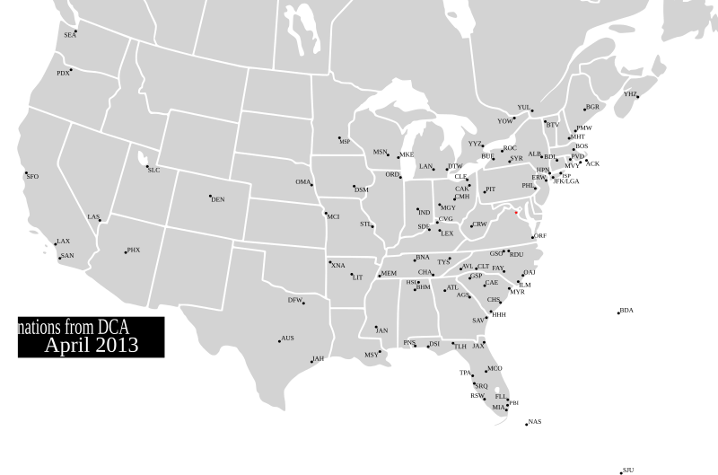
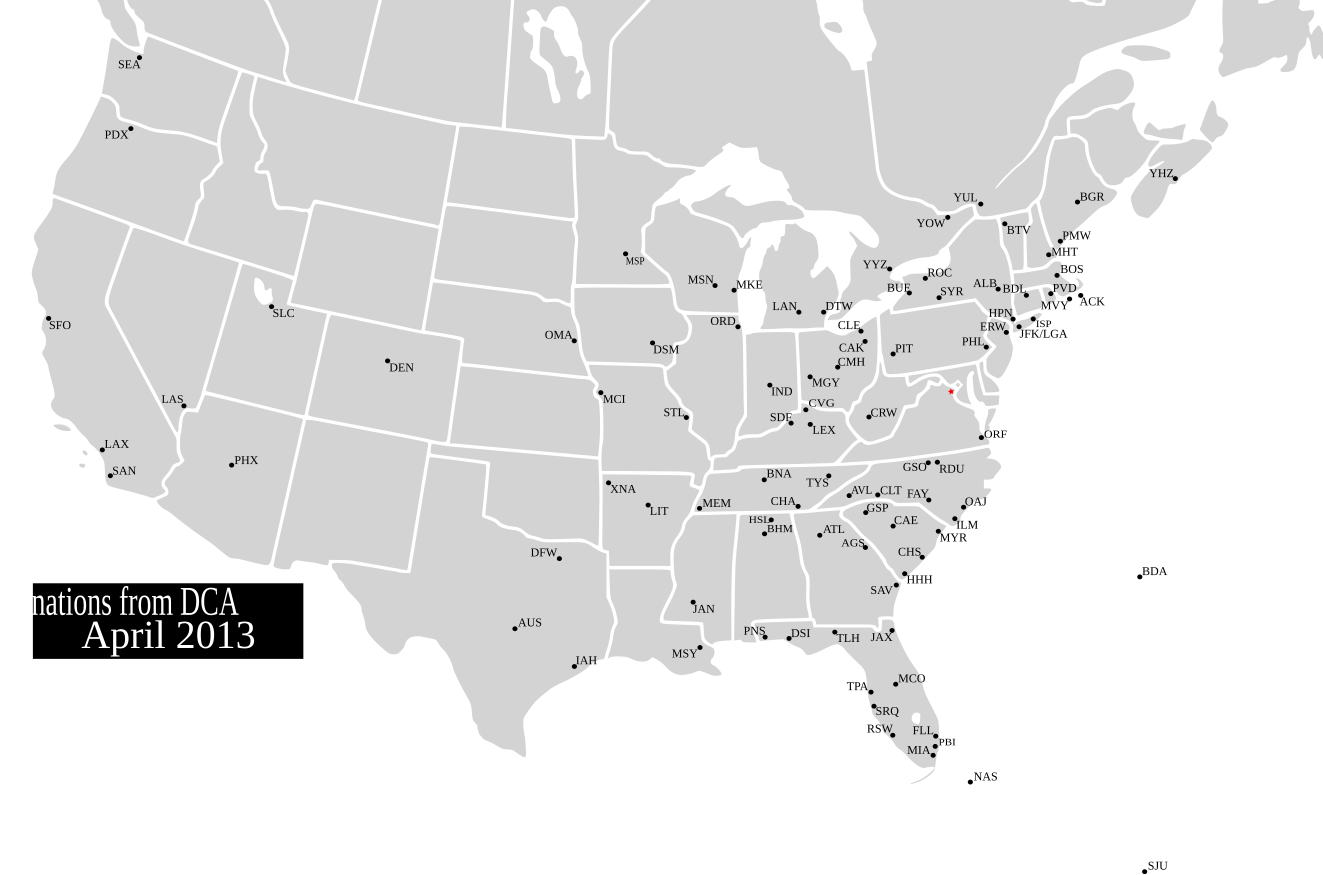
English: Map showing the destinations of flights outbound from Ronald Reagan Washington National Airport |
||
| Date | (UTC) | ||
| Source |
This file was derived from: BlankMap-USA-states-Canada-provinces, HI closer.svg: |
||
| Author | |||
| SVG development |
|
Licensing edit
I, the copyright holder of this work, hereby publish it under the following license:
This file is licensed under the Creative Commons Attribution-Share Alike 2.5 Generic license.
- You are free:
- to share – to copy, distribute and transmit the work
- to remix – to adapt the work
- Under the following conditions:
- attribution – You must give appropriate credit, provide a link to the license, and indicate if changes were made. You may do so in any reasonable manner, but not in any way that suggests the licensor endorses you or your use.
- share alike – If you remix, transform, or build upon the material, you must distribute your contributions under the same or compatible license as the original.
Original upload log edit
This image is a derivative work of the following images:
- File:BlankMap-USA-states-Canada-provinces,_HI_closer.svg licensed with Cc-by-sa-2.5
- 2007-12-08T21:18:24Z Lokal Profil 1730x1730 (216736 Bytes) Code trimming
- 2007-07-03T04:21:30Z Lokal Profil 1730x1730 (217702 Bytes) {{Information |Description={{en|Blank SVG map of USA and Canada with state and province borders. Hawaii has been moved closer to the mainland USA to reduce width of image.}} Non-contiguous parts of a states/provinces are "gro
Uploaded with derivativeFX
File history
Click on a date/time to view the file as it appeared at that time.
| Date/Time | Thumbnail | Dimensions | User | Comment | |
|---|---|---|---|---|---|
| current | 22:09, 9 April 2013 | | 1,323 × 874 (375 KB) | Presidentman (talk | contribs) | Repositioned Montreal |
| 19:15, 3 April 2013 |  | 1,323 × 874 (375 KB) | Presidentman (talk | contribs) | added caption | |
| 19:10, 3 April 2013 |  | 1,323 × 874 (373 KB) | Presidentman (talk | contribs) | corrected Charlotte's code | |
| 18:45, 3 April 2013 |  | 1,323 × 874 (374 KB) | Presidentman (talk | contribs) | repositioned Ottawa & Hartford; enlarged star | |
| 18:41, 3 April 2013 |  | 1,323 × 874 (374 KB) | Presidentman (talk | contribs) | cropped | |
| 18:38, 3 April 2013 |  | 1,330 × 999 (319 KB) | Presidentman (talk | contribs) | == {{int:filedesc}} == {{Information |Description={{en|Map showing the destinations of flights outbound from Ronald Reagan Washington National Airport}} |Source={{Derived from|BlankMap-USA-states-Canada-p... |
You cannot overwrite this file.
File usage on Commons
The following page uses this file:
File usage on other wikis
The following other wikis use this file:
- Usage on ar.wikipedia.org
- Usage on he.wikipedia.org