File:D 67 (Allier) map-fr.svg

Size of this PNG preview of this SVG file: 800 × 480 pixels. Other resolutions: 320 × 192 pixels | 1,024 × 614 pixels | 1,280 × 768 pixels | 2,560 × 1,536 pixels | 1,500 × 900 pixels.
Original file (SVG file, nominally 1,500 × 900 pixels, file size: 91 KB)
Captions
Captions
Add a one-line explanation of what this file represents
| Description |
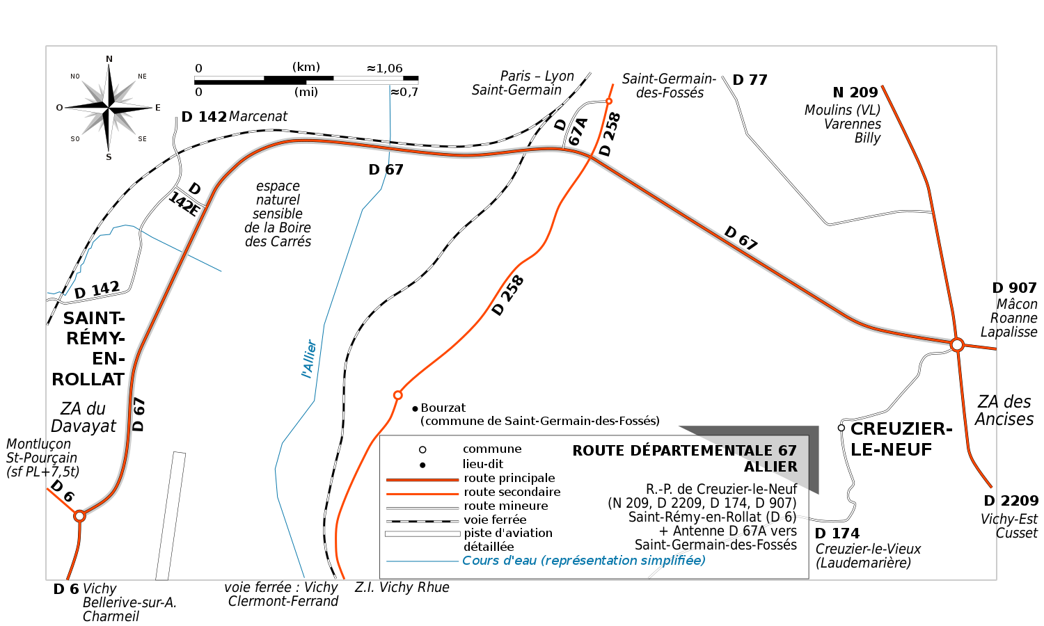
English: Map of departmental road 67, Allier, France. Replaces the MS Paint-made 2007-5 map. Version without color profile
Français : Carte de la route départementale 67 (Allier), France. Remplace la carte réalisée avec Microsoft Paint en mai 2007. Version sans profil de couleur |
|||
| Date | ||||
| Source | Derived work from OpenStreetMap data / Œuvre dérivée depuis la carte OpenStreetMap | |||
| Author | OpenStreetMap contributors - adapted by / adaptée par Tabl-trai | |||
| Permission (Reusing this file) |
This file is licensed under the Creative Commons Attribution-Share Alike 2.0 Generic license.
|
File history
Click on a date/time to view the file as it appeared at that time.
| Date/Time | Thumbnail | Dimensions | User | Comment | |
|---|---|---|---|---|---|
| current | 12:44, 26 June 2016 | | 1,500 × 900 (91 KB) | Tabl-trai (talk | contribs) | {{Information |Description ={{en|1=Map of departmental road 67, Allier, France. Replaces the MS Paint-made 2007-5 map. '''Version without color profile'''}} {{fr|1=Carte de la route départementale 67 (Allier), France. R... |
You cannot overwrite this file.
File usage on Commons
The following 3 pages use this file:
File usage on other wikis
The following other wikis use this file:
- Usage on fr.wikipedia.org
_map-fr.svg&oldid=708355941)