File:Dalila 25 july 2007 2100Z.jpg

Size of this preview: 600 × 600 pixels. Other resolutions: 240 × 240 pixels | 480 × 480 pixels | 768 × 768 pixels | 1,024 × 1,024 pixels | 2,048 × 2,048 pixels | 4,400 × 4,400 pixels.
Original file (4,400 × 4,400 pixels, file size: 3.19 MB, MIME type: image/jpeg)
Captions
Captions
Add a one-line explanation of what this file represents
Summary edit
| Description |
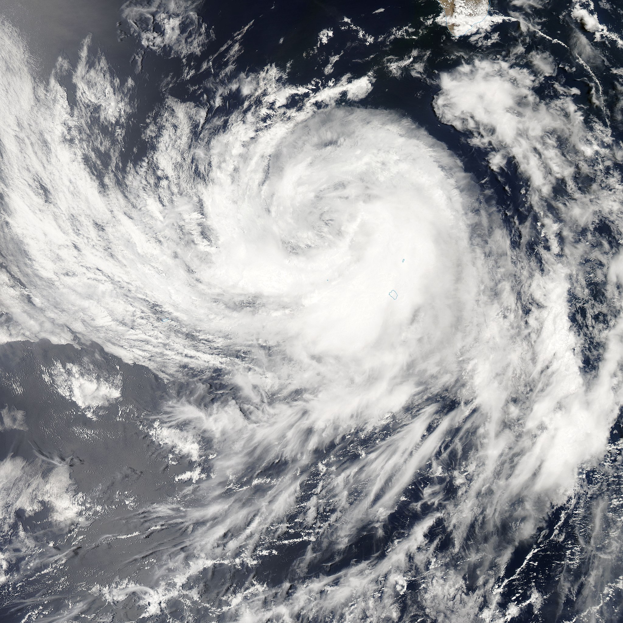
Tropical Storm Dalila is shown in this image, captured by the MODIS on the Aqua satellite on Wednesday, July 25, 2007. Out over Mexico's Pacific coast, the storm weakened, but still dumped a lot of rain on Baja California on Thursday. By Friday, it weakened into a tropical depression. Tropical Storm Dalila was the eighth tropical system to form in the East Pacific during the 2007 season, and the fourth named storm. Dalila formed south of Baja California and arced northwest over cooled waters as it degraded. |
|||||
| Date | ||||||
| Source | http://modis.gsfc.nasa.gov/gallery/individual.php?db_date=2007-07-31 | |||||
| Author | Image courtesy of MODIS Rapid Response Project at NASA/GSFC | |||||
| Permission (Reusing this file) |
|

File history
Click on a date/time to view the file as it appeared at that time.
| Date/Time | Thumbnail | Dimensions | User | Comment | |
|---|---|---|---|---|---|
| current | 17:00, 31 July 2007 | | 4,400 × 4,400 (3.19 MB) | Good kitty (talk | contribs) | == Summary == {{Information |Description=Tropical Storm Dalila is shown in this image, captured by the MODIS on the Aqua satellite on Wednesday, July 25, 2007. Out over Mexico's Pacific coast, the storm weakened, but still dumped a lot of rain on Baja Cal |
You cannot overwrite this file.
File usage on Commons
The following page uses this file:
File usage on other wikis
The following other wikis use this file:
- Usage on de.wikipedia.org
- Usage on en.wikipedia.org
- Usage on es.wikipedia.org
- Usage on nl.wikipedia.org
- Usage on sv.wikipedia.org
- Usage on zh.wikipedia.org