File:Dallas Horseshoe project map.png
Size of this preview: 646 × 599 pixels. Other resolutions: 259 × 240 pixels | 518 × 480 pixels | 828 × 768 pixels | 1,103 × 1,023 pixels.
Original file (1,103 × 1,023 pixels, file size: 756 KB, MIME type: image/png)
Captions
Captions
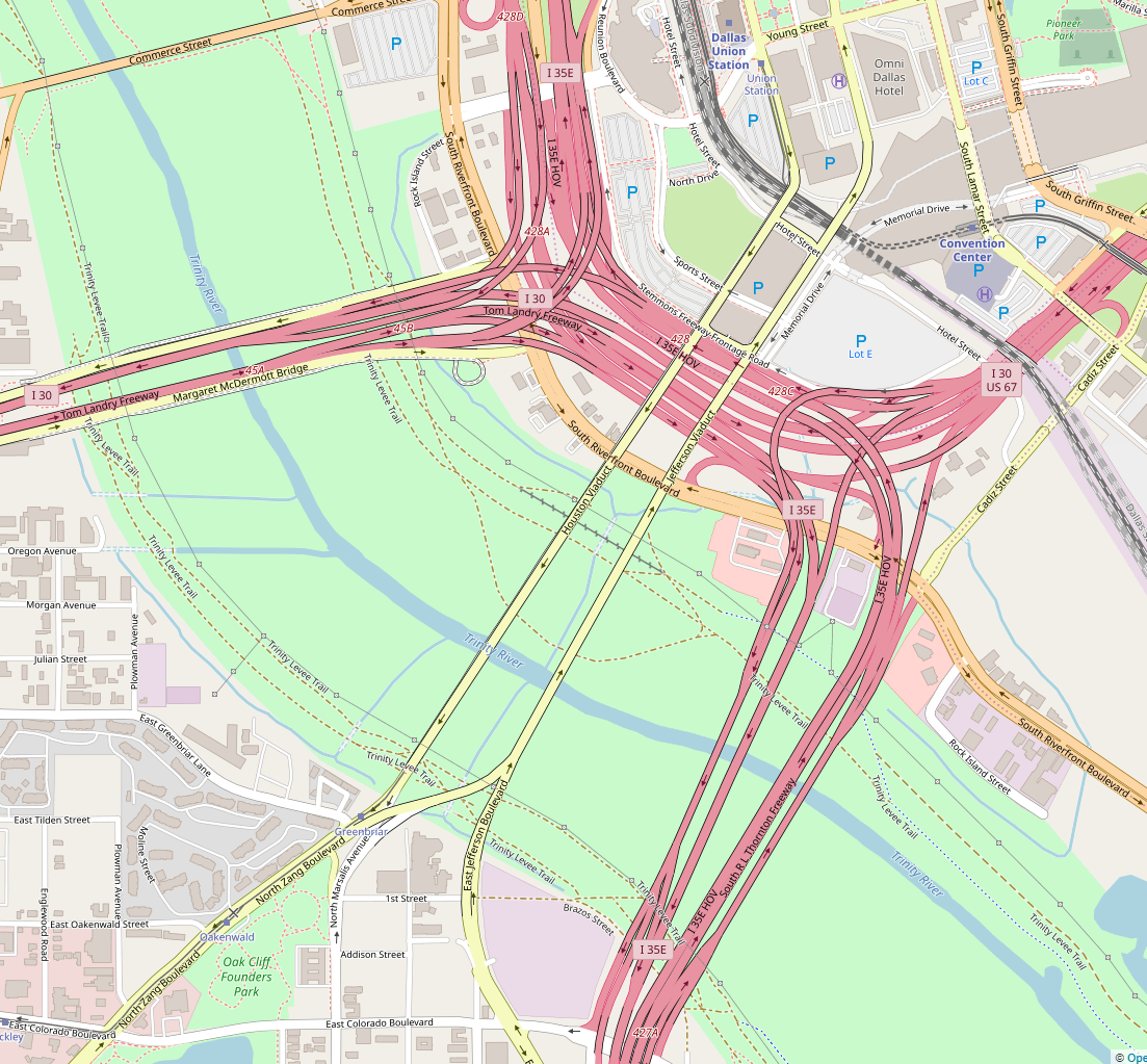
Map of Dallas Horseshoe Project after completion
Summary edit
| Description |
English: Map of Dallas Horseshoe Project after completion. The project added 7 new lanes to I-30 and I-35E and added ramps from eastbound I-30 to southbound I-35E and northbound I-35E to westbound I-30. |
| Date | |
| Source | https://www.openstreetmap.org/search?query=dallas#map=16/32.7673/-96.8111 |
| Author | OpenStreetMap contributors |
Licensing edit
This file is licensed under the Creative Commons Attribution-Share Alike 2.0 Generic license.
- You are free:
- to share – to copy, distribute and transmit the work
- to remix – to adapt the work
- Under the following conditions:
- attribution – You must give appropriate credit, provide a link to the license, and indicate if changes were made. You may do so in any reasonable manner, but not in any way that suggests the licensor endorses you or your use.
- share alike – If you remix, transform, or build upon the material, you must distribute your contributions under the same or compatible license as the original.
File history
Click on a date/time to view the file as it appeared at that time.
| Date/Time | Thumbnail | Dimensions | User | Comment | |
|---|---|---|---|---|---|
| current | 21:11, 15 April 2019 | | 1,103 × 1,023 (756 KB) | Zarxos (talk | contribs) | User created page with UploadWizard |
You cannot overwrite this file.
File usage on Commons
The following page uses this file:
File usage on other wikis
The following other wikis use this file:
- Usage on en.wikipedia.org