File:Darien Gap OSM.png
No higher resolution available.
Darien_Gap_OSM.png (512 × 512 pixels, file size: 97 KB, MIME type: image/png)
Captions
Captions
Add a one-line explanation of what this file represents
Summary edit
| Description |
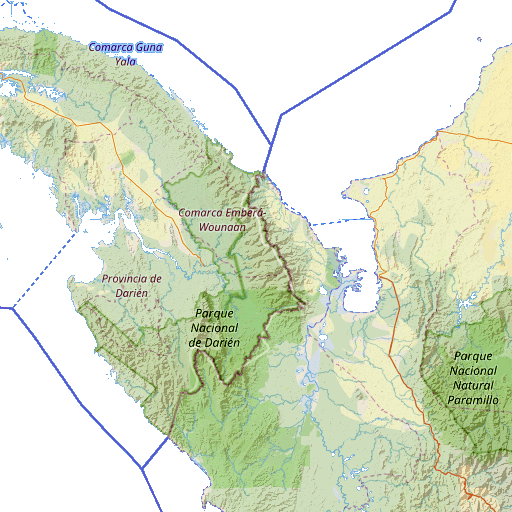
English: Linear Burn composite of cropped Standard and Cycle Map views of the Darien Gap, with levels tweaked (red: 0-240 gamma 1, green: 64-240 gamma 1, blue: 64-240 gamma 1), exported as Perceptual 8-bit PNG and seas set to transparent. |
| Date | |
| Source | http://openstreetmap.org/#map=8/8.214/-77.726 |
| Author | © OpenStreetMap contributors, cmglee |
Licensing edit
This file is licensed under the Creative Commons Attribution-Share Alike 2.5 Generic license.
- You are free:
- to share – to copy, distribute and transmit the work
- to remix – to adapt the work
- Under the following conditions:
- attribution – You must give appropriate credit, provide a link to the license, and indicate if changes were made. You may do so in any reasonable manner, but not in any way that suggests the licensor endorses you or your use.
- share alike – If you remix, transform, or build upon the material, you must distribute your contributions under the same or compatible license as the original.
File history
Click on a date/time to view the file as it appeared at that time.
| Date/Time | Thumbnail | Dimensions | User | Comment | |
|---|---|---|---|---|---|
| current | 12:31, 3 January 2018 | | 512 × 512 (97 KB) | Cmglee (talk | contribs) | User created page with UploadWizard |
You cannot overwrite this file.
File usage on Commons
The following page uses this file: