File:DeadHorsePoint.JPG
Size of this preview: 800 × 600 pixels. Other resolutions: 320 × 240 pixels | 640 × 480 pixels | 1,024 × 768 pixels | 1,280 × 960 pixels | 2,560 × 1,920 pixels | 3,648 × 2,736 pixels.
Original file (3,648 × 2,736 pixels, file size: 3.38 MB, MIME type: image/jpeg)
Captions
Captions
Add a one-line explanation of what this file represents
Summary edit
| Description |
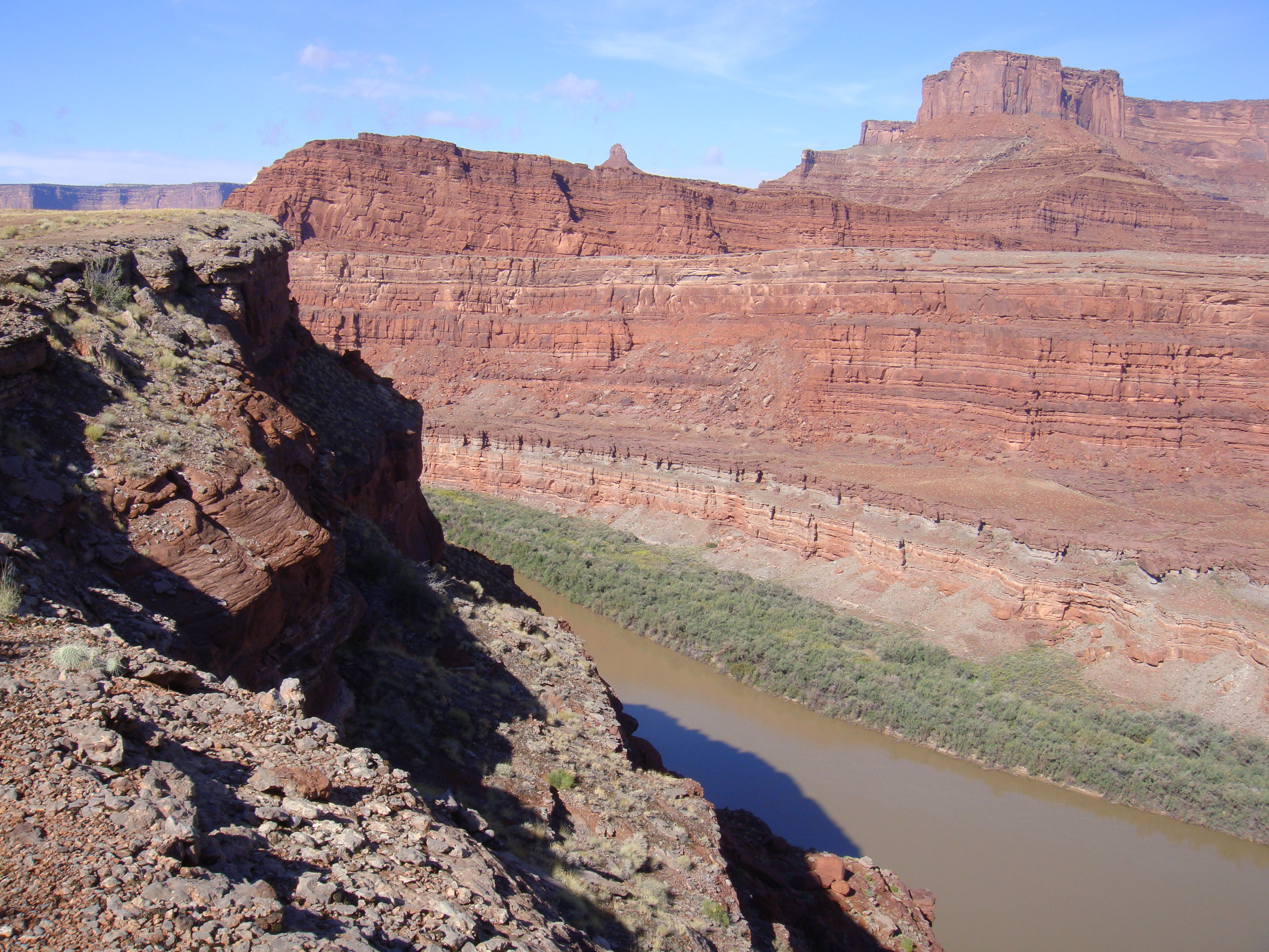
English: Dead Horse Point, as seen from the Chicken Corners off-road trail, west of Moab, on the Colorado River. The prominence of Dead Horse Point are bedded-cliffs of Kayenta Formatin, upon (vertical, columnar)-Wingate Sandstone cliffs. The Wingate sits on eroded slopes of the Chinle Formation. At the Colorado River, cliffs of Cedar Mesa Sandstone, are multi-bedded sectins of (darker red) Organ Rock Formation. |
||
| Date | Taken on 23 October 2010 | ||
| Source | Own work | ||
| Author | Qfl247 | ||
| Permission (Reusing this file) |
|
Licensing edit
I, the copyright holder of this work, hereby publish it under the following licenses:
This file is licensed under the Creative Commons Attribution-Share Alike 3.0 Unported license.
- You are free:
- to share – to copy, distribute and transmit the work
- to remix – to adapt the work
- Under the following conditions:
- attribution – You must give appropriate credit, provide a link to the license, and indicate if changes were made. You may do so in any reasonable manner, but not in any way that suggests the licensor endorses you or your use.
- share alike – If you remix, transform, or build upon the material, you must distribute your contributions under the same or compatible license as the original.

|
Permission is granted to copy, distribute and/or modify this document under the terms of the GNU Free Documentation License, Version 1.2 or any later version published by the Free Software Foundation; with no Invariant Sections, no Front-Cover Texts, and no Back-Cover Texts. A copy of the license is included in the section entitled GNU Free Documentation License. |
You may select the license of your choice.
File history
Click on a date/time to view the file as it appeared at that time.
| Date/Time | Thumbnail | Dimensions | User | Comment | |
|---|---|---|---|---|---|
| current | 01:33, 18 January 2011 | | 3,648 × 2,736 (3.38 MB) | Qfl247 (talk | contribs) | {{Information |Description={{en|1=Dead Horse Point, as seen from the Chicken Corners off-road trail, west of Moab}} |Source={{own}} |Author=Qfl247 |Date=2010-10-23 |Permission={{GFDL}} |other_versions= }} |
You cannot overwrite this file.
File usage on Commons
There are no pages that use this file.
File usage on other wikis
The following other wikis use this file:
- Usage on en.wikipedia.org
- Usage on ro.wikipedia.org