File:Dearfield CO 2.jpg

Size of this preview: 800 × 450 pixels. Other resolutions: 320 × 180 pixels | 640 × 360 pixels | 1,024 × 576 pixels | 1,280 × 720 pixels | 2,560 × 1,440 pixels | 3,840 × 2,160 pixels.
Original file (3,840 × 2,160 pixels, file size: 1.75 MB, MIME type: image/jpeg)
Captions
Captions
Add a one-line explanation of what this file represents
|
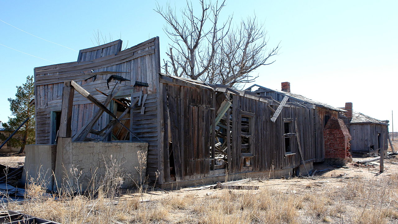
This is an image of a place or building that is listed on the National Register of Historic Places in the United States of America. Its reference number is 95001002. |
Summary edit
| Description |
English: A couple of building in Dearfield, CO. The roofs have fallen down. |
||
| Source | Own work | ||
| Author | Hustvedt | ||
| Permission (Reusing this file) |
I, the copyright holder of this work, hereby publish it under the following licenses: This file is licensed under the Creative Commons Attribution-Share Alike 3.0 Unported license.
You may select the license of your choice. |

| Camera location | | View this and other nearby images on: OpenStreetMap |
|---|
File history
Click on a date/time to view the file as it appeared at that time.
| Date/Time | Thumbnail | Dimensions | User | Comment | |
|---|---|---|---|---|---|
| current | 04:16, 1 March 2009 | | 3,840 × 2,160 (1.75 MB) | Hustvedt (talk | contribs) | {{Information |Description={{en|1=A couple of building in Dearfield, CO. The roofs have fallen down.}} |Source=Own work by uploader |Author=Hustvedt |Date= |Permission= |other_versions= }} [[Category:Registered Historic Places in Colorad |
You cannot overwrite this file.
File usage on Commons
The following page uses this file:
File usage on other wikis
The following other wikis use this file:
- Usage on en.wikipedia.org
- Usage on www.wikidata.org