File:Debra 1959 rainfall.png

Size of this preview: 723 × 599 pixels. Other resolutions: 290 × 240 pixels | 579 × 480 pixels | 927 × 768 pixels | 1,034 × 857 pixels.
Original file (1,034 × 857 pixels, file size: 32 KB, MIME type: image/png)
Captions
Captions
Add a one-line explanation of what this file represents
Summary
| Description |
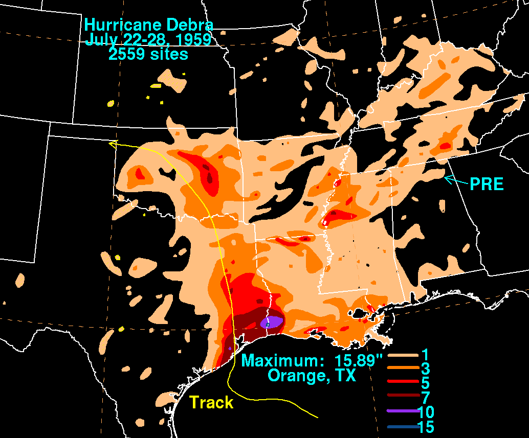
English: Storm total rainfall map of Hurricane Debra during July 1959. |
|||
| Date | ||||
| Source | WPC tropical cyclone rainfall data | |||
| Author | David Roth, Weather Prediction Center, Camp Springs, Maryland | |||
| Permission (Reusing this file) |
|
| Annotations | This image is annotated: View the annotations at Commons |
Original upload log edit
| Date/Time | Dimensions | User | Comment |
|---|---|---|---|
| 6 December 2011, 15:59:35 | 1034 × 857 (36158 bytes) | Hurricanefan25 (talk · contribs) | {{Information |Description ={{en|1=A map of rainfall produced by [[:en:Hurricane Debra (1959)|Hurricane Debra]] in July 1959.}} |Source =http://www.hpc.ncep.noaa.gov/tropical/rain/debra1959filledrainblk.gif |Author =[[:en:David M. |
File history
Click on a date/time to view the file as it appeared at that time.
| Date/Time | Thumbnail | Dimensions | User | Comment | |
|---|---|---|---|---|---|
| current | 11:35, 10 December 2014 | | 1,034 × 857 (32 KB) | GifTagger (talk | contribs) | Bot: Converting file to superior PNG file. (Source: Debra_1959_rainfall.gif). This GIF was problematic due to non-greyscale color table. |
You cannot overwrite this file.
File usage on Commons
The following page uses this file:
- File:Debra 1959 rainfall.gif (file redirect)
File usage on other wikis
The following other wikis use this file:
- Usage on en.wikipedia.org