File:Delisle 1739..jpg
Size of this preview: 697 × 599 pixels. Other resolutions: 279 × 240 pixels | 558 × 480 pixels | 998 × 858 pixels.
Original file (998 × 858 pixels, file size: 279 KB, MIME type: image/jpeg)
Captions
Captions
Add a one-line explanation of what this file represents
Summary edit
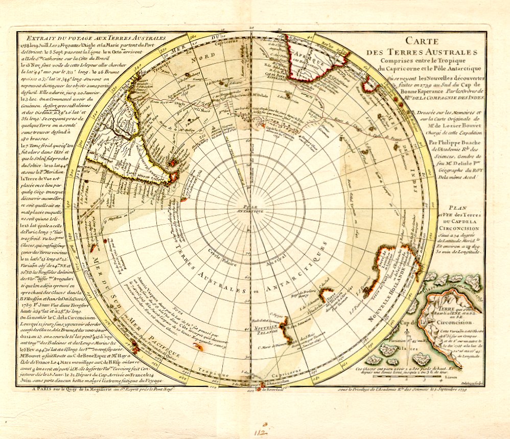
| Description |
French:
Carte des Terres Australes Comprises entre le Tropique du Capricorne et le Pôle Antarctique Deutsch: Terra Australis in Karte von Guillaume Delisle 1739 |
|||||||||||||||||||||||
| Date | ||||||||||||||||||||||||
| Source | http://www.oeaw.ac.at/biblio/en/Woldan/graphics3.html | |||||||||||||||||||||||
| Author |
|
|||||||||||||||||||||||
| Permission (Reusing this file) |
frei, da älter als 200 Jahre | |||||||||||||||||||||||

Licensing edit
|
This is a faithful photographic reproduction of a two-dimensional, public domain work of art. The work of art itself is in the public domain for the following reason:
The official position taken by the Wikimedia Foundation is that "faithful reproductions of two-dimensional public domain works of art are public domain".
This photographic reproduction is therefore also considered to be in the public domain in the United States. In other jurisdictions, re-use of this content may be restricted; see Reuse of PD-Art photographs for details. | ||||
Original upload log edit
Transferred from de.wikipedia to Commons by Ireas using CommonsHelper.
The original description page was here. All following user names refer to de.wikipedia.
- 2009-10-18 22:11 Borsanova 998×858× (285376 bytes) {{Information |Beschreibung = Terra Australis in Karte von Delisle 1739 |Quelle = |Urheber = Delisle |Datum = 1739 |Genehmigung = frei, da älter als 200 Jahre |Andere Versionen = |Anmerkungen = }}
File history
Click on a date/time to view the file as it appeared at that time.
| Date/Time | Thumbnail | Dimensions | User | Comment | |
|---|---|---|---|---|---|
| current | 20:59, 26 September 2010 | | 998 × 858 (279 KB) | File Upload Bot (Magnus Manske) (talk | contribs) | {{BotMoveToCommons|de.wikipedia|year={{subst:CURRENTYEAR}}|month={{subst:CURRENTMONTHNAME}}|day={{subst:CURRENTDAY}}}} {{Information |Description={{de|Terra Australis in Karte von de:Guillaume Delisle 1739<br/> }} |Source=Transferred from [http://d |
You cannot overwrite this file.
File usage on Commons
There are no pages that use this file.
File usage on other wikis
The following other wikis use this file:
- Usage on de.wikipedia.org