File:Demre,Turkey.jpg
No higher resolution available.
Demre,Turkey.jpg (720 × 480 pixels, file size: 212 KB, MIME type: image/jpeg)
Captions
Captions
Add a one-line explanation of what this file represents
| Description |
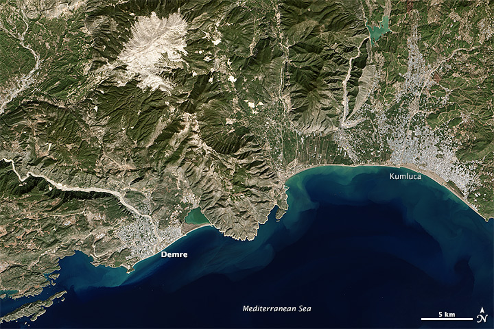
English: The Operational Land Imager on the Landsat 8 satellite acquired this image of the southwest Turkish coast on October 20, 2013. The river Demre cuts through the city, while the Taurus Mountains stand to the north and east. The town of Kumluca meets the coast east of the mountains. |
|||||
| Date | acquired October 20, 2013 | |||||
| Source | http://earthobservatory.nasa.gov/IOTD/view.php?id=82652&src=eoa-iotd | |||||
| Author | Jesse Allen and Robert Simmon | |||||
| Permission (Reusing this file) |
|

File history
Click on a date/time to view the file as it appeared at that time.
| Date/Time | Thumbnail | Dimensions | User | Comment | |
|---|---|---|---|---|---|
| current | 07:57, 1 January 2014 | | 720 × 480 (212 KB) | Tillman (talk | contribs) | {{Information |Description ={{en|1=The Operational Land Imager on the Landsat 8 satellite acquired this image of the southwest Turkish coast on October 20, 2013. The river Demre cuts through the city, while the Taurus Mountains stand to the north an... |
You cannot overwrite this file.
File usage on Commons
There are no pages that use this file.
File usage on other wikis
The following other wikis use this file: