File:Descriptive map of London poverty, 1889 Wellcome L0074437.jpg
Original file (6,256 × 5,700 pixels, file size: 12.71 MB, MIME type: image/jpeg)
Captions
Captions
Summary edit
| Descriptive map of London poverty, 1889 | |||
|---|---|---|---|
| Title |
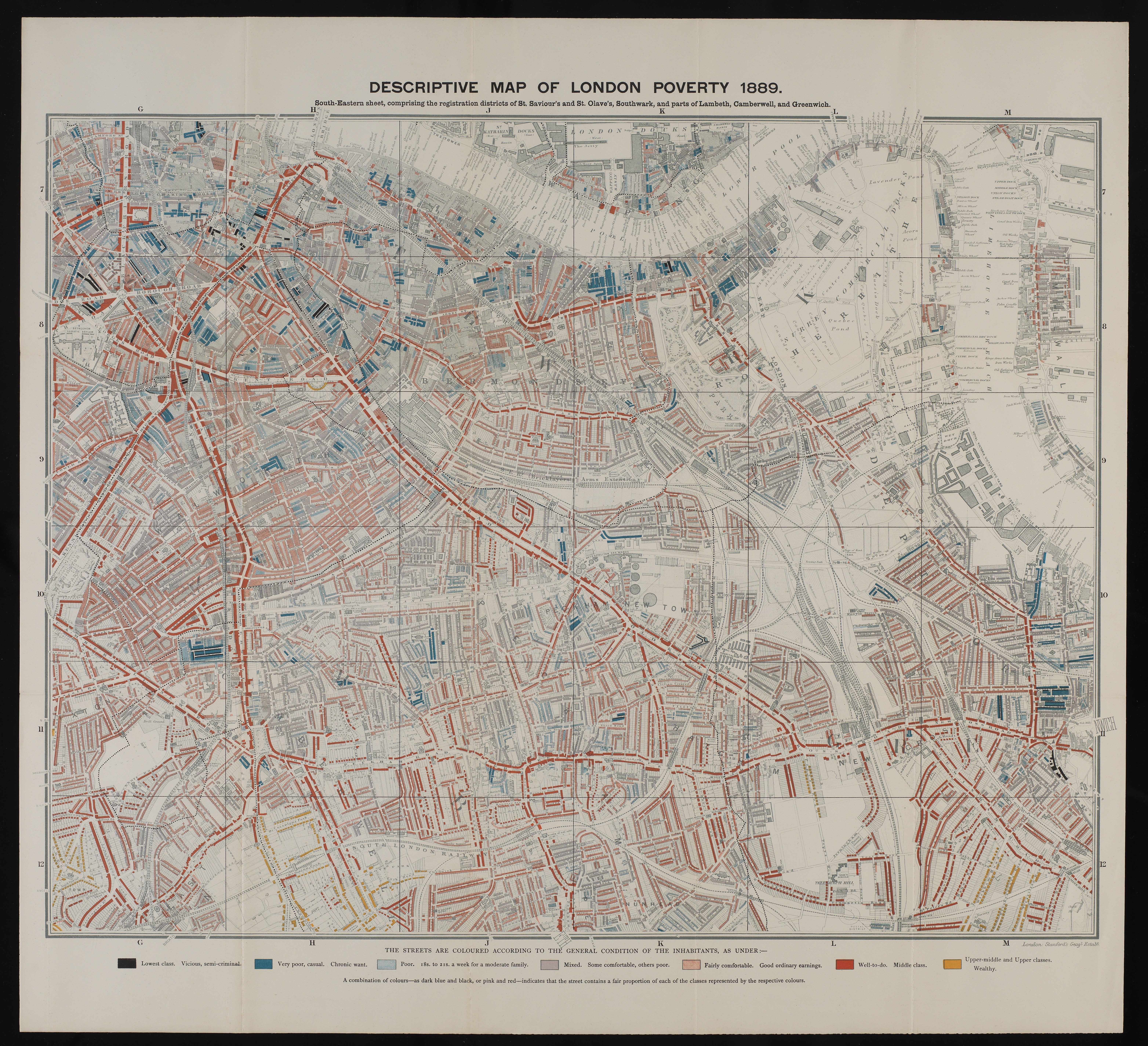
Descriptive map of London poverty, 1889 |
||
| Description |
South-Eastern sheet, comprising the registration districts of St. Saviour's and St. Olvae's, Southwark, and parts of Lambeth, Camberwell, and Greenwich. Charles Booth, Life and labour in the people of London. General Collections |
||
| Credit line |
|
||
| References |
|
||
| Source/Photographer |
https://wellcomeimages.org/indexplus/obf_images/85/ef/22999bb9a4f670edf54c3e7b4d5d.jpg
|
||
| Other versions |
     |
||
Licensing edit
- You are free:
- to share – to copy, distribute and transmit the work
- to remix – to adapt the work
- Under the following conditions:
- attribution – You must give appropriate credit, provide a link to the license, and indicate if changes were made. You may do so in any reasonable manner, but not in any way that suggests the licensor endorses you or your use.
File history
Click on a date/time to view the file as it appeared at that time.
| Date/Time | Thumbnail | Dimensions | User | Comment | |
|---|---|---|---|---|---|
| current | 20:10, 21 October 2014 | | 6,256 × 5,700 (12.71 MB) | Fæ (talk | contribs) | =={{int:filedesc}}== {{Artwork |artist = |author = |title = Descriptive map of London poverty, 1889 |description = South-Eastern sheet, comprising the registration districts of St. Saviour's and St. Olvae's,... |
You cannot overwrite this file.
File usage on Commons
The following page uses this file: