File:Detail kaart Gelderland en Kleef 1573.jpg
Size of this preview: 800 × 566 pixels. Other resolutions: 320 × 226 pixels | 640 × 453 pixels | 1,024 × 724 pixels | 1,280 × 906 pixels | 2,338 × 1,654 pixels.
Original file (2,338 × 1,654 pixels, file size: 1.06 MB, MIME type: image/jpeg)
Captions
Captions
Add a one-line explanation of what this file represents
Summary edit
| Description |
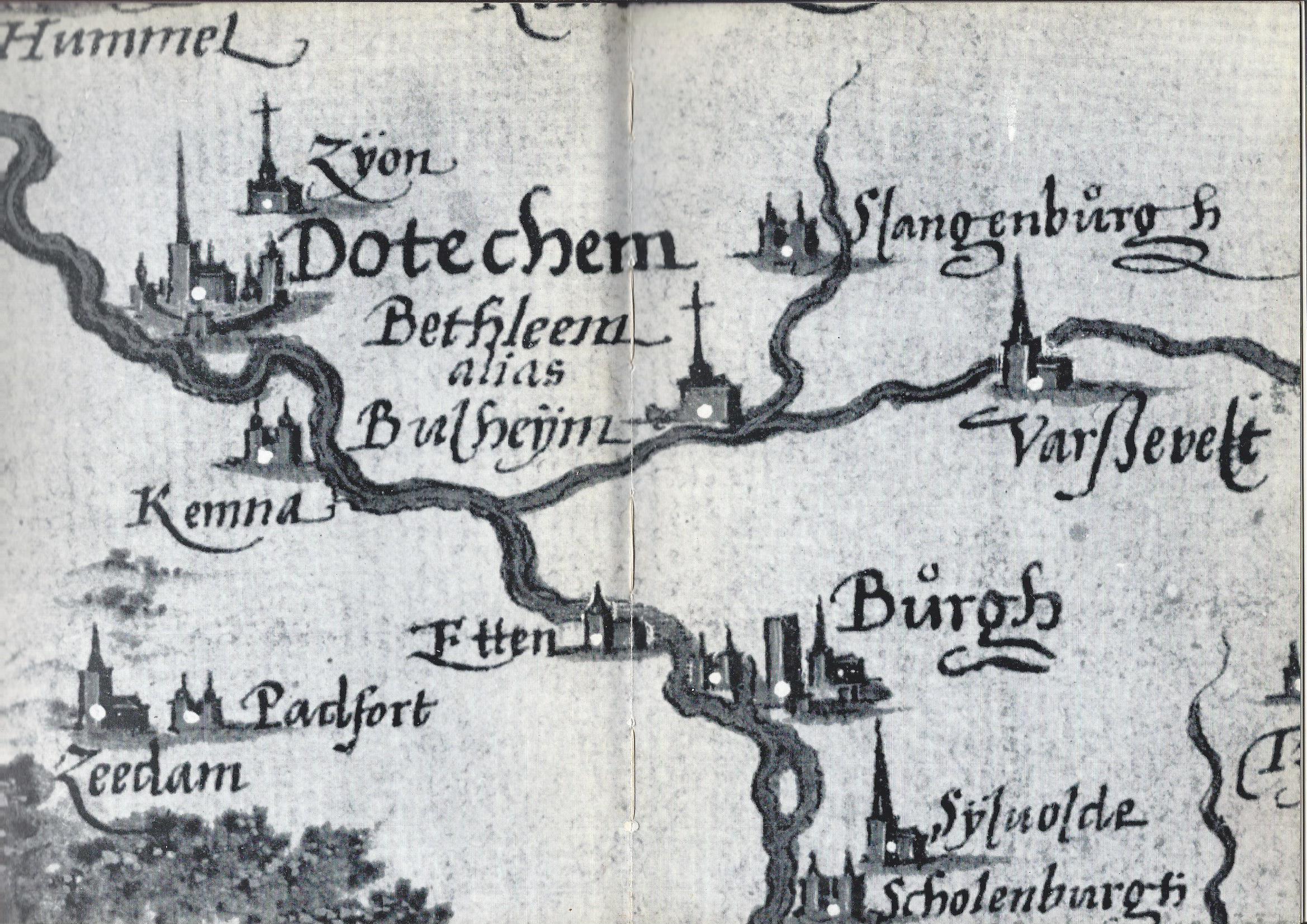
Nederlands: Detail kaart van Gelre en Kleef uit 1573 met de kloosters Zyon en Bethlehem, de stad Doetinchem, de kerspels Varsseveld, Terborg, Silvolde en Zeddam, de kastelen Slangenburg, Burgh, Schuilenburg, Padevoort en Kemnade |
| Date | omstreeks 1565 |
| Source | KB Brussel |
| Author | Christiaan Sgroten |
| Object location | | View this and other nearby images on: OpenStreetMap |
|---|
Licensing edit
|
This work is in the public domain in its country of origin and other countries and areas where the copyright term is the author's life plus 100 years or fewer. | |
| This file has been identified as being free of known restrictions under copyright law, including all related and neighboring rights. | |
File history
Click on a date/time to view the file as it appeared at that time.
| Date/Time | Thumbnail | Dimensions | User | Comment | |
|---|---|---|---|---|---|
| current | 08:13, 11 September 2013 | | 2,338 × 1,654 (1.06 MB) | Haagschebluf (talk | contribs) | User created page with UploadWizard |
You cannot overwrite this file.
File usage on Commons
The following 2 pages use this file:
File usage on other wikis
The following other wikis use this file:
- Usage on fr.wikipedia.org
- Usage on nl.wikipedia.org
- Usage on www.wikidata.org