File:Detailkarte der Gräben in Sankt Andreasberg.jpg

Size of this preview: 800 × 533 pixels. Other resolutions: 320 × 213 pixels | 640 × 427 pixels | 1,024 × 683 pixels | 1,280 × 854 pixels | 2,560 × 1,707 pixels | 6,438 × 4,293 pixels.
Original file (6,438 × 4,293 pixels, file size: 6.87 MB, MIME type: image/jpeg)
Captions
Captions
Add a one-line explanation of what this file represents
Summary edit
| Title |
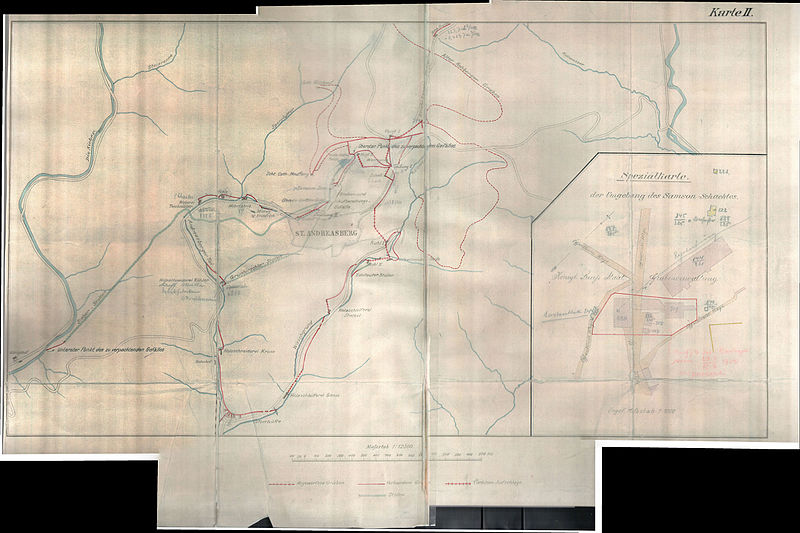
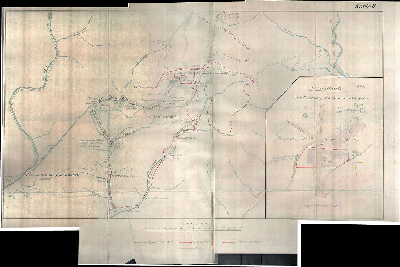
Deutsch: Detailkarte der Gräben in Sankt Andreasberg |
|||||||||
| Description |
Deutsch: Detailkarte der Gräben in Sankt Andreasberg |
|||||||||
| Date | ||||||||||
| Source | Unknown author | |||||||||
| Creator |
Unknown author |
|||||||||
| Geotemporal data | ||||||||||
| Scale | 1:12500 | |||||||||
| Bounding box |
|
|||||||||
| Georeferencing | If inappropriate please set warp_status = skip to hide. | |||||||||
| Bibliographic data | ||||||||||
| Language | German | |||||||||
| Archival data | ||||||||||
| Medium | print on paper | |||||||||
Licensing edit
|
This work is in the public domain in its country of origin and other countries and areas where the copyright term is the author's life plus 70 years or fewer. This work is in the public domain in the United States because it was published (or registered with the U.S. Copyright Office) before January 1, 1929. | |
| This file has been identified as being free of known restrictions under copyright law, including all related and neighboring rights. | |
File history
Click on a date/time to view the file as it appeared at that time.
| Date/Time | Thumbnail | Dimensions | User | Comment | |
|---|---|---|---|---|---|
| current | 09:34, 12 December 2015 | | 6,438 × 4,293 (6.87 MB) | Ogmios (talk | contribs) | User created page with UploadWizard |
You cannot overwrite this file.
File usage on Commons
The following page uses this file:
File usage on other wikis
The following other wikis use this file:
- Usage on de.wikipedia.org
- Usage on www.wikidata.org