File:Devil's Tower.jpg

Size of this preview: 800 × 537 pixels. Other resolutions: 320 × 215 pixels | 640 × 430 pixels | 1,024 × 687 pixels | 1,280 × 859 pixels | 2,560 × 1,718 pixels | 5,465 × 3,668 pixels.
Original file (5,465 × 3,668 pixels, file size: 4.12 MB, MIME type: image/jpeg)
Captions
Captions
Add a one-line explanation of what this file represents
Summary edit
| Camera location | | View this and other nearby images on: OpenStreetMap |
|---|
| Description |
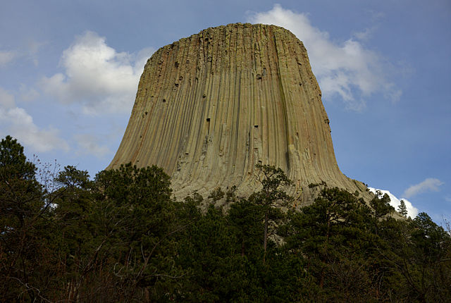
English: Devil's Tower is a is a Monolithic Intrusion or Volcanic Neck in the Black Hills above the Belle Fourche River in Crook county Wyoming. It rises 1,267 feet above the surrounding terrain and 5,112 feet above sea level.
|
||
| Date | Taken on 4 May 2011 | ||
| Source | Own work | ||
| Author | Alan Hinkel | ||
| Permission (Reusing this file) |
I, the copyright holder of this work, hereby publish it under the following license: This file is licensed under the Creative Commons Attribution-Share Alike 3.0 Unported license.
|

|
This image was uploaded as part of Wiki Loves Monuments 2012.
|
 |
File history
Click on a date/time to view the file as it appeared at that time.
| Date/Time | Thumbnail | Dimensions | User | Comment | |
|---|---|---|---|---|---|
| current | 00:09, 3 September 2012 | | 5,465 × 3,668 (4.12 MB) | Alan Hinkel (talk | contribs) | User created page with UploadWizard |
You cannot overwrite this file.
File usage on Commons
There are no pages that use this file.