File:Dia17.JPG
No higher resolution available.
Dia17.JPG (720 × 540 pixels, file size: 61 KB, MIME type: image/jpeg)
Captions
Captions
Add a one-line explanation of what this file represents
|
This is a photo of onroerend erfgoed number 56848
|
Summary edit
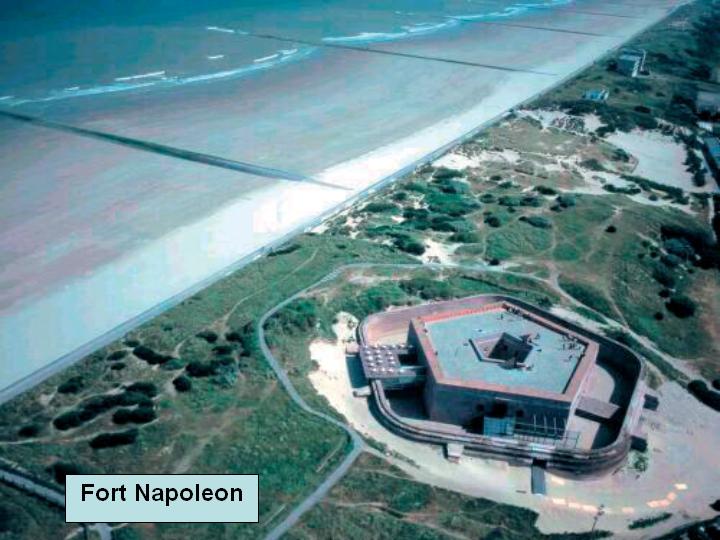
Fort Napoleon seen from the air; Oostende, Belgium
Licensing edit

|
The copyright holder of this work allows anyone to use it for any purpose including unrestricted redistribution, commercial use, and modification.
Usage notes:
|
| Object location | | View this and other nearby images on: OpenStreetMap |
|---|
File history
Click on a date/time to view the file as it appeared at that time.
| Date/Time | Thumbnail | Dimensions | User | Comment | |
|---|---|---|---|---|---|
| current | 18:18, 7 September 2005 | | 720 × 540 (61 KB) | JoJan (talk | contribs) | Fort Napoleon seen from the air; Oostende, Belgium |
You cannot overwrite this file.
File usage on Commons
The following page uses this file:
File usage on other wikis
The following other wikis use this file:
- Usage on de.wikipedia.org
- Usage on en.wikipedia.org
- Usage on fr.wikipedia.org
- Usage on is.wikipedia.org
- Usage on nl.wikipedia.org
- Usage on vls.wikipedia.org