File:Dołhobyczów (gmina) location map.png

Original file (1,283 × 1,769 pixels, file size: 353 KB, MIME type: image/png)
Captions
Captions
Summary edit
_location_map.png&action=edit§ion=1)
| Description |
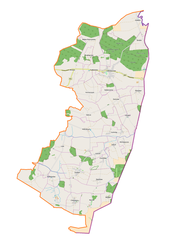
English: Location map |
| Date | |
| Source | Own work |
| Author | Smat |
| Description |
Polski: Mapa gminy Dołhobyczów, Polska
English: Map of Dołhobyczów (gmina), Poland |
|||||||||
| Date | ||||||||||
| Source | You may find a page on the OpenStreetMap wiki page for Dołhobyczów (gmina) | |||||||||
| Creator |
OpenStreetMap contributors OpenStreetMap contributors |
|||||||||
| Permission (Reusing this file) |
OpenStreetMap data is available under the Open Database License (details). Map tiles are licensed under the Creative Commons Attribution-ShareAlike 2.0 license (CC-BY-SA 2.0).
This file is licensed under the Creative Commons Attribution-Share Alike 2.0 Generic license.
|
|||||||||
| Geotemporal data | ||||||||||
| Bounding box |
|
|||||||||
| Georeferencing | If inappropriate please set warp_status = skip to hide. | |||||||||
Licensing edit
_location_map.png&action=edit§ion=2)
| This work contains information from OpenStreetMap, which is made available under the Open Database License (ODbL).
The ODbL does not require any particular license for maps produced from ODbL data. Prior to 1 August 2020, map tiles produced by the OpenStreetMap Foundation were licensed under the CC-BY-SA-2.0 license. Maps produced by other people may be subject to other licences. |
File history
Click on a date/time to view the file as it appeared at that time.
| Date/Time | Thumbnail | Dimensions | User | Comment | |
|---|---|---|---|---|---|
| current | 12:58, 5 September 2017 | | 1,283 × 1,769 (353 KB) | Smat (talk | contribs) | User created page with UploadWizard |
You cannot overwrite this file.
File usage on Commons
There are no pages that use this file.
File usage on other wikis
The following other wikis use this file:
- Usage on pl.wikipedia.org
- Rezerwat przyrody Suśle Wzgórza
- Dołhobyczów (gmina)
- Dołhobyczów
- Chochłów
- Chłopiatyn
- Dłużniów
- Honiatyn
- Horoszczyce
- Hulcze (wieś)
- Kościaszyn
- Liwcze
- Myców
- Oszczów
- Oszczów-Kolonia
- Podhajczyki
- Przewodów
- Setniki
- Siekierzyńce
- Uśmierz
- Wólka Poturzyńska
- Wyżłów
- Żabcze
- Żniatyn
- Zaręka
- Białystok (województwo lubelskie)
- Gołębie (województwo lubelskie)
- Lipina (województwo lubelskie)
- Sulimów (województwo lubelskie)
- Witków (województwo lubelskie)
- Horodyszcze (powiat hrubieszowski)
- Kadłubiska (powiat hrubieszowski)
- Majdan (powiat hrubieszowski)
- Liski (gmina Dołhobyczów)
- Kolonia Sulimów
- Dołhobyczów-Kolonia (osada)
- Mołczany
- Przejście graniczne Dołhobyczów-Uhrynów
- Cerkiew św. Symeona Słupnika w Dołhobyczowie
- Cerkiew Podniesienia Krzyża Świętego w Dłużniowie
- Winniki (województwo lubelskie)
- Kościół Matki Bożej Częstochowskiej w Dołhobyczowie
- Cerkiew Zesłania Ducha Świętego w Chłopiatynie
- Cerkiew św. Jana Chrzciciela w Liskach
- Kościół św. Barbary w Oszczowie
- Parafia Matki Bożej Częstochowskiej w Dołhobyczowie
- Dołhobyczów-Kolonia (kolonia)
- Hulcze (osada)
- Korczunek (województwo lubelskie)
- Liwcze (osada)
- Myców (osada)
View more global usage of this file.
_location_map.png)
_location_map.png&oldid=708053639)