File:Doe Creek Farm driveway.jpg

Size of this preview: 800 × 532 pixels. Other resolutions: 320 × 213 pixels | 640 × 426 pixels | 1,024 × 681 pixels | 1,280 × 851 pixels | 2,560 × 1,702 pixels | 6,016 × 4,000 pixels.
Original file (6,016 × 4,000 pixels, file size: 6.3 MB, MIME type: image/jpeg)
Captions
Captions
Add a one-line explanation of what this file represents
|
This is an image of a place or building that is listed on the National Register of Historic Places in the United States of America. Its reference number is 100001079. |
| Camera location | | View this and other nearby images on: OpenStreetMap |
|---|
| Description |
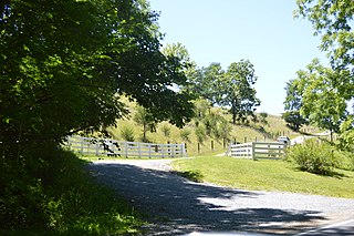
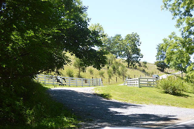
English: Driveway to Doe Creek Farm, located on Doe Creek Road east of Pembroke in Giles County, Virginia, United States. The estate is listed on the National Register of Historic Places. |
||
| Date | Taken on 5 August 2017 | ||
| Source | Own work | ||
| Author | Nyttend | ||
| Permission (Reusing this file) |
|
File history
Click on a date/time to view the file as it appeared at that time.
| Date/Time | Thumbnail | Dimensions | User | Comment | |
|---|---|---|---|---|---|
| current | 03:07, 23 August 2017 | | 6,016 × 4,000 (6.3 MB) | Nyttend (talk | contribs) | {{NRHP|100001079}} {{Location|37|20|2|N|80|34|36|W}} {{Information |Description={{en|Driveway to {{w|Doe Creek Farm}}, located on Doe Creek Road east of {{w|Pembroke, Virginia|Pembroke}} in {{w|Giles County, Virginia|Giles County}}, {{w|Virginia}}, {{w... |
You cannot overwrite this file.
File usage on Commons
There are no pages that use this file.
File usage on other wikis
The following other wikis use this file:
- Usage on en.wikipedia.org
- Usage on www.wikidata.org