File:Domodedovo International Airport aerial view.jpg
Size of this preview: 800 × 450 pixels. Other resolutions: 320 × 180 pixels | 640 × 360 pixels | 1,024 × 576 pixels | 1,280 × 721 pixels | 2,560 × 1,441 pixels | 4,320 × 2,432 pixels.
Original file (4,320 × 2,432 pixels, file size: 2.61 MB, MIME type: image/jpeg)
File information
Structured data
Captions
DescriptionDomodedovo International Airport aerial view.jpg |
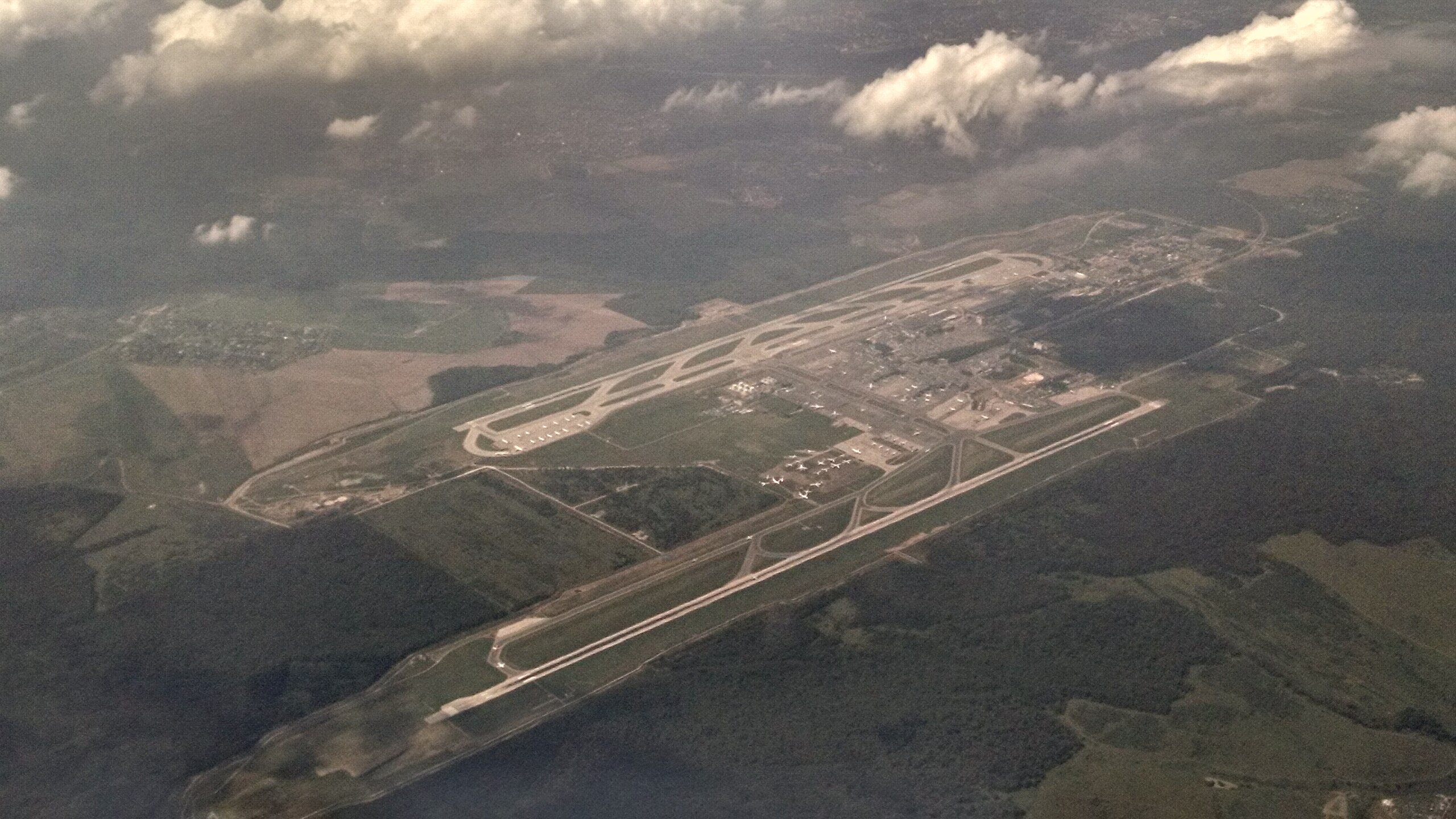
English: Aerial view of Domodedovo International Airport |
|||
Date | ||||
Source | Own work | |||
Author | Rifleman_82 | |||
Permission (Reusing this file) |
|
Camera location | 55° 24′ 51.59″ N, 38° 01′ 27.74″ E | View this and other nearby images on: OpenStreetMap | 55.414331; 38.024372 |
---|
File history
Click on a date/time to view the file as it appeared at that time.
Date/Time | Thumbnail | Dimensions | User | Comment | |
---|---|---|---|---|---|
current | 19:50, 11 November 2014 | 4,320 × 2,432 (2.61 MB) | Rifleman 82 (talk | contribs) | {{Information |Description ={{en|1=Aerial view of en:Domodedovo International Airport}} |Source =Self |Author =Rifleman_82 |Date =2014-07-10 |Permission ={{pd-self}} |other_versions = }} |
You cannot overwrite this file.
File usage on Commons
The following page uses this file:
File usage on other wikis
The following other wikis use this file:
- Usage on cs.wikipedia.org
- Usage on gl.wikipedia.org
- Usage on he.wikivoyage.org
- Usage on id.wikipedia.org
- Usage on it.wikipedia.org
- Usage on ms.wikipedia.org
- Usage on sco.wikipedia.org
- Usage on uz.wikipedia.org
- Usage on zh.wikipedia.org
Metadata
This file contains additional information such as Exif metadata which may have been added by the digital camera, scanner, or software program used to create or digitize it. If the file has been modified from its original state, some details such as the timestamp may not fully reflect those of the original file. The timestamp is only as accurate as the clock in the camera, and it may be completely wrong.
Camera manufacturer | Motorola |
---|---|
Camera model | XT1053 |
Exposure time | 1/3,125 sec (0.00032) |
F-number | f/2.4 |
ISO speed rating | 160 |
Date and time of data generation | 13:46, 10 July 2014 |
Lens focal length | 4.499 mm |
Latitude | 55° 24′ 51.59″ N |
Longitude | 38° 1′ 27.74″ E |
Altitude | 3,401 meters above sea level |
Horizontal resolution | 72 dpi |
Vertical resolution | 72 dpi |
File change date and time | 13:46, 10 July 2014 |
Y and C positioning | Centered |
Exposure Program | Manual |
Exif version | 2.2 |
Date and time of digitizing | 13:46, 10 July 2014 |
Meaning of each component |
|
APEX shutter speed | 11.56 |
APEX aperture | 2.4 |
APEX brightness | −1 |
APEX exposure bias | 0 |
Maximum land aperture | 2.4 APEX (f/2.3) |
Subject distance | 1.97 meters |
Metering mode | Average |
Light source | D65 |
Flash | Flash did not fire, auto mode |
Supported Flashpix version | 1 |
Color space | sRGB |
Scene type | 49 |
Custom image processing | Custom process |
Exposure mode | Auto bracket |
White balance | Auto white balance |
Digital zoom ratio | 1.66 |
Scene capture type | Standard |
Contrast | Normal |
Saturation | Normal |
Sharpness | Soft |
GPS time (atomic clock) | 09:46 |
Geodetic survey data used | WGS-84 |
GPS date | 10 July 2014 |
GPS tag version | 2.2.0.0 |