File:Dresden Überblick 13.jpg

Size of this preview: 800 × 600 pixels. Other resolutions: 320 × 240 pixels | 640 × 480 pixels | 1,024 × 768 pixels | 1,280 × 960 pixels | 2,560 × 1,920 pixels | 3,072 × 2,304 pixels.
Original file (3,072 × 2,304 pixels, file size: 1.54 MB, MIME type: image/jpeg)
Captions
Captions
Add a one-line explanation of what this file represents
Summary edit
| Description |
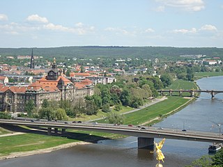
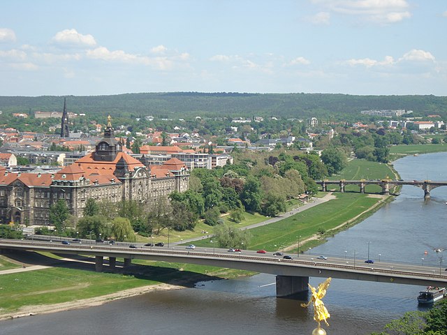
The terrain of Dresden Deutsch: Dresden von der Frauenkirche aus gesehen: Im Vordergrund die Elbe und die Innere Neustadt, dahinter Äußere Neustadt, Albertstadt und Radeberger Vorstadt und schließlich die Dresdner Heide. |
| Date | |
| Source | Kay Körner from Dresden Seevortstad/Großer Garten |
| Author | Kay Körner from Dresden Seevortstad/Großer Garten |
| Permission (Reusing this file) |
This file is licensed under the Creative Commons Attribution 2.5 Generic license.
|
| Object location | | View this and other nearby images on: OpenStreetMap |
|---|
| Camera location | | View this and other nearby images on: OpenStreetMap |
|---|
| Annotations | This image is annotated: View the annotations at Commons |
File history
Click on a date/time to view the file as it appeared at that time.
| Date/Time | Thumbnail | Dimensions | User | Comment | |
|---|---|---|---|---|---|
| current | 16:04, 14 May 2008 | | 3,072 × 2,304 (1.54 MB) | Kay Körner (talk | contribs) | == Summary == {{Information |Description=The terrain of Dresden |Source=Kay Körner from Dresden Seevortstad/Großer Garten |Date=Metadata |Author=Kay Körner from Dresden Seevortstad/Großer Garten |Permission={{cc-by-2.5}} |other_versions= }} |
You cannot overwrite this file.
File usage on Commons
The following page uses this file:
File usage on other wikis
The following other wikis use this file:
- Usage on de.wikipedia.org
- Usage on www.wikidata.org