File:Druhy zeleznicni koridor.svg

Size of this PNG preview of this SVG file: 800 × 458 pixels. Other resolutions: 320 × 183 pixels | 640 × 366 pixels | 1,024 × 586 pixels | 1,280 × 733 pixels | 2,560 × 1,465 pixels | 3,000 × 1,717 pixels.
Original file (SVG file, nominally 3,000 × 1,717 pixels, file size: 316 KB)
Captions
Captions
Add a one-line explanation of what this file represents
| Description |
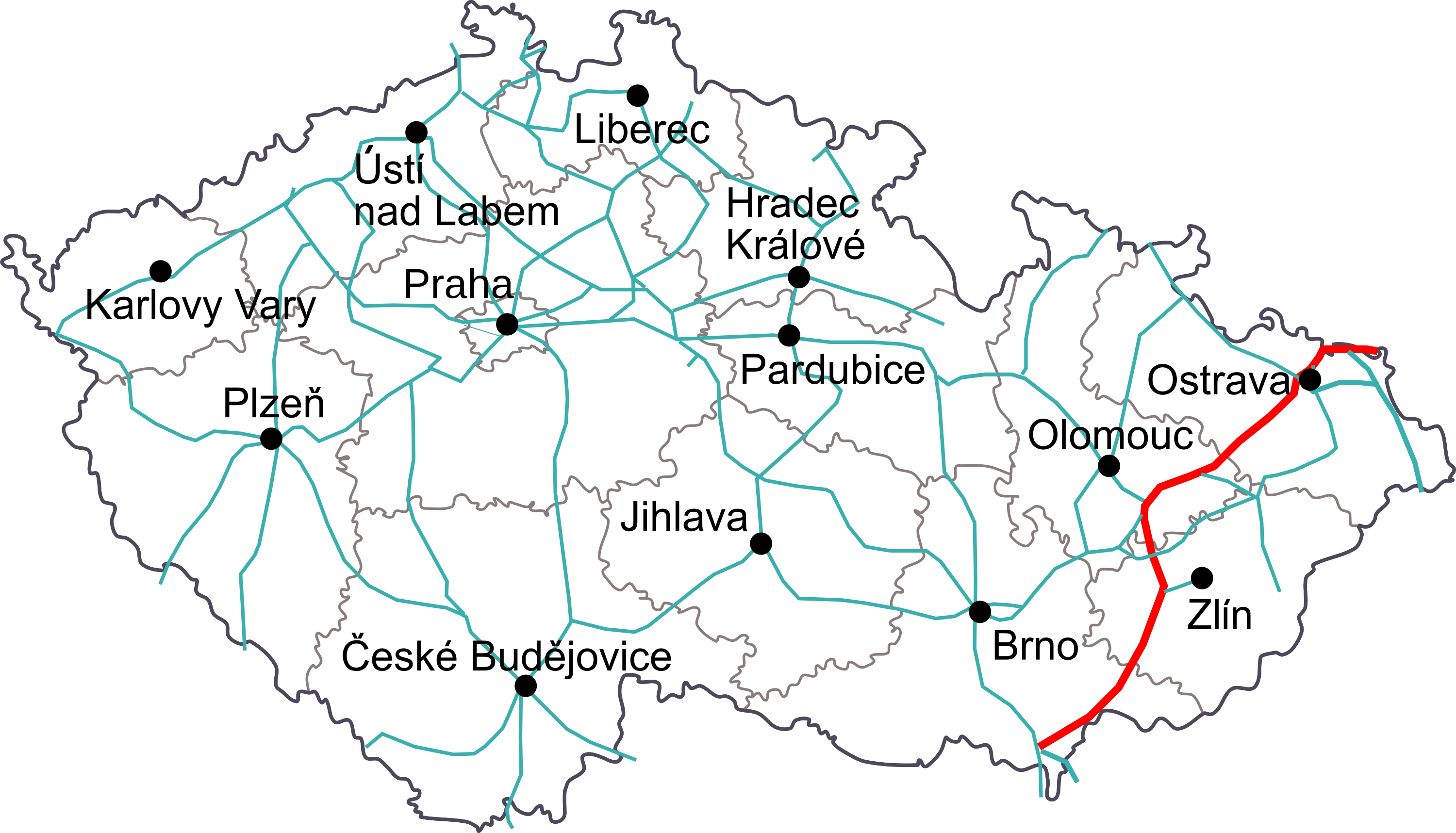
Čeština: Mapa druhéhoželezničního koridoru v České republice
English: Map of second train coridor in the Czech republic |
| Date | |
| Source | Vlastní fotografie/ Own work |
| Author | Honza Groh |
| Permission (Reusing this file) |
Při použití fotografie mimo Wikipedie nutno uvést mé jméno/ Photo can be use out Wikipedia only with my name |
I, the copyright holder of this work, hereby publish it under the following licenses:

|
Permission is granted to copy, distribute and/or modify this document under the terms of the GNU Free Documentation License, Version 1.2 or any later version published by the Free Software Foundation; with no Invariant Sections, no Front-Cover Texts, and no Back-Cover Texts. A copy of the license is included in the section entitled GNU Free Documentation License. |
This file is licensed under the Creative Commons Attribution 3.0 Unported license.
- You are free:
- to share – to copy, distribute and transmit the work
- to remix – to adapt the work
- Under the following conditions:
- attribution – You must give appropriate credit, provide a link to the license, and indicate if changes were made. You may do so in any reasonable manner, but not in any way that suggests the licensor endorses you or your use.
You may select the license of your choice.
File history
Click on a date/time to view the file as it appeared at that time.
| Date/Time | Thumbnail | Dimensions | User | Comment | |
|---|---|---|---|---|---|
| current | 22:44, 2 January 2017 | | 3,000 × 1,717 (316 KB) | Pavouk (talk | contribs) | odstraněn úsek Česká Třebová-Přerov, který nepatří do druhého koridoru |
| 18:33, 14 September 2008 |  | 3,000 × 1,717 (315 KB) | Jagro (talk | contribs) | {{Information |Description={{cs|Mapa druhéhoželezničního koridoru v České republice}} {{en|Map of second train coridor in the Czech republic}} |Source=Vlastní fotografie/ Own work |Date=14. 8. 2008 |Author=Honza Groh |Permission=Při použití foto |
You cannot overwrite this file.
File usage on Commons
The following 4 pages use this file:
File usage on other wikis
The following other wikis use this file:
- Usage on cs.wikipedia.org
- Usage on de.wikipedia.org
- Usage on www.wikidata.org