File:Dundee, Michigan. Detail from Map of Monroe County 1901.jpg
Size of this preview: 768 × 599 pixels. Other resolutions: 308 × 240 pixels | 615 × 480 pixels | 984 × 768 pixels | 1,280 × 999 pixels | 2,560 × 1,997 pixels | 5,629 × 4,392 pixels.
Original file (5,629 × 4,392 pixels, file size: 7.74 MB, MIME type: image/jpeg)
Captions
Captions
Add a one-line explanation of what this file represents
Summary edit
| Description |
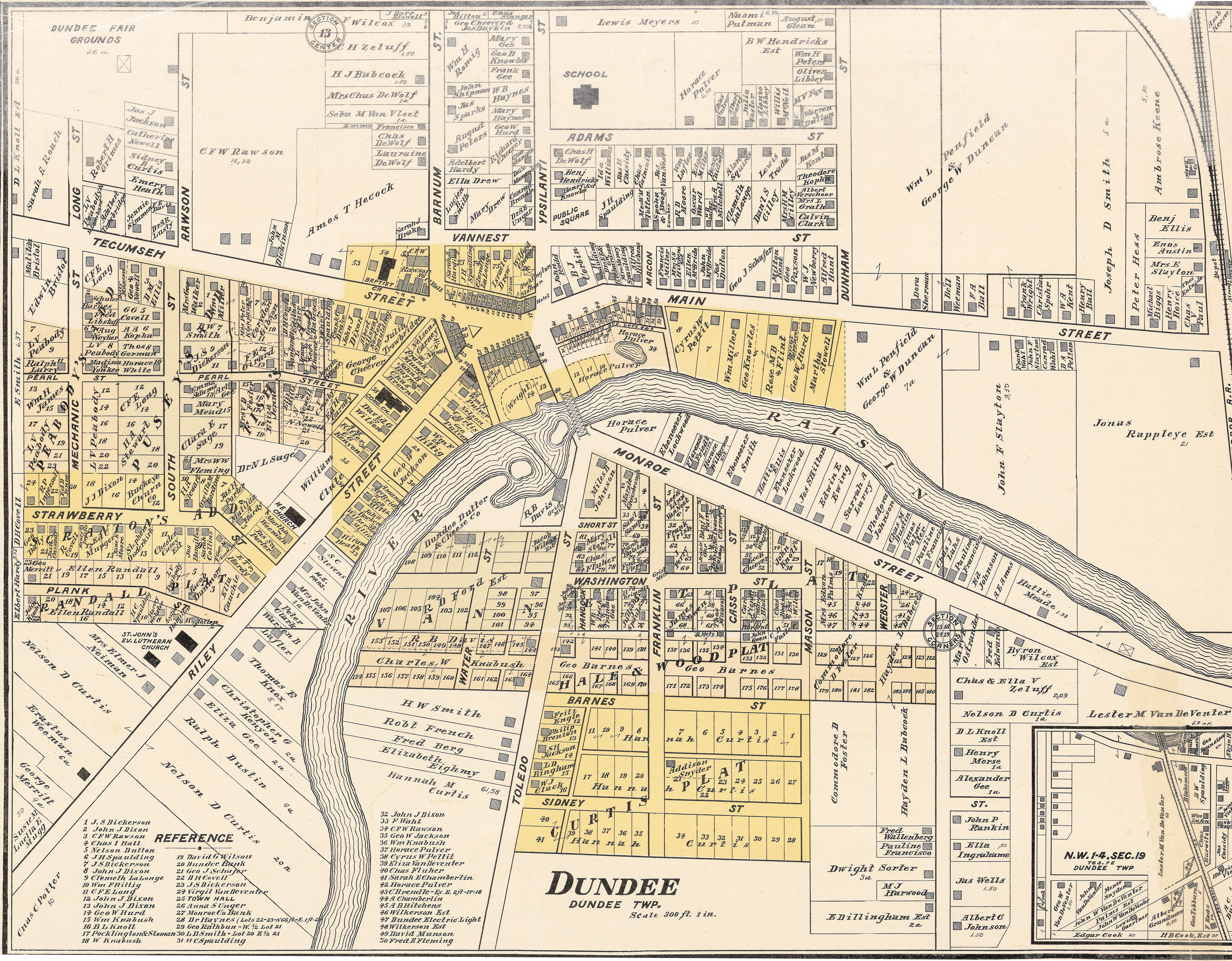
English: 1901 cadastral map of Dundee, Michigan showing property lines and major landowners. |
| Date | |
| Source | Map of Monroe County, Michigan. Carleton, MI: Geo. E. Lang, 1901. |
| Author | George Earl Lang |
| Camera location | | View this and other nearby images on: OpenStreetMap |
|---|
MSU Library catalog record http://catalog.lib.msu.edu/record=b5014617~S39a
Licensing edit
This work is in the public domain in the United States because it was published (or registered with the U.S. Copyright Office) before January 1, 1929.
Public domain works must be out of copyright in both the United States and in the source country of the work in order to be hosted on the Commons. If the work is not a U.S. work, the file must have an additional copyright tag indicating the copyright status in the source country.
Note: This tag should not be used for sound recordings. |
File history
Click on a date/time to view the file as it appeared at that time.
| Date/Time | Thumbnail | Dimensions | User | Comment | |
|---|---|---|---|---|---|
| current | 23:16, 30 December 2016 | | 5,629 × 4,392 (7.74 MB) | Wildiewill (talk | contribs) | User created page with UploadWizard |
You cannot overwrite this file.
File usage on Commons
There are no pages that use this file.
File usage on other wikis
The following other wikis use this file:
- Usage on en.wikipedia.org