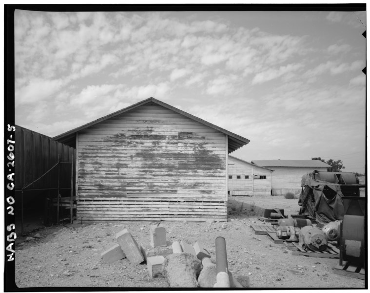
File:EAST WING from E - Latimer Packing House, 321 South San Antonio Avenue, Ontario, San Bernardino County, CA HABS CAL,36-ONT,1-5.tif

Original file (5,000 × 3,952 pixels, file size: 18.85 MB, MIME type: image/tiff)
Captions
Captions
Summary edit
| EAST WING from E - Latimer Packing House, 321 South San Antonio Avenue, Ontario, San Bernardino County, CA | |||||
|---|---|---|---|---|---|
| Photographer |
Related names:
|
||||
| Title |
EAST WING from E - Latimer Packing House, 321 South San Antonio Avenue, Ontario, San Bernardino County, CA |
||||
| Depicted place | California; San Bernardino County; Ontario | ||||
| Date | Documentation compiled after 1933 | ||||
| Dimensions | 4 x 5 in. | ||||
| Current location |
Library of Congress Prints and Photographs Division Washington, D.C. 20540 USA http://hdl.loc.gov/loc.pnp/pp.print |
||||
| Accession number |
HABS CAL,36-ONT,1-5 |
||||
| Credit line |
|
||||
| Notes |
|
||||
| Source | https://www.loc.gov/pictures/item/ca1985.photos.181669p | ||||
| Permission (Reusing this file) |
|
||||
| Object location | 34° 03′ 47.99″ N, 117° 39′ 00″ W | View this and other nearby images on: OpenStreetMap |
|---|
File history
Click on a date/time to view the file as it appeared at that time.
| Date/Time | Thumbnail | Dimensions | User | Comment | |
|---|---|---|---|---|---|
| current | 08:39, 5 July 2014 |  | 5,000 × 3,952 (18.85 MB) | Fæ (talk | contribs) | GWToolset: Creating mediafile for Fæ. HABS 05 July 2014 (401:500) |
You cannot overwrite this file.
File usage on Commons
The following page uses this file:
Metadata
This file contains additional information such as Exif metadata which may have been added by the digital camera, scanner, or software program used to create or digitize it. If the file has been modified from its original state, some details such as the timestamp may not fully reflect those of the original file. The timestamp is only as accurate as the clock in the camera, and it may be completely wrong.
| Author | Library of Congress |
|---|---|
| Width | 5,000 px |
| Height | 3,952 px |
| Compression scheme | Uncompressed |
| Pixel composition | Black and white (Black is 0) |
| Orientation | Normal |
| Number of components | 1 |
| Number of rows per strip | 13 |
| Horizontal resolution | 1,000 dpi |
| Vertical resolution | 1,000 dpi |
| Data arrangement | chunky format |
| File change date and time | 15:51, 21 June 2000 |

