File:ESP 054832 2185 (29563081297).jpg

Size of this preview: 800 × 600 pixels. Other resolutions: 320 × 240 pixels | 640 × 480 pixels | 1,024 × 768 pixels | 1,280 × 960 pixels | 2,560 × 1,920 pixels.
Original file (2,560 × 1,920 pixels, file size: 6.38 MB, MIME type: image/jpeg)
Captions
Captions
Add a one-line explanation of what this file represents
Summary edit
.jpg&action=edit§ion=1)
| Description |
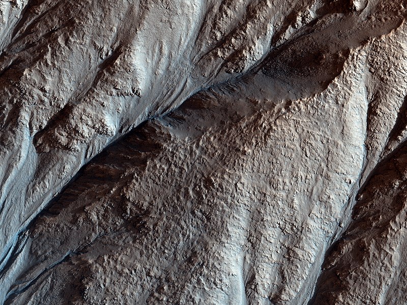
This image shows the gullied western slopes of an unnamed crater (about 10 kilometers wide) in Acidalia Planitia. These slopes have gone through a complicated history of gully erosion of the bedrock layers in the upper section, followed by the formation of fractures along the lower slopes. NASA/JPL/University of Arizona (298 km above the surface, less than 1 km across) Source: www.uahirise.org/ESP_054832_2185 |
| Date | |
| Source | ESP_054832_2185 |
| Author | UAHiRISE (NASA) |
Licensing edit
.jpg&action=edit§ion=2)
| This file is in the public domain in the United States because it was solely created by NASA. NASA copyright policy states that "NASA material is not protected by copyright unless noted". (See Template:PD-USGov, NASA copyright policy page or JPL Image Use Policy.) | ||
 |
Warnings:
|
File history
Click on a date/time to view the file as it appeared at that time.
| Date/Time | Thumbnail | Dimensions | User | Comment | |
|---|---|---|---|---|---|
| current | 10:20, 16 May 2019 | | 2,560 × 1,920 (6.38 MB) | Meisam (talk | contribs) | Transferred from Flickr via #flickr2commons |
You cannot overwrite this file.
File usage on Commons
The following page uses this file:
.jpg&oldid=695835995)