File:EastPrussiaMap1944 (Zichenau).png

Size of this preview: 800 × 594 pixels. Other resolutions: 320 × 238 pixels | 640 × 476 pixels | 1,024 × 761 pixels | 1,280 × 951 pixels | 1,845 × 1,371 pixels.
Original file (1,845 × 1,371 pixels, file size: 351 KB, MIME type: image/png)
Captions
Captions
Add a one-line explanation of what this file represents
Summary edit
| Description |
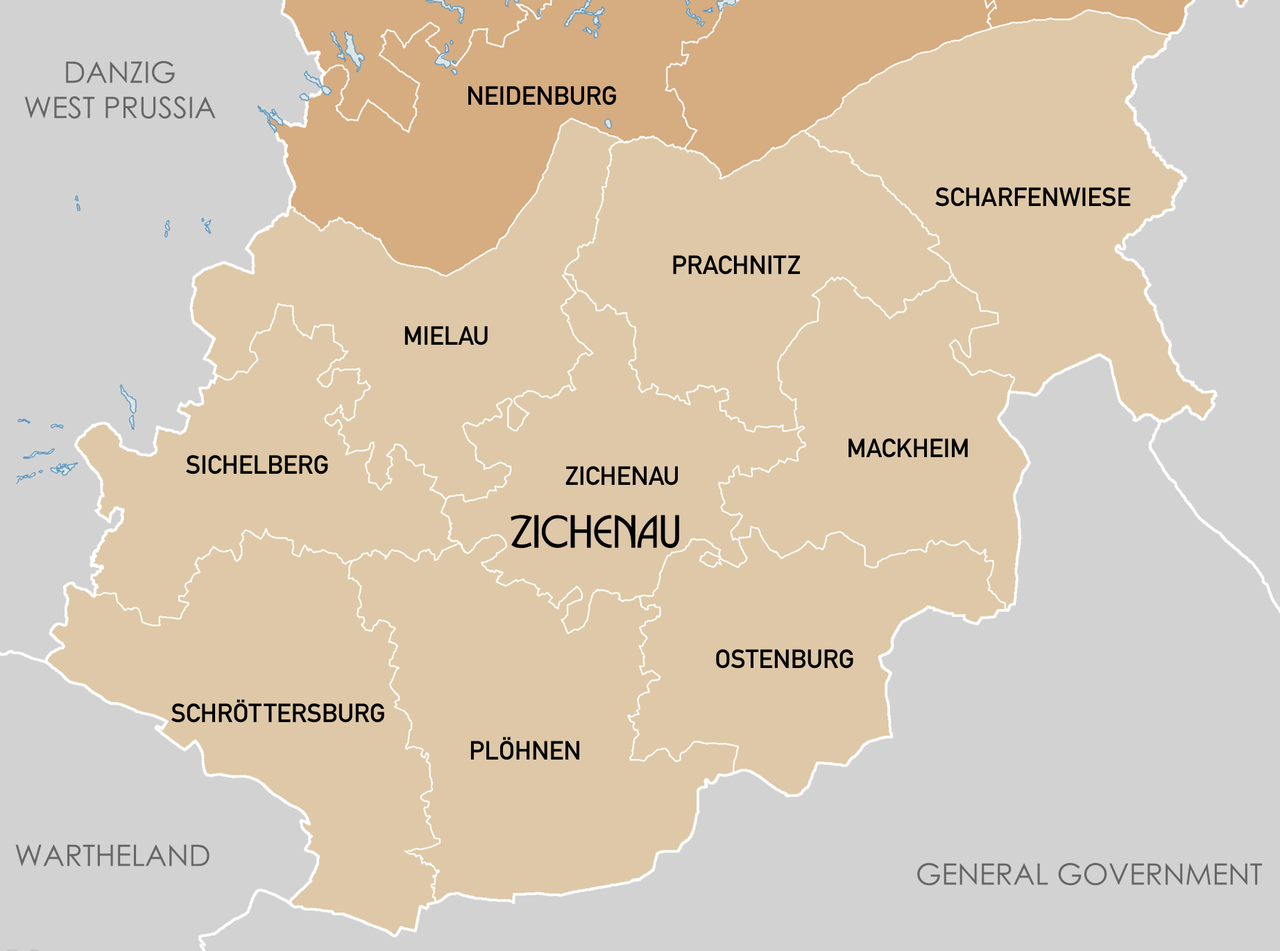
English: Administrative map of East Prussia in 1944. Map data digitised from Karte des Deutschen Reiches 1:100k, Karte von Mitteleuropa 1:300k. Some source maps from WIG (www.mapywig.org). |
| Date | |
| Source | Own work |
| Author | XrysD |
| Other versions |

.png&action=edit§ion=1)
Licensing edit
.png&action=edit§ion=2)
I, the copyright holder of this work, hereby publish it under the following license:
This file is licensed under the Creative Commons Attribution-Share Alike 3.0 Unported license.
- You are free:
- to share – to copy, distribute and transmit the work
- to remix – to adapt the work
- Under the following conditions:
- attribution – You must give appropriate credit, provide a link to the license, and indicate if changes were made. You may do so in any reasonable manner, but not in any way that suggests the licensor endorses you or your use.
- share alike – If you remix, transform, or build upon the material, you must distribute your contributions under the same or compatible license as the original.
File history
Click on a date/time to view the file as it appeared at that time.
| Date/Time | Thumbnail | Dimensions | User | Comment | |
|---|---|---|---|---|---|
| current | 00:23, 30 December 2017 | | 1,845 × 1,371 (351 KB) | Charmbook (talk | contribs) | File:EastPrussiaMap1944.png cropped 39 % horizontally and 67 % vertically using CropTool with precise mode. |
You cannot overwrite this file.
File usage on Commons
The following 2 pages use this file:
File usage on other wikis
The following other wikis use this file:
- Usage on de.wikipedia.org
- Usage on en.wikipedia.org
- Usage on ru.wikipedia.org
- Usage on www.wikidata.org
.png&oldid=637832818)