File:East Sussex UK locator map 2010.svg

Size of this PNG preview of this SVG file: 494 × 600 pixels. Other resolutions: 198 × 240 pixels | 395 × 480 pixels | 633 × 768 pixels | 843 × 1,024 pixels | 1,687 × 2,048 pixels | 1,108 × 1,345 pixels.
Original file (SVG file, nominally 1,108 × 1,345 pixels, file size: 302 KB)
Captions
Captions
Add a one-line explanation of what this file represents
Summary edit
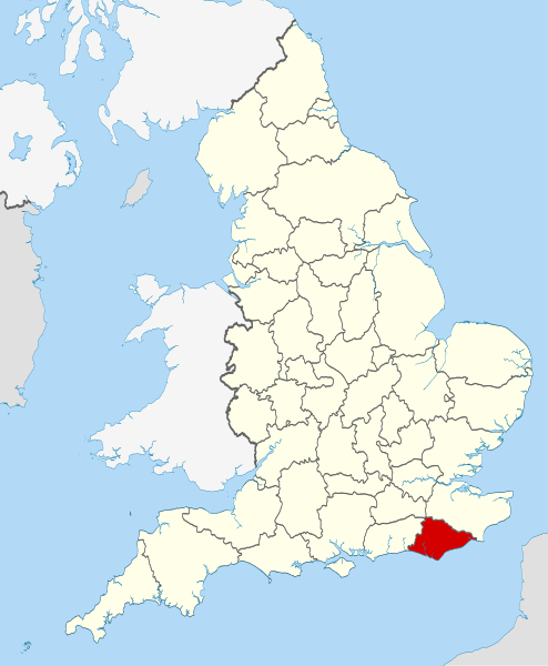
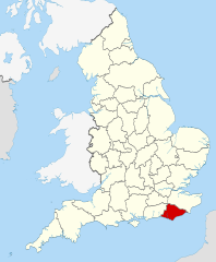
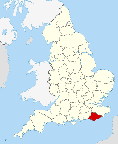
| Description | Location of the ceremonial county of East Sussex within England. |
| Date | |
| Source |
National Geospatial-Intelligence Agency
|
| Author | Nilfanion |
Licensing edit
I, the copyright holder of this work, hereby publish it under the following licenses:
This file is licensed under the Creative Commons Attribution-Share Alike 3.0 Unported license.
- You are free:
- to share – to copy, distribute and transmit the work
- to remix – to adapt the work
- Under the following conditions:
- attribution – You must give appropriate credit, provide a link to the license, and indicate if changes were made. You may do so in any reasonable manner, but not in any way that suggests the licensor endorses you or your use.
- share alike – If you remix, transform, or build upon the material, you must distribute your contributions under the same or compatible license as the original.

|
Permission is granted to copy, distribute and/or modify this document under the terms of the GNU Free Documentation License, Version 1.2 or any later version published by the Free Software Foundation; with no Invariant Sections, no Front-Cover Texts, and no Back-Cover Texts. A copy of the license is included in the section entitled GNU Free Documentation License. |
You may select the license of your choice.

|
This is one of the images forming part of the Valued image set: Locator maps of the Ceremonial counties of England on Wikimedia Commons. The image set has been assessed under the valued image set criteria and is considered the most valued set on Commons within the scope:
Locator maps of the Ceremonial counties of England
You can see its nomination at Commons:Valued image candidates/Locator maps of English ceremonial counties. |
File history
Click on a date/time to view the file as it appeared at that time.
| Date/Time | Thumbnail | Dimensions | User | Comment | |
|---|---|---|---|---|---|
| current | 22:35, 23 November 2010 | | 1,108 × 1,345 (302 KB) | Nilfanion (talk | contribs) | == Summary == {{Information |Description=Location of the ceremonial county of East Sussex within England. |Source=Ordnance Survey [https://www.ordnancesurvey.co.uk/opendatadownload/products.html OpenData]: *County b |
You cannot overwrite this file.
File usage on Commons
The following 30 pages use this file:
- Valued image set: Locator maps of the Ceremonial counties of England
- Commons:Valued image candidates/Locator maps of English ceremonial counties
- Category:Almshouses in East Sussex
- Category:Alumni by school in East Sussex
- Category:Births in East Sussex
- Category:Bridges in East Sussex
- Category:Cemeteries in East Sussex
- Category:Deaths in East Sussex
- Category:East Sussex
- Category:East Sussex in the 1990s
- Category:East Sussex in the 2000s
- Category:East Sussex in the 2010s
- Category:East Sussex in the 20th century
- Category:East Sussex in the 21st century
- Category:Festivals in East Sussex
- Category:Geography of East Sussex
- Category:Hospitals in East Sussex
- Category:Maps of East Sussex
- Category:People of East Sussex
- Category:Populated places in East Sussex
- Category:Rail transport in East Sussex
- Category:Railway stations in East Sussex
- Category:Rivers of East Sussex
- Category:Roads in East Sussex
- Category:Towers in East Sussex
- Category:Tunnels in East Sussex
- Category:Views of East Sussex
- Category:Villages in East Sussex
- Category:Visitor attractions in East Sussex
- Category:Windmills in East Sussex
File usage on other wikis
The following other wikis use this file:
- Usage on af.wikipedia.org
- Usage on ar.wikipedia.org
- Usage on ast.wikipedia.org
- Usage on be-tarask.wikipedia.org
- Usage on bg.wikipedia.org
- Usage on ca.wikipedia.org
- Usage on ceb.wikipedia.org
- Usage on cs.wikipedia.org
- Usage on dag.wikipedia.org
- Usage on en.wikipedia.org
- Sussex
- East Sussex
- Cliffe Hill
- Upper Hartfield
- Icklesham
- Withdean
- Fletching, East Sussex
- Dallington, East Sussex
- East Guldeford
- Iden, East Sussex
- Playden
- Rye Foreign
- Udimore
- Little Horsted
- Wartling
- St Ann Without
- Preston, Brighton
- Denton, East Sussex
- Chailey Common
- Newhaven Seaplane Base
- Lullington, East Sussex
- East Blatchington
- Darwell Reservoir
- Winchelsea Beach
- Plumpton Racecourse
- River Uck
- Ridgewood, East Sussex
- Template:EastSussex-geo-stub
- Hove Park
- Sussex Ouse Valley Way
- Baldslow
- Belmont, East Sussex
- Rock-a-Nore
- Gensing, East Sussex
- Sussex Border Path
- Broad Oak, Wealden
- Salehurst and Robertsbridge
- Sidley, East Sussex
View more global usage of this file.