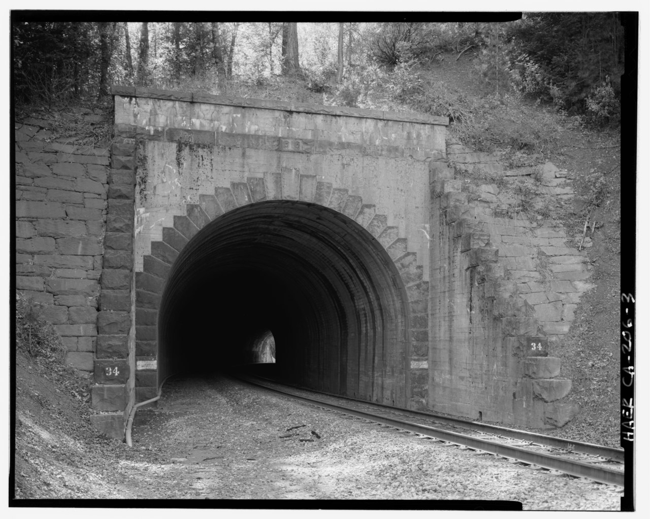
File:East portal of Tunnel 34, view to south-southwest, 135mm lens with electronic flash fill. Note the shift, in these later tunnels east of Colfax, to concrete portal faces with HAER CAL,31-COLF.V,1-3.tif

Size of this JPG preview of this TIF file: 751 × 599 pixels. Other resolutions: 301 × 240 pixels | 601 × 480 pixels | 962 × 768 pixels | 1,280 × 1,022 pixels | 2,560 × 2,043 pixels | 5,000 × 3,991 pixels.
Original file (5,000 × 3,991 pixels, file size: 19.03 MB, MIME type: image/tiff)
Captions
Captions
Add a one-line explanation of what this file represents
Summary edit
| Photographer |
Related names:
|
|||
| Title |
East portal of Tunnel 34, view to south-southwest, 135mm lens with electronic flash fill. Note the shift, in these later tunnels east of Colfax, to concrete portal faces with granite masonry voussoirs and coping. - Central Pacific Transcontinental Railroad, Tunnel No. 34, Milepost 145.4, Colfax, Placer County, CA |
|||
| Depicted place | California; Placer County; Colfax | |||
| Date | Documentation compiled after 1968 | |||
| Dimensions | height: 4 in (10.1 cm); width: 5 in (12.7 cm) | |||
| Current location |
Library of Congress Prints and Photographs Division Washington, D.C. 20540 USA http://hdl.loc.gov/loc.pnp/pp.print |
|||
| Accession number |
HAER CAL,31-COLF.V,1-3 |
|||
| Credit line |
|
|||
| Notes |
|
|||
| Source | https://www.loc.gov/pictures/item/ca2404.photos.315580p | |||
| Permission (Reusing this file) |
|

| Object location | | View this and other nearby images on: OpenStreetMap |
|---|
File history
Click on a date/time to view the file as it appeared at that time.
| Date/Time | Thumbnail | Dimensions | User | Comment | |
|---|---|---|---|---|---|
| current | 18:19, 6 July 2014 |  | 5,000 × 3,991 (19.03 MB) | Fæ (talk | contribs) | GWToolset: Creating mediafile for Fæ. HABS 05 July 2014 (401:500) |
You cannot overwrite this file.
File usage on Commons
The following page uses this file:
File usage on other wikis
The following other wikis use this file:
- Usage on en.wikipedia.org