File:East vs West Coast Earthquakes USGS.jpg

Size of this preview: 720 × 600 pixels. Other resolutions: 288 × 240 pixels | 576 × 480 pixels | 922 × 768 pixels | 1,229 × 1,024 pixels | 2,458 × 2,048 pixels | 3,600 × 3,000 pixels.
Original file (3,600 × 3,000 pixels, file size: 1.75 MB, MIME type: image/jpeg)
Captions
Captions
Add a one-line explanation of what this file represents
Summary edit
| Description |
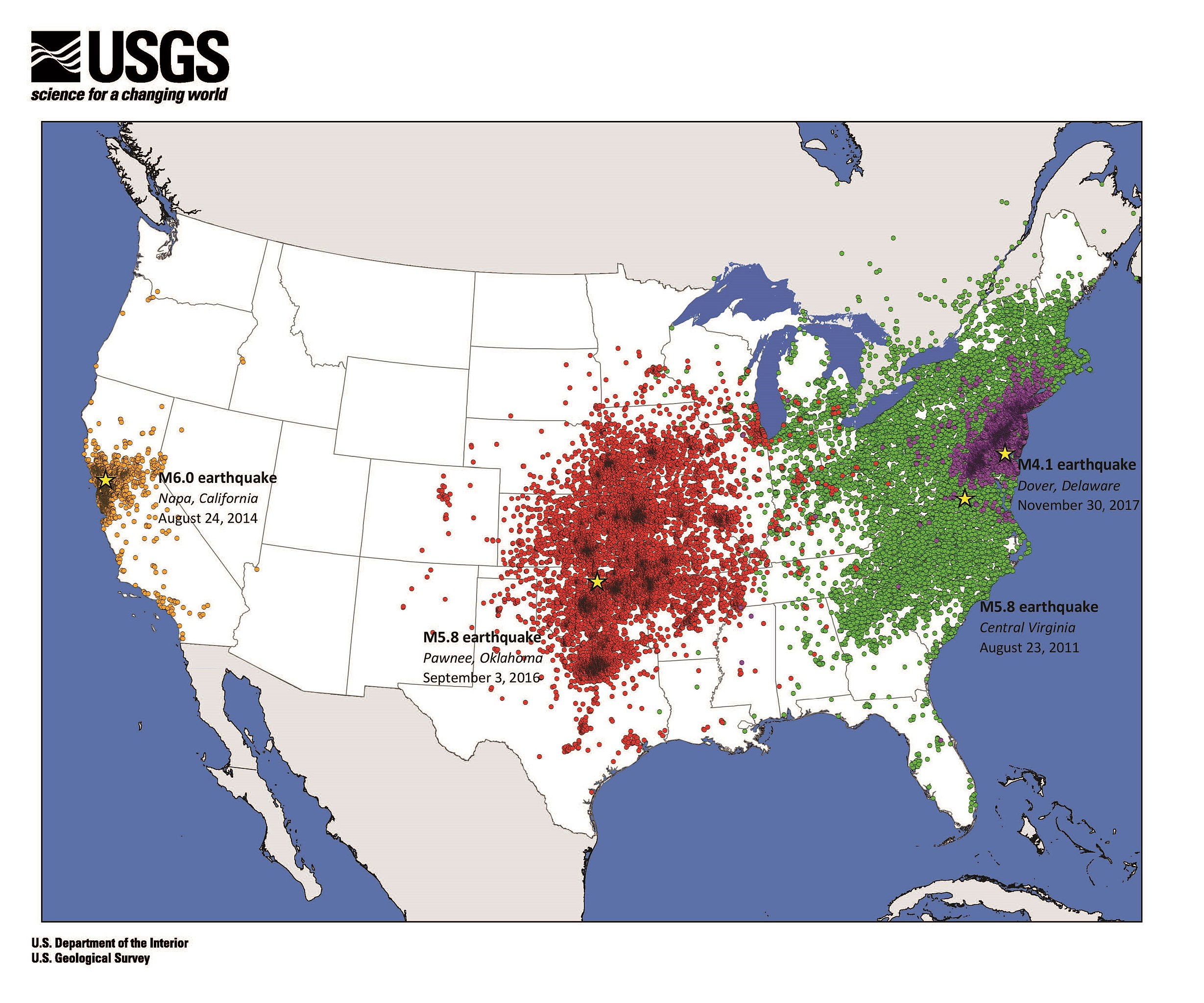
English: Map of USGS "Did You Feel It?" data shows that earthquakes east of the Rocky Mountains are felt over larger areas than earthquakes in the West. [1] |
| Date | |
| Source | https://prd-wret.s3-us-west-2.amazonaws.com/assets/palladium/production/s3fs-public/thumbnails/image/DYFI_eq_Dover%20JPEG.jpg |
| Author | Eric Jones, USGS |
Licensing edit
This image is in the public domain in the United States because it only contains materials that originally came from the United States Geological Survey, an agency of the United States Department of the Interior. For more information, see the official USGS copyright policy.
|
File history
Click on a date/time to view the file as it appeared at that time.
| Date/Time | Thumbnail | Dimensions | User | Comment | |
|---|---|---|---|---|---|
| current | 04:19, 9 June 2019 | | 3,600 × 3,000 (1.75 MB) | King of Hearts (talk | contribs) | crop |
| 04:13, 9 June 2019 |  | 4,500 × 3,000 (1.88 MB) | King of Hearts (talk | contribs) | User created page with UploadWizard |
You cannot overwrite this file.
File usage on Commons
There are no pages that use this file.
File usage on other wikis
The following other wikis use this file:
- Usage on en.wikipedia.org