File:Echelsbacher Brücke 2010-08-07.jpg

Size of this preview: 800 × 449 pixels. Other resolutions: 320 × 180 pixels | 640 × 360 pixels | 1,024 × 575 pixels | 1,280 × 719 pixels | 2,649 × 1,488 pixels.
Original file (2,649 × 1,488 pixels, file size: 1.48 MB, MIME type: image/jpeg)
Captions
Captions
Add a one-line explanation of what this file represents
Summary edit
| Description |
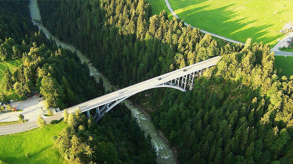
Deutsch: Ammerschlucht mit Echelsbacher Brücke (während einer Ballonfahrt aufgenommen)
English: Valley of the Bavarian river Ammer with the Echelsbacher Brücke (bridge), near Bad Bayersoien (district Garmisch-Partenkirchen) and Rottenbuch (district Weilheim-Schongau), seen northwards from a hot air balloon) |
| Date | |
| Source | Own work |
| Author | Karl432 |
| Camera location | | View this and other nearby images on: OpenStreetMap |
|---|
Licensing edit
I, the copyright holder of this work, hereby publish it under the following license:
This file is licensed under the Creative Commons Attribution-Share Alike 3.0 Unported license.
- You are free:
- to share – to copy, distribute and transmit the work
- to remix – to adapt the work
- Under the following conditions:
- attribution – You must give appropriate credit, provide a link to the license, and indicate if changes were made. You may do so in any reasonable manner, but not in any way that suggests the licensor endorses you or your use.
- share alike – If you remix, transform, or build upon the material, you must distribute your contributions under the same or compatible license as the original.
File history
Click on a date/time to view the file as it appeared at that time.
| Date/Time | Thumbnail | Dimensions | User | Comment | |
|---|---|---|---|---|---|
| current | 23:58, 13 October 2013 | | 2,649 × 1,488 (1.48 MB) | Karl432 (talk | contribs) | User created page with UploadWizard |
You cannot overwrite this file.
File usage on Commons
The following 2 pages use this file:
File usage on other wikis
The following other wikis use this file:
- Usage on de.wikipedia.org
- Usage on www.wikidata.org