File:Eisenbahnstrecke Herbesthal-Eupen-Raeren-Walheim-Stolberg.jpg
Size of this preview: 800 × 503 pixels. Other resolutions: 320 × 201 pixels | 640 × 403 pixels | 1,024 × 644 pixels | 1,280 × 805 pixels | 1,680 × 1,057 pixels.
Original file (1,680 × 1,057 pixels, file size: 1.37 MB, MIME type: image/jpeg)
Captions
Captions
Add a one-line explanation of what this file represents
| Description |
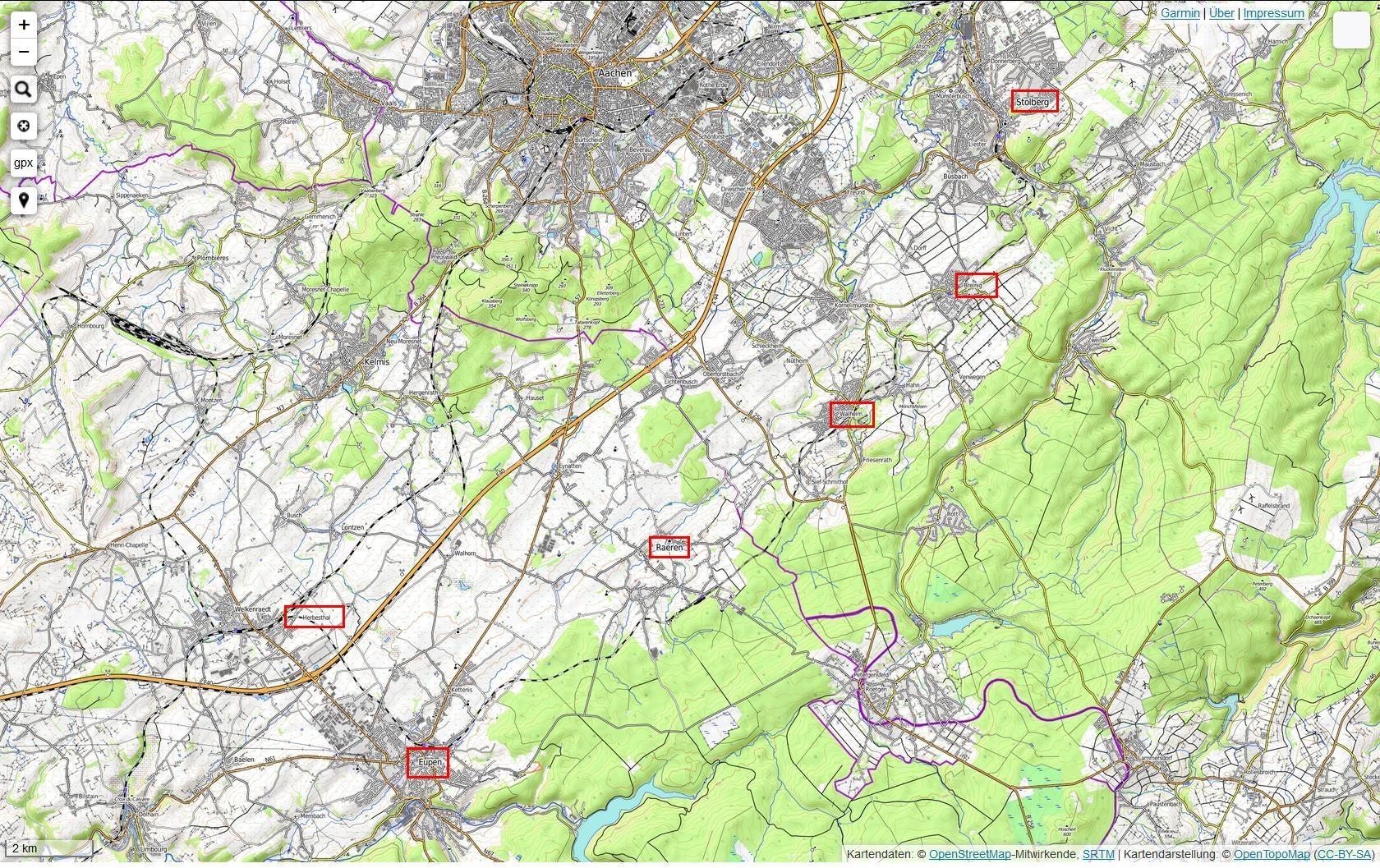
Deutsch: 2015 stillliegende Eisenbahnstrecke Herbesthal-Eupen-Raeren-Walheim-Stolberg. Die kartografische Abildung bildet gewollt staatsgrenzen überschreitend nicht ab, wer
|
| Date | |
| Source | Kartendarstellung: © OpenTopoMap |
| Author | OpenStreetMap-Mitwirkende, SRTM |
| Permission (Reusing this file) |
This file is licensed under the Creative Commons Attribution-Share Alike 3.0 Unported license.
|
File history
Click on a date/time to view the file as it appeared at that time.
| Date/Time | Thumbnail | Dimensions | User | Comment | |
|---|---|---|---|---|---|
| current | 07:45, 29 October 2015 | | 1,680 × 1,057 (1.37 MB) | Albert Gr. (talk | contribs) | Stationen kenntlich gemacht |
| 07:40, 29 October 2015 |  | 1,680 × 1,057 (1.42 MB) | Albert Gr. (talk | contribs) | {{Information |Description ={{de|1=2015 stilliegende Eisenbahnstrecke Hergenrath-Eupen-Raeren-Walheim-Stolberg.}} |Source =Kartendarstellung: © OpenTopoMap |Author =OpenStreetMap-Mitwirkende, SRTM |Date =2015-10-29 |Permis... |
You cannot overwrite this file.
File usage on Commons
The following page uses this file:
File usage on other wikis
The following other wikis use this file: