File:Elevation - Arapahoe Street, Existing Tree Planting, Planting Comparison, Planting Sections - Skyline Park, 1500-1800 Arapaho Street, Denver, Denver County, CO HALS CO-1 (sheet 10 of 11).png

Size of this preview: 776 × 600 pixels. Other resolutions: 311 × 240 pixels | 621 × 480 pixels | 994 × 768 pixels | 1,280 × 989 pixels | 2,560 × 1,979 pixels | 17,597 × 13,600 pixels.
Original file (17,597 × 13,600 pixels, file size: 11.03 MB, MIME type: image/png)
Captions
Captions
Add a one-line explanation of what this file represents
| This image is a JPEG version of the original TIF image at File: Elevation - Arapahoe Street, Existing Tree Planting, Planting Comparison, Planting Sections - Skyline Park, 1500-1800 Arapaho Street, Denver, Denver County, CO HALS CO-1 (sheet 10 of 11).tif.
However, any edits to the image should be based on the original TIF version in order to prevent generation loss, and both versions should be updated. Do not make edits based on this version. |
Summary edit
| Warning | The original file is very high-resolution. It might not load properly or could cause your browser to freeze when opened at full size. |
|---|
| Elevation - Arapahoe Street, Existing Tree Planting, Planting Comparison, Planting Sections - Skyline Park, 1500-1800 Arapaho Street, Denver, Denver County, CO | ||||
|---|---|---|---|---|
| Photographer |
Komara, Ann, creator |
|||
| Title |
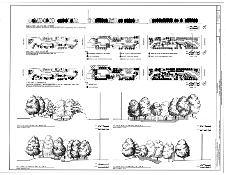
Elevation - Arapahoe Street, Existing Tree Planting, Planting Comparison, Planting Sections - Skyline Park, 1500-1800 Arapaho Street, Denver, Denver County, CO |
|||
| Depicted place | Colorado; Denver County; Denver | |||
| Date | 2005 | |||
| Dimensions | 34 x 44 in. (E size) | |||
| Current location |
Library of Congress Prints and Photographs Division Washington, D.C. 20540 USA http://hdl.loc.gov/loc.pnp/pp.print |
|||
| Accession number |
HALS CO-1 (sheet 10 of 11) |
|||
| Credit line |
|
|||
| Notes |
|
|||
| References |
Related names:
|
|||
| Source | https://www.loc.gov/pictures/item/co0917.sheet.00010a | |||
| Permission (Reusing this file) |
|
|||
| Other versions |
.png) .png) .png) .png) .png) ,_Surface_Treatments,_Vegetation,_and_Ambient_Sounds_-_Skyline_Park,_1500-1800_Arapaho_Street,_Denver,_Denver_County,_CO_HALS_CO-1_(sheet_9_of_11).png) .png) .png) .png) .png) |
|||

.png&action=edit§ion=1)
| Object location | | View this and other nearby images on: OpenStreetMap |
|---|
.png¶ms=039.739170_N_-104.984170_E_globe:Earth_class:object_type:object__&language=en)
File history
Click on a date/time to view the file as it appeared at that time.
| Date/Time | Thumbnail | Dimensions | User | Comment | |
|---|---|---|---|---|---|
| current | 02:10, 9 July 2014 | | 17,597 × 13,600 (11.03 MB) | Fæ (talk | contribs) | {{Compressed version|file=File:Elevation_-_Arapahoe_Street,_Existing_Tree_Planting,_Planting_Comparison,_Planting_Sections_-_Skyline_Park,_1500-1800_Arapaho_Street,_Denver,_Denver_County,_CO_HALS_CO-1_(sheet_10_of_11).tif|thumb=nothumb}} =={{int:filede... |
You cannot overwrite this file.
File usage on Commons
The following 22 pages use this file:
- File:Aerial View of Block 1 Fountain, view to southeast, and Perspective view of Block 1 Fountain, view to the northwest - Skyline Park, 1500-1800 Arapaho Street, Denver, Denver HALS CO-1 (sheet 6 of 11).png
- File:Aerial View of Block 1 Fountain, view to southeast, and Perspective view of Block 1 Fountain, view to the northwest - Skyline Park, 1500-1800 Arapaho Street, Denver, Denver HALS CO-1 (sheet 6 of 11).tif
- File:Coversheet - Skyline Park, 1500-1800 Arapaho Street, Denver, Denver County, CO HALS CO-1 (sheet 1 of 11).png
- File:Coversheet - Skyline Park, 1500-1800 Arapaho Street, Denver, Denver County, CO HALS CO-1 (sheet 1 of 11).tif
- File:Elevation - Arapahoe Street, Existing Tree Planting, Planting Comparison, Planting Sections - Skyline Park, 1500-1800 Arapaho Street, Denver, Denver County, CO HALS CO-1 (sheet 10 of 11).png
- File:Elevation - Arapahoe Street, Existing Tree Planting, Planting Comparison, Planting Sections - Skyline Park, 1500-1800 Arapaho Street, Denver, Denver County, CO HALS CO-1 (sheet 10 of 11).tif
- File:Motation Study, Circulation, Features and Water, and Spatial Edges and Visual Boundaries - Skyline Park, 1500-1800 Arapaho Street, Denver, Denver County, CO HALS CO-1 (sheet 8 of 11).png
- File:Motation Study, Circulation, Features and Water, and Spatial Edges and Visual Boundaries - Skyline Park, 1500-1800 Arapaho Street, Denver, Denver County, CO HALS CO-1 (sheet 8 of 11).tif
- File:Perspective of Block 1 and 2, Drinking Fountain Plan and Details, Plan and Sections of Light Column, Drain Detail, and Section of Wall Mounted Bench - Skyline Park, 1500 HALS CO-1 (sheet 11 of 11).png
- File:Perspective of Block 1 and 2, Drinking Fountain Plan and Details, Plan and Sections of Light Column, Drain Detail, and Section of Wall Mounted Bench - Skyline Park, 1500 HALS CO-1 (sheet 11 of 11).tif
- File:Perspective of Block 2 Fountain, view to the northeast, Perspective of Block 2 Fountain, view to the northwest, Wall Pattern of Block 2 Fountain, Perspective of Block 3 HALS CO-1 (sheet 7 of 11).png
- File:Perspective of Block 2 Fountain, view to the northeast, Perspective of Block 2 Fountain, view to the northwest, Wall Pattern of Block 2 Fountain, Perspective of Block 3 HALS CO-1 (sheet 7 of 11).tif
- File:Seating (Moments to Pause), Surface Treatments, Vegetation, and Ambient Sounds - Skyline Park, 1500-1800 Arapaho Street, Denver, Denver County, CO HALS CO-1 (sheet 9 of 11).png
- File:Seating (Moments to Pause), Surface Treatments, Vegetation, and Ambient Sounds - Skyline Park, 1500-1800 Arapaho Street, Denver, Denver County, CO HALS CO-1 (sheet 9 of 11).tif
- File:Site Plan, Block 1, and Sections - Skyline Park, 1500-1800 Arapaho Street, Denver, Denver County, CO HALS CO-1 (sheet 2 of 11).png
- File:Site Plan, Block 1, and Sections - Skyline Park, 1500-1800 Arapaho Street, Denver, Denver County, CO HALS CO-1 (sheet 2 of 11).tif
- File:Site Plan Block 3, Section - Skyline Park, 1500-1800 Arapaho Street, Denver, Denver County, CO HALS CO-1 (sheet 5 of 11).png
- File:Site Plan Block 3, Section - Skyline Park, 1500-1800 Arapaho Street, Denver, Denver County, CO HALS CO-1 (sheet 5 of 11).tif
- File:Site Plan Blocks 1 and 2, sections - Skyline Park, 1500-1800 Arapaho Street, Denver, Denver County, CO HALS CO-1 (sheet 3 of 11).png
- File:Site Plan Blocks 1 and 2, sections - Skyline Park, 1500-1800 Arapaho Street, Denver, Denver County, CO HALS CO-1 (sheet 3 of 11).tif
- File:Site Plan Blocks 2 and 3, Section - Skyline Park, 1500-1800 Arapaho Street, Denver, Denver County, CO HALS CO-1 (sheet 4 of 11).png
- File:Site Plan Blocks 2 and 3, Section - Skyline Park, 1500-1800 Arapaho Street, Denver, Denver County, CO HALS CO-1 (sheet 4 of 11).tif
.png)
.png&oldid=664132719)