File:Encyclopaedie van Nederlandsch West-Indië-Overview east-Benj004ency01ill07.gif
Size of this preview: 483 × 599 pixels. Other resolutions: 193 × 240 pixels | 387 × 480 pixels | 619 × 768 pixels | 825 × 1,024 pixels | 1,651 × 2,048 pixels | 3,265 × 4,050 pixels.
Original file (3,265 × 4,050 pixels, file size: 4.96 MB, MIME type: image/gif)
Captions
Captions
Add a one-line explanation of what this file represents
Summary
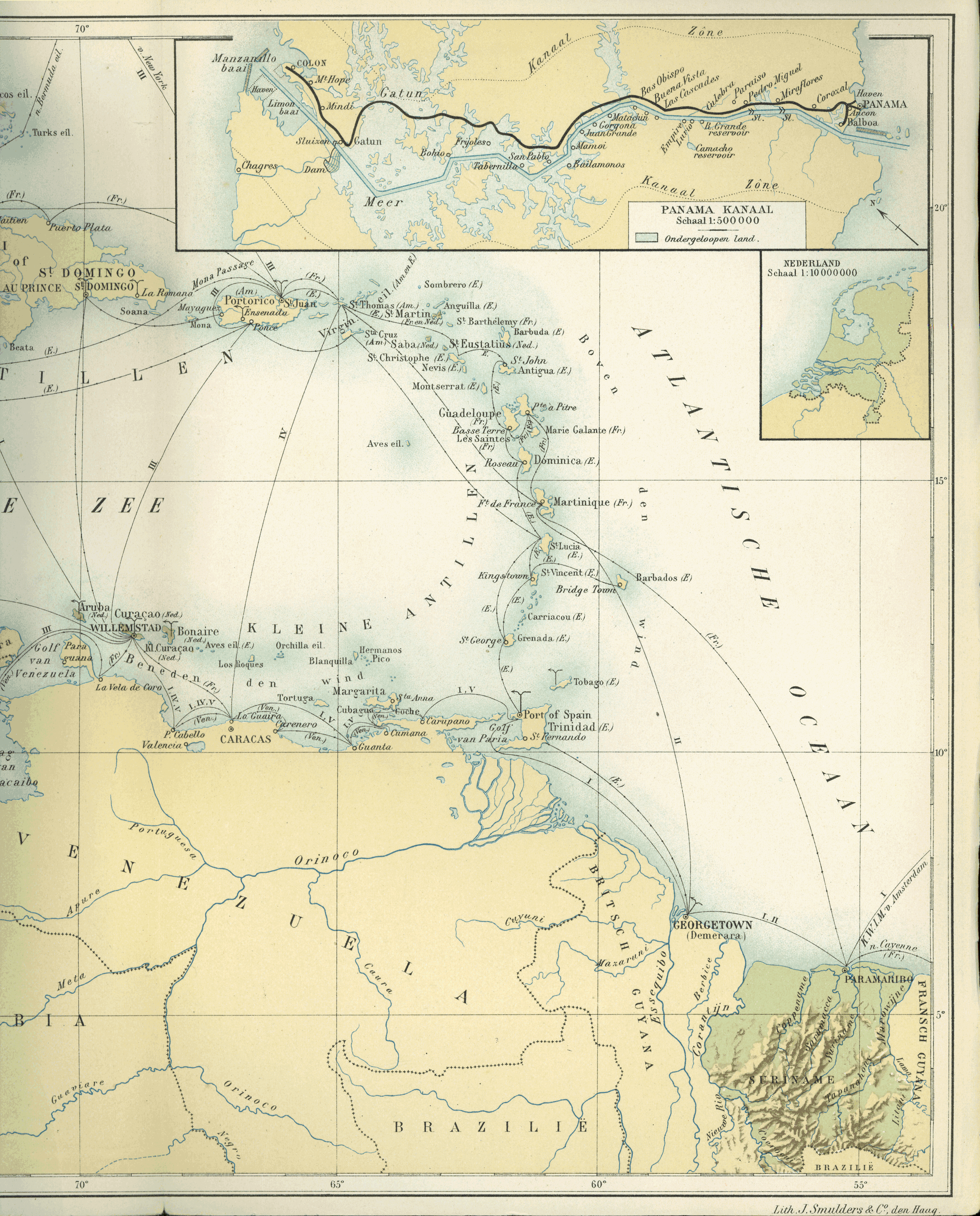
edit| Description |
Nederlands: Kaart III, behoorende bij de Encyclopaedie van Nederlandsch West-Indië. Situatiekaart van de Nederlandsch West-Indische bezittingen.
(eastern part) |
| Date | between 1914 and 1917 |
| Source | http://www.dbnl.org/tekst/benj004ency01_01/benj004ency01_01_0032.php |
| Author | Herman Benjamins († 1933-01-23) and Johannes François Snelleman († 1938-05-18) |
| Other versions |
|


Licensing
edit
|
This work is in the public domain in its country of origin and other countries and areas where the copyright term is the author's life plus 70 years or fewer. This work is in the public domain in the United States because it was published (or registered with the U.S. Copyright Office) before January 1, 1929. | |
| This file has been identified as being free of known restrictions under copyright law, including all related and neighboring rights. | |
File history
Click on a date/time to view the file as it appeared at that time.
| Date/Time | Thumbnail | Dimensions | User | Comment | |
|---|---|---|---|---|---|
| current | 09:26, 10 March 2015 | | 3,265 × 4,050 (4.96 MB) | Ratzer (talk | contribs) | User created page with UploadWizard |
You cannot overwrite this file.
File usage on Commons
The following 3 pages use this file:
File usage on other wikis
The following other wikis use this file:
- Usage on de.wikipedia.org