File:Engelhartstetten - Schloss Hof (1).JPG

Size of this preview: 800 × 472 pixels. Other resolutions: 320 × 189 pixels | 640 × 378 pixels | 1,024 × 604 pixels | 1,280 × 755 pixels | 2,560 × 1,511 pixels | 4,252 × 2,509 pixels.
Original file (4,252 × 2,509 pixels, file size: 9.6 MB, MIME type: image/jpeg)
Captions
Captions
Add a one-line explanation of what this file represents
Summary edit
| Description |
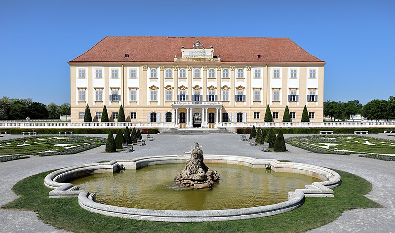
Deutsch: Die Hauptfassade bzw. der Osttrakt des Schlosses der Schlossanlage Schloss Hof in der niederösterreichischen Marktgemeinde Engelhartstetten.
Die Schlossanlage wurde um 1627 auf einer Geländekante und östlich der mittelalterlichen Feste Hof errichtet. Nachdem 1725 Prinz Eugen die Anlage erworben hatte, baute er diese zu einem repräsentativen Landsitz aus. 1755 kam das Schloss in den Besitz von Maria Theresia. Von 1773 bis 1775 erfolgte dann ein Um- und Ausbau zum heutigen Erscheinungsbild durch Franz Anton Hillebrandt. |
| Date | |
| Source | Own work |
| Author | C.Stadler/Bwag |
| Permission (Reusing this file) |
Deutsch: Hallo, du darfst mein Foto kostenlos nutzen, aber nenne mich bitte als Fotograf, beispielsweise „Foto: C.Stadler/Bwag“ oder © C.Stadler/Bwag; CC-BY-SA-4.0. Auf mehr Angaben bestehe ich nicht - im Gegensatz zu manch anderen, die die Vorgaben der unten angeführten Lizenzierung auf Punkt und Beistrich einfordern. English: Feel free to use my photos, but please mention me as the author like © C.Stadler/Bwag or © C.Stadler/Bwag; CC-BY-SA-4.0 (that's good enough) and if you want send me a message: bwag@gmx.net. |
| Other versions |
|
.JPG)
.JPG)
.JPG&action=edit§ion=1)
| Camera location | | View this and other nearby images on: OpenStreetMap |
|---|
.JPG¶ms=048.213840_N_0016.938310_E_globe:Earth_type:camera_heading:275.00&language=en)
| Object location | | View this and other nearby images on: OpenStreetMap |
|---|
.JPG¶ms=048.213870_N_0016.937000_E_globe:Earth_class:object_type:object_region:AT-3_&language=en)
Licensing edit
.JPG&action=edit§ion=2)
I, the copyright holder of this work, hereby publish it under the following license:
This file is licensed under the Creative Commons Attribution-Share Alike 4.0 International license.
- You are free:
- to share – to copy, distribute and transmit the work
- to remix – to adapt the work
- Under the following conditions:
- attribution – You must give appropriate credit, provide a link to the license, and indicate if changes were made. You may do so in any reasonable manner, but not in any way that suggests the licensor endorses you or your use.
- share alike – If you remix, transform, or build upon the material, you must distribute your contributions under the same or compatible license as the original.
File history
Click on a date/time to view the file as it appeared at that time.
| Date/Time | Thumbnail | Dimensions | User | Comment | |
|---|---|---|---|---|---|
| current | 20:18, 6 May 2018 | | 4,252 × 2,509 (9.6 MB) | Bwag (talk | contribs) | {{Information |Description= {{de|1=Die Hauptfassade bzw. der Osttrakt des Schlosses der Schlossanlage Schloss Hof in der niederösterreichischen Marktgemeinde Engelhartstetten.<br/>Die Schlossanlage wurde auf einer Geländekante und östlich der gelegenen mittelalterlichen ''Feste Hof'' 1627 errichtet. Nachdem 1725 Prinz Eugen die Anlage erworben hatte, baute er diese zu einem repräsentativen Landsitz aus. 1755 kam das Schlo... |
You cannot overwrite this file.
File usage on Commons
The following 12 pages use this file:
- User:Althair/Gallery/Clasic/Giant order
- User:Einstein2/Budapest/2018 May 1-10
- File:Archduke Franz Karl of Austria (1802-1878) and his family.jpg
- File:Die Familie des Kaisers von Österreich.jpg
- File:Engelhartstetten - Schloss Hof (2).JPG
- File:Engelhartstetten - Schloss Hof (3).JPG
- File:Kaiserin Elisabeth mit Sternenschmuck und schwarzgoldenem Spitzenüberwurf.jpg
- File:Schloss Hof - Familienportrait Marie Amalia.jpg
- File:Thaddäus von Ajdukiewicz Kronprinz Rudolf zu Pferd 1889.jpg
- Category:Interior of Schloss Hof
- Category:Schloss Hof
- Institution:Schloss Hof
_and_his_family.jpg)
File usage on other wikis
The following other wikis use this file:
- Usage on ar.wikipedia.org
- Usage on cs.wikipedia.org
- Usage on de.wikipedia.org
- Usage on de.wikivoyage.org
- Usage on en.wikipedia.org
- Usage on es.wikipedia.org
- Usage on it.wikivoyage.org
- Usage on nl.wikipedia.org
- Usage on ru.wikipedia.org
- Usage on sk.wikipedia.org
- Usage on uk.wikipedia.org
- Usage on www.wikidata.org
.JPG&oldid=706357844)