File:EnglandCumbria.svg

Size of this PNG preview of this SVG file: 200 × 247 pixels. Other resolutions: 194 × 240 pixels | 389 × 480 pixels | 622 × 768 pixels | 829 × 1,024 pixels | 1,658 × 2,048 pixels.
Original file (SVG file, nominally 200 × 247 pixels, file size: 231 KB)
Captions
Captions
Add a one-line explanation of what this file represents
Summary edit
| Description |
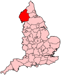
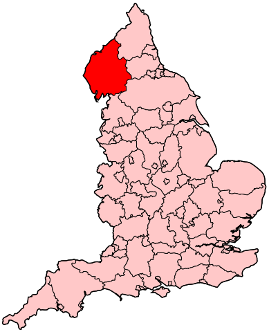
English: Map of the administrative county of Cumbria. |
| Source | Own work |
| Author | Wereon |
Licensing edit
| I, the copyright holder of this work, release this work into the public domain. This applies worldwide. In some countries this may not be legally possible; if so: I grant anyone the right to use this work for any purpose, without any conditions, unless such conditions are required by law. |
File history
Click on a date/time to view the file as it appeared at that time.
| Date/Time | Thumbnail | Dimensions | User | Comment | |
|---|---|---|---|---|---|
| current | 20:15, 22 April 2007 | | 200 × 247 (231 KB) | Wereon (talk | contribs) | Map of the administrative county of Cumbria. Category:Maps of counties of England |
You cannot overwrite this file.
File usage on Commons
The following page uses this file:
File usage on other wikis
The following other wikis use this file:
- Usage on cy.wikipedia.org
- Usage on en.wikipedia.org
- Workington (UK Parliament constituency)
- Carlisle (UK Parliament constituency)
- Copeland (UK Parliament constituency)
- Penrith and The Border (UK Parliament constituency)
- Westmorland and Lonsdale (UK Parliament constituency)
- Barrow and Furness (UK Parliament constituency)
- Portal:Cheshire
- Portal:Cheshire/Related portals
- Parliamentary constituencies in North West England
- Usage on pl.wikipedia.org
- Usage on ru.wikipedia.org
- Usage on uk.wikipedia.org