File:Erfurter Stadtbahn Steigerstraße.png
Size of this preview: 395 × 600 pixels. Other resolutions: 158 × 240 pixels | 316 × 480 pixels | 506 × 768 pixels | 1,128 × 1,712 pixels.
Original file (1,128 × 1,712 pixels, file size: 202 KB, MIME type: image/png)
Captions
Captions
Add a one-line explanation of what this file represents
Summary edit
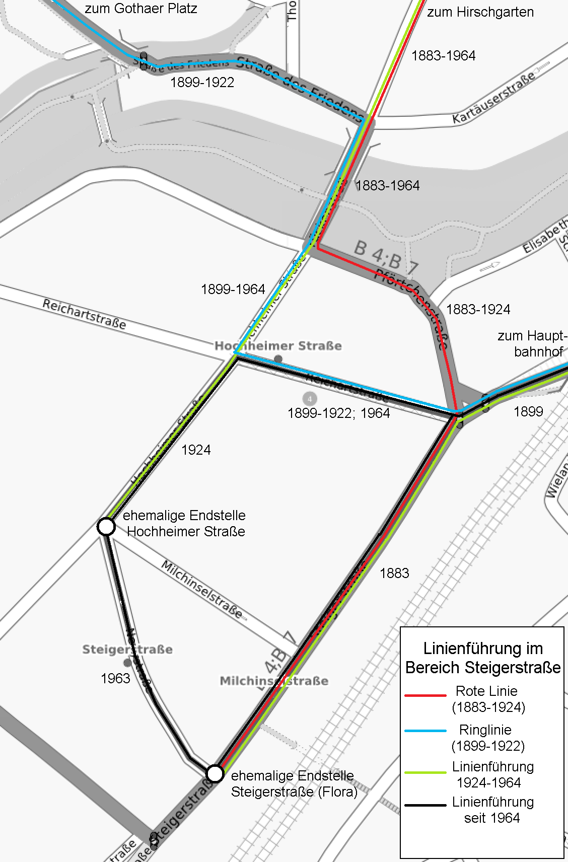
| Description | Der Plan zeigt einen Ausschnitt des Erfurter Stadtbahnnetzes, rund um die Steigerstraße/Hochheimer Straße im Südwesten der Stadt. Näheres dazu in der Legende im Plan. |
| Date | |
| Source | Der Plan wurde von mir auf Grundlage einer Karte von OpenStreetMaps erstellt. |
| Author | Michael Sander (Netz-Skizze), OpenStreetMaps (Hintergrundkarte) |
Licensing edit
This file is licensed under the Creative Commons Attribution-Share Alike 3.0 Unported license.
- You are free:
- to share – to copy, distribute and transmit the work
- to remix – to adapt the work
- Under the following conditions:
- attribution – You must give appropriate credit, provide a link to the license, and indicate if changes were made. You may do so in any reasonable manner, but not in any way that suggests the licensor endorses you or your use.
- share alike – If you remix, transform, or build upon the material, you must distribute your contributions under the same or compatible license as the original.
File history
Click on a date/time to view the file as it appeared at that time.
| Date/Time | Thumbnail | Dimensions | User | Comment | |
|---|---|---|---|---|---|
| current | 19:10, 13 March 2009 | | 1,128 × 1,712 (202 KB) | Michael Sander (talk | contribs) | {{Information |Description=Der Plan zeigt einen Ausschnitt des Erfurter Stadtbahnnetzes, rund um die Steigerstraße/Hochheimer Straße im Südwesten der Stadt. Näheres dazu in der Legende im Plan. |Source=Der Plan wurde von mir auf Grundlage einer Karte |
You cannot overwrite this file.
File usage on Commons
There are no pages that use this file.
File usage on other wikis
The following other wikis use this file:
- Usage on de.wikipedia.org