File:Erie Canal (Enlarged), Lock Number 18, 252 North Mohawk Street, Cohoes, Albany County, NY HAER NY,1-COHO,5A-3.tif
Size of this JPG preview of this TIF file: 800 × 569 pixels. Other resolutions: 320 × 228 pixels | 640 × 455 pixels | 1,024 × 728 pixels | 1,280 × 910 pixels | 2,560 × 1,821 pixels | 5,000 × 3,556 pixels.
Original file (5,000 × 3,556 pixels, file size: 16.96 MB, MIME type: image/tiff)
Captions
Captions
Add a one-line explanation of what this file represents
Summary edit
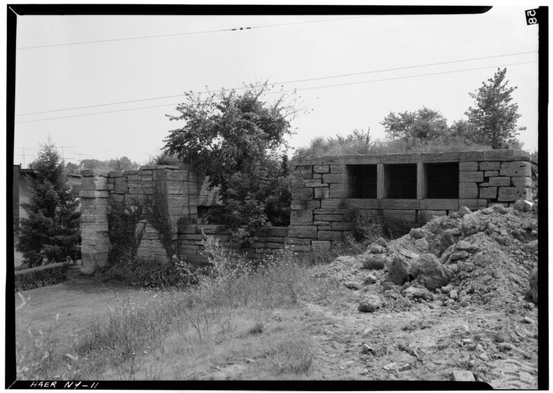
| - Erie Canal (Enlarged), Lock Number 18, 252 North Mohawk Street, Cohoes, Albany County, NY | ||||
|---|---|---|---|---|
| Photographer |
Related names:
|
|||
| Title |
- Erie Canal (Enlarged), Lock Number 18, 252 North Mohawk Street, Cohoes, Albany County, NY |
|||
| Depicted place | New York; Albany County; Cohoes | |||
| Date | Documentation compiled after 1968 | |||
| Dimensions | 5 x 7 in. | |||
| Current location |
Library of Congress Prints and Photographs Division Washington, D.C. 20540 USA http://hdl.loc.gov/loc.pnp/pp.print |
|||
| Accession number |
HAER NY,1-COHO,5A-3 |
|||
| Credit line |
|
|||
| Notes |
|
|||
| References |
|
|||
| Source | https://www.loc.gov/pictures/item/ny0027.photos.114500p | |||
| Permission (Reusing this file) |
|
|||

| Object location | | View this and other nearby images on: OpenStreetMap |
|---|
File history
Click on a date/time to view the file as it appeared at that time.
| Date/Time | Thumbnail | Dimensions | User | Comment | |
|---|---|---|---|---|---|
| current | 03:13, 29 July 2014 |  | 5,000 × 3,556 (16.96 MB) | Fæ (talk | contribs) | GWToolset: Creating mediafile for Fæ. HABS 24 July 2014 (2301:2600) |
You cannot overwrite this file.
File usage on Commons
The following 2 pages use this file: