File:Essen Map 1681.jpg

Size of this preview: 799 × 600 pixels. Other resolutions: 320 × 240 pixels | 640 × 480 pixels | 1,024 × 768 pixels | 1,280 × 961 pixels | 1,611 × 1,209 pixels.
Original file (1,611 × 1,209 pixels, file size: 1.05 MB, MIME type: image/jpeg)
Captions
Captions
Add a one-line explanation of what this file represents
| Description |
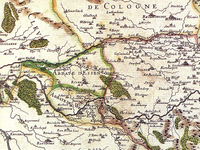
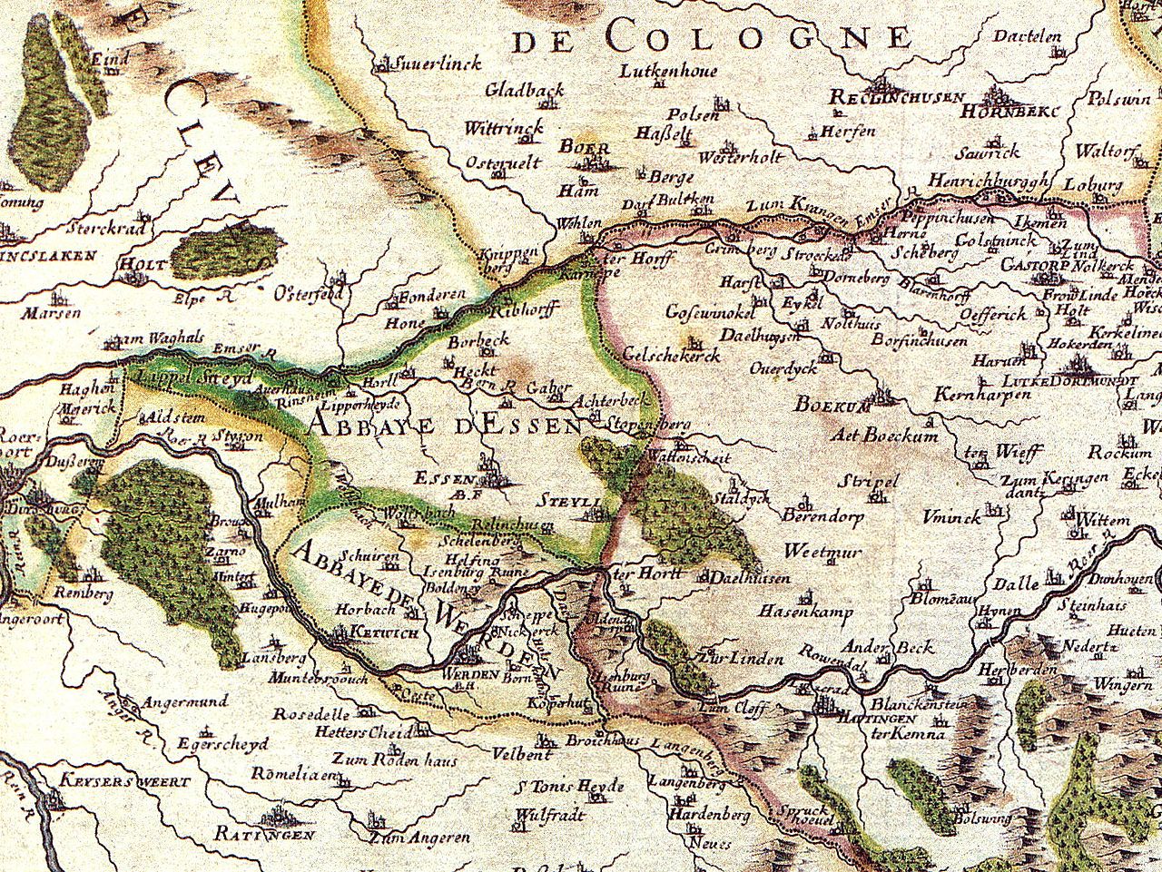
Detail of a map from 1681 showing the territory of the Imperial abbeys of Essen and Werden, by Nicolas Sanson, Public Domain Kartenausschnitt: |
||||||||||||||||||||||||||
| Date | (UTC) | ||||||||||||||||||||||||||
| Source | |||||||||||||||||||||||||||
| Author |
|
||||||||||||||||||||||||||


| This is a retouched picture, which means that it has been digitally altered from its original version. Modifications: Image cropped.. The original can be viewed here: Grafschaft mark 1681 sanson.jpg:
|
|
This is a faithful photographic reproduction of a two-dimensional, public domain work of art. The work of art itself is in the public domain for the following reason:
The official position taken by the Wikimedia Foundation is that "faithful reproductions of two-dimensional public domain works of art are public domain".
This photographic reproduction is therefore also considered to be in the public domain in the United States. In other jurisdictions, re-use of this content may be restricted; see Reuse of PD-Art photographs for details. | ||||
Original upload log edit
This image is a derivative work of the following images:
- File:Grafschaft_mark_1681_sanson.jpg licensed with PD-old
- 2005-01-03T16:55:27Z Simplicius 3833x2901 (9441288 Bytes) reload
Uploaded with derivativeFX
File history
Click on a date/time to view the file as it appeared at that time.
| Date/Time | Thumbnail | Dimensions | User | Comment | |
|---|---|---|---|---|---|
| current | 21:10, 18 March 2010 | | 1,611 × 1,209 (1.05 MB) | Beckstet (talk | contribs) | {{Information |Description=Map of territories Essen and Werden, Germany, 1681, by Nicolas Sanson, Public Domain Kartenausschnitt: <gallery>Image:Grafschaft mark 1681 sanson-Ausschnitt.jpg</gallery> |Source=*File:Grafschaft_mark_1681_sanson.jpg |Date |
You cannot overwrite this file.
File usage on Commons
The following 5 pages use this file:
File usage on other wikis
The following other wikis use this file:
- Usage on de.wikipedia.org