File:Essex-Morris-Union county tripoint, Chatham-Short Hills-Summit, NJ.jpg

Size of this preview: 800 × 549 pixels. Other resolutions: 320 × 219 pixels | 640 × 439 pixels | 1,024 × 702 pixels | 1,280 × 878 pixels | 2,560 × 1,755 pixels | 5,880 × 4,032 pixels.
Original file (5,880 × 4,032 pixels, file size: 13.54 MB, MIME type: image/jpeg)
Captions
Captions
Add a one-line explanation of what this file represents
Summary edit
| Description |
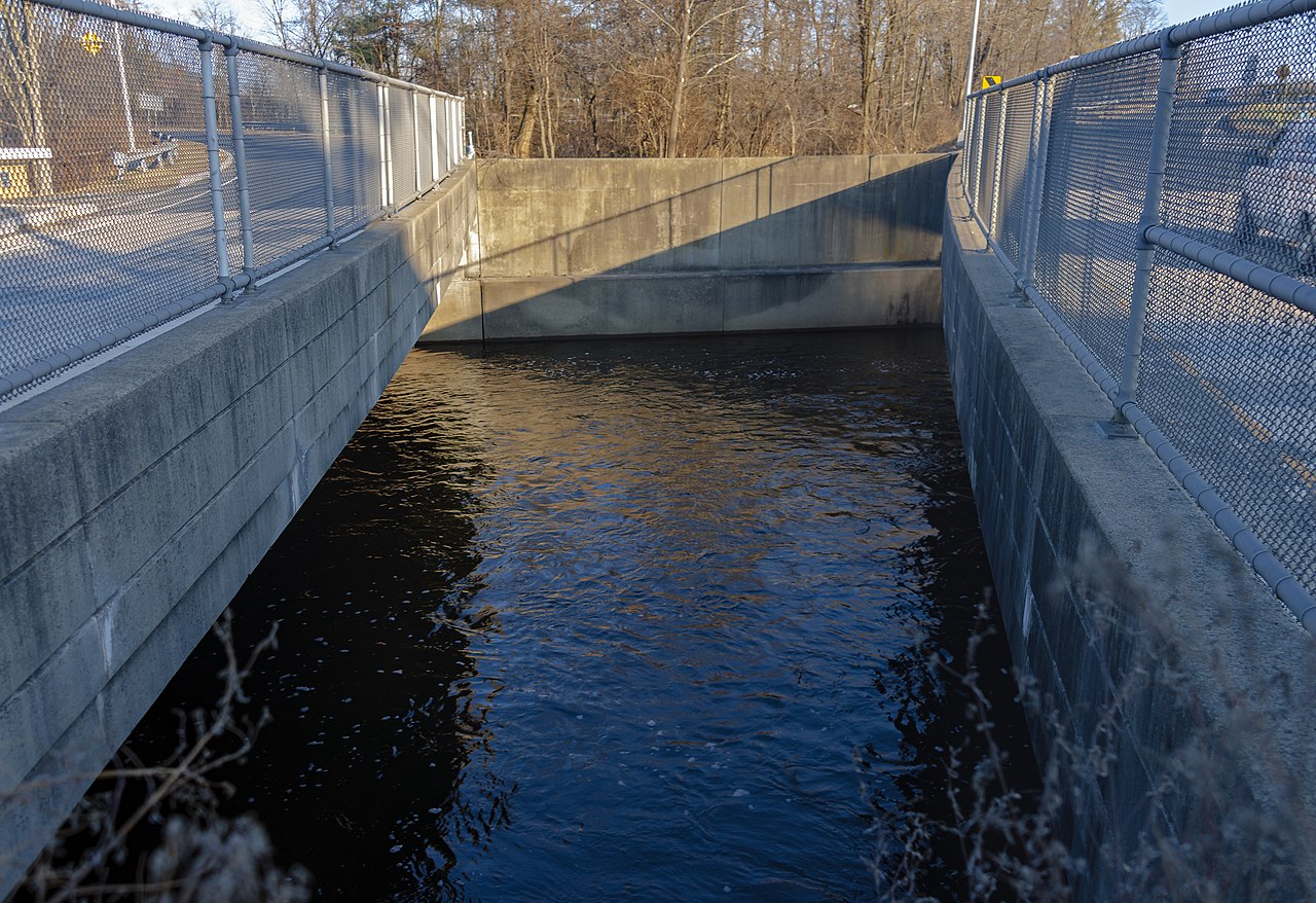
English: The tripoint of New Jersey's Essex, Morris and Union counties, in the middle of the Passaic River channel between two bridges carrying NJ 124 over the river.
The image is taken from the Chatham side of the river in Morris County, the only location from which this point can be easily reached and viewed. The upper right is in the Union County city of Summit and constitutes the northernmost point in both city and county. The upper left is in the portion of Essex County's Millburn Township known as Short Hills. |
||
| Date | |||
| Source | Own work | ||
| Author | Daniel Case | ||
| Permission (Reusing this file) |
I, the copyright holder of this work, hereby publish it under the following licenses:
This file is licensed under the Creative Commons Attribution-Share Alike 3.0 Unported license.
You may select the license of your choice. |

| Camera location | | View this and other nearby images on: OpenStreetMap |
|---|
The geographical information in this file was retrospectively estimated.
The location may therefore be somewhat imprecise. Verifying and refining these coordinates is strongly encouraged. |
File history
Click on a date/time to view the file as it appeared at that time.
| Date/Time | Thumbnail | Dimensions | User | Comment | |
|---|---|---|---|---|---|
| current | 06:20, 8 January 2019 | | 5,880 × 4,032 (13.54 MB) | Daniel Case (talk | contribs) | {{Information |description ={{en|1=The {{w|tripoint}} of {{w|New Jersey}}'s Essex, Morris and Union counties, in the middle of the {{w|Passaic River}} channel between two bridges carrying NJ 124 over the river. The image is taken from the Chatham side of the river in Morris County, the only location from which this point can be e... |
You cannot overwrite this file.
File usage on Commons
There are no pages that use this file.