File:Ethiopia-map-blank.png
No higher resolution available.
Ethiopia-map-blank.png (330 × 355 pixels, file size: 7 KB, MIME type: image/png)
Captions
Captions
Add a one-line explanation of what this file represents
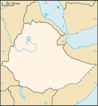
| Description | Map of Ethiopia (blank) for use in locator maps |
| Date | (UTC) |
| Source | image:Ethiopia.png |
| Author | Bemoeial2/CIA |
| Permission (Reusing this file) |
PD |
This image is in the public domain because it contains materials that originally came from the United States Central Intelligence Agency's World Factbook.
|
 |
File history
Click on a date/time to view the file as it appeared at that time.
| Date/Time | Thumbnail | Dimensions | User | Comment | |
|---|---|---|---|---|---|
| current | 21:25, 31 March 2018 | | 330 × 355 (7 KB) | Maphobbyist (talk | contribs) | This map was originally uploaded as a blank map and is specified in its title. |
| 17:49, 11 October 2016 |  | 330 × 355 (16 KB) | SCC California (talk | contribs) | added south sudan and names of surrounding countries | |
| 17:44, 16 September 2007 |  | 330 × 355 (7 KB) | Bemoeial~commonswiki (talk | contribs) | {{Information |Description=Map of Ethiopia (blank) for use in locator maps |Source=image:Ethiopia.png |Date=~~~~~ |Author=~~~/CIA |Permission=PD |other_versions= }} {{CIA-map}} Category:Maps of Ethiopia |
You cannot overwrite this file.
File usage on Commons
The following page uses this file:
File usage on other wikis
The following other wikis use this file:
- Usage on am.wikipedia.org
- ኢትዮጵያ
- አዲስ አበባ
- ባሕር-ዳር
- መቀሌ
- አዲግራት
- ጅጅጋ
- አሶሳ
- ድሬዳዋ
- ማይጨው
- ጎንደር ከተማ
- ሐረር
- ደሴ
- ጅማ
- አዋሳ
- ጋምቤላ (ከተማ)
- አዳማ
- አምበር
- አድዋ
- እንዳስላሴ
- አላማጣ
- ወልደያ
- ኮምቦልቻ
- ደብረ ብርሃን
- ደብረ ማርቆስ
- ነቀምት
- አጋሮ
- አምቦ
- ሞጆ
- ደብረ ዘይት
- አርሲ ነገሌ
- ሻሸመኔ
- ጎባ
- ደገሃቡር
- ሆሣዕና (ከተማ)
- ይርጋለም
- ዲላ
- ሶዶ
- አርባ ምንጭ
- መለጠፊያ:የኢትዮጵያ ከተሞች
- መለጠፊያ:Coordinate square
- ጌቶ
- ደብረ ታቦር (ከተማ)
- መርጡለ ማርያም
- አክሱም ጽዮን
- መቅደላ
- ባሌ ሮቤ
- አለማያ
- ሰመራ
- ጋስጫ አባ ጊዮርጊስ
- ዛሬማ ጊዮርጊስ
View more global usage of this file.