File:Externsteine pano edit.jpg

Size of this preview: 800 × 438 pixels. Other resolutions: 320 × 175 pixels | 640 × 350 pixels | 1,024 × 561 pixels | 1,280 × 701 pixels | 2,560 × 1,402 pixels | 4,018 × 2,200 pixels.
Original file (4,018 × 2,200 pixels, file size: 3.92 MB, MIME type: image/jpeg)
Captions
Captions
Add a one-line explanation of what this file represents
Summary edit
| Camera location | | View this and other nearby images on: OpenStreetMap |
|---|
| Description |
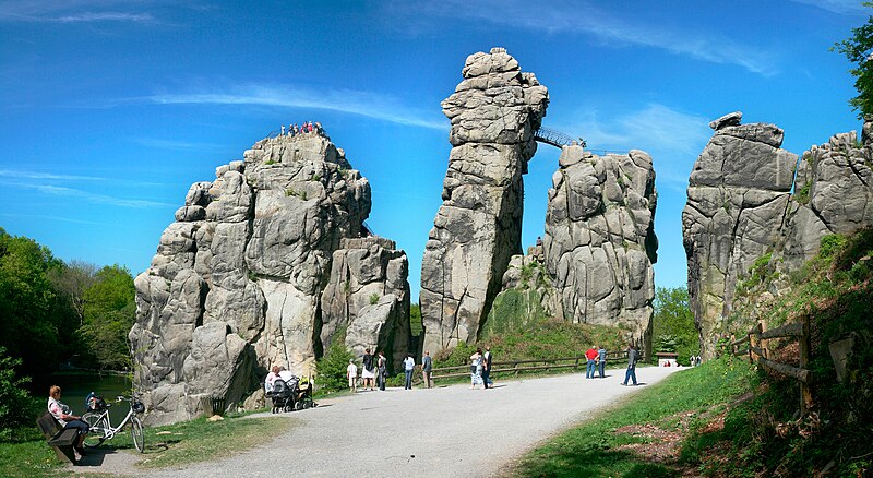
Deutsch: Externsteine im Teutoburger Wald bei Horn-Bad Meinberg English: Externsteine in Teutoburg Forrest near Horn-Bad Meinberg |
| Date | |
| Source | Own work |
| Author | Daniel Schwen |
Edited by Fir0002
Licensing edit
I, the copyright holder of this work, hereby publish it under the following license:
This file is licensed under the Creative Commons Attribution-Share Alike 2.5 Generic license.
- You are free:
- to share – to copy, distribute and transmit the work
- to remix – to adapt the work
- Under the following conditions:
- attribution – You must give appropriate credit, provide a link to the license, and indicate if changes were made. You may do so in any reasonable manner, but not in any way that suggests the licensor endorses you or your use.
- share alike – If you remix, transform, or build upon the material, you must distribute your contributions under the same or compatible license as the original.
File history
Click on a date/time to view the file as it appeared at that time.
| Date/Time | Thumbnail | Dimensions | User | Comment | |
|---|---|---|---|---|---|
| current | 09:05, 3 May 2007 | | 4,018 × 2,200 (3.92 MB) | Fir0002 (talk | contribs) | == Summary == {{Location|51|52|7.0968|N|8|55|1.3116|E|type:landmark}} {{Information |Description={{de|Externsteine im Teutoburger Wald bei Horn-Bad Meinberg}} {{en| Externsteine in Teutoburg Forrest near Horn-Bad Meinberg}} |Source=Own work |Date=April 29 |
You cannot overwrite this file.
File usage on Commons
The following page uses this file:
File usage on other wikis
The following other wikis use this file:
- Usage on en.wikipedia.org