File:FIRST FLOOR WAITING ROOM, FIREPLACE ON SOUTH WALL - Pennsylvania Hospital for Mental and Nervous Diseases, Forty-fourth and Market Streets, Philadelphia, Philadelphia County, PA HABS PA,51-PHILA,511-8.tif

Size of this JPG preview of this TIF file: 800 × 569 pixels. Other resolutions: 320 × 228 pixels | 640 × 455 pixels | 1,024 × 728 pixels | 1,280 × 910 pixels | 2,560 × 1,821 pixels | 5,000 × 3,556 pixels.
Original file (5,000 × 3,556 pixels, file size: 16.96 MB, MIME type: image/tiff)
Captions
Captions
Add a one-line explanation of what this file represents
Summary edit
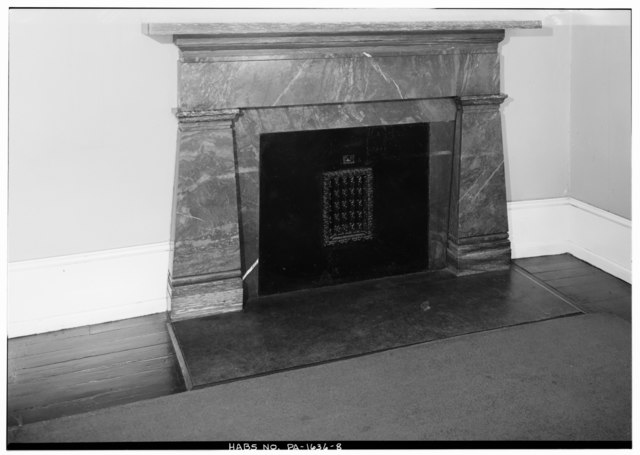
| FIRST FLOOR WAITING ROOM, FIREPLACE ON SOUTH WALL - Pennsylvania Hospital for Mental and Nervous Diseases, Forty-fourth and Market Streets, Philadelphia, Philadelphia County, PA | ||||
|---|---|---|---|---|
| Photographer |
Related names:
|
|||
| Title |
FIRST FLOOR WAITING ROOM, FIREPLACE ON SOUTH WALL - Pennsylvania Hospital for Mental and Nervous Diseases, Forty-fourth and Market Streets, Philadelphia, Philadelphia County, PA |
|||
| Depicted place | Pennsylvania; Philadelphia County; Philadelphia | |||
| Date | Documentation compiled after 1933 | |||
| Dimensions | 5 x 7 in. | |||
| Current location |
Library of Congress Prints and Photographs Division Washington, D.C. 20540 USA http://hdl.loc.gov/loc.pnp/pp.print |
|||
| Accession number |
HABS PA,51-PHILA,511-8 |
|||
| Credit line |
|
|||
| Notes |
|
|||
| Source | https://www.loc.gov/pictures/item/pa1041.photos.138960p | |||
| Permission (Reusing this file) |
|
|||

| Object location | | View this and other nearby images on: OpenStreetMap |
|---|
File history
Click on a date/time to view the file as it appeared at that time.
| Date/Time | Thumbnail | Dimensions | User | Comment | |
|---|---|---|---|---|---|
| current | 09:07, 3 August 2014 |  | 5,000 × 3,556 (16.96 MB) | Fæ (talk | contribs) | GWToolset: Creating mediafile for Fæ. HABS 2014-08-01 2601-2900 missing |
You cannot overwrite this file.
File usage on Commons
The following page uses this file: